Mesoregion of Araraquara
The Mesoregion of Araraquara is one of the 15 mesoregions of the São Paulo state, Brazil. It is located on the center of the state, and has an area of 9,451.2 km².
Mesoregion of Araraquara | |
|---|---|
Mesoregion | |
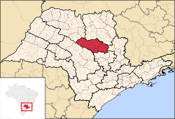 Location of the Mesoregion of Araraquara | |
| Coordinates: 21°47′38″S 48°10′33″W | |
| Country | |
| Region | Southeast |
| State | |
| Area | |
| • Total | 9,451.2 km2 (3,649.1 sq mi) |
| Population (2010/IBGE) | |
| • Total | 810,926 |
| • Density | 85.80/km2 (222.2/sq mi) |
| Time zone | UTC-3 (UTC-3) |
| • Summer (DST) | UTC-2 (UTC-2) |
| Area code(s) | +55 16 |
The population of the mesoregion is 810,926[1] inhabitants (IBGE/2010), spread over 21 municipalities.
Municipalities
Microregion of Araraquara
- Population: 502,149
- Area (km²): 6,265.8
- Population density (km²): 80.14
Américo Brasiliense, Araraquara, Boa Esperança do Sul, Borborema, Dobrada, Gavião Peixoto, Ibitinga, Itápolis, Matão, Motuca, Nova Europa, Rincão, Santa Lúcia, Tabatinga, Trabiju
Microregion of São Carlos
- Population: 308,777
- Area (km²): 3,185.4
- Population density (km²): 96.94
Analândia, Descalvado, Dourado, Ibaté, Ribeirão Bonito, São Carlos
gollark: You can write an interpreter for that in a few hundred lines of high-level language.
gollark: If you want "simple", how about, I don't know, lisp?
gollark: "Costless" how?
gollark: I'd partly agree, but that doesn't mean ALL ABSTRACTION is hard to use.
gollark: If we accept your ridiculous "simple to implement means easy" thing, then machine code is easier than assembly, and... CPU microcode? is easier than machine code.
References
- "2010 Census of the IBGE - Synopsis - Tables 761 and 1301" (in Portuguese). IBGE.gov.br. Retrieved 22 July 2011.
| Mesoregions |
|
|---|---|
| Microregions |
|
This article is issued from Wikipedia. The text is licensed under Creative Commons - Attribution - Sharealike. Additional terms may apply for the media files.