Dahlem, North Rhine-Westphalia
Dahlem is a municipality in the district of Euskirchen. It has the lowest population density and population of all municipalities of in the state of North Rhine-Westphalia, Germany. It is located in the Eifel hills, approx. 35 km south-west of Euskirchen. The small medieval town Kronenburg is part of the municipality.
Dahlem | |
|---|---|
 Coat of arms | |
Location of Dahlem within Euskirchen district 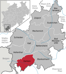  | |
 Dahlem 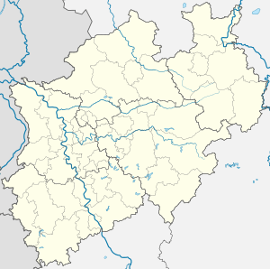 Dahlem | |
| Coordinates: 50°22′59″N 06°32′59″E | |
| Country | Germany |
| State | North Rhine-Westphalia |
| Admin. region | Köln |
| District | Euskirchen |
| Government | |
| • Mayor | Reinhold Müller (CDU) |
| Area | |
| • Total | 95.18 km2 (36.75 sq mi) |
| Elevation | 539 m (1,768 ft) |
| Population (2018-12-31)[1] | |
| • Total | 4,183 |
| • Density | 44/km2 (110/sq mi) |
| Time zone | CET/CEST (UTC+1/+2) |
| Postal codes | 53949 |
| Dialling codes | 02447 |
| Vehicle registration | EU |
| Website | www.dahlem.de |
Geography
Dahlem is located in the northern Eifel region in the High Fens – Eifel Nature Park between Blankenheim in the Northeast and Stadtkyll the southwest. The Kyll flows through the region from the Glaadtbach. The Heidenköpfe lie in the Ripsdorfer forest to the east.
gollark: I don't think that even needs ctypes.
gollark: Anyway. That obfuscated Python script should install it in CCEmuX.
gollark: They probably wouldn't like it be since I have no version control.
gollark: `shell.run"b"`
gollark: PotatOS isn't a language.
References
- "Bevölkerung der Gemeinden Nordrhein-Westfalens am 31. Dezember 2018" (in German). Landesbetrieb Information und Technik NRW. Retrieved 10 July 2019.
Towns and municipalities in Euskirchen (district) | ||
|---|---|---|
Coat of Arms of Euskirchen County | ||
| Authority control |
|
|---|
This article is issued from Wikipedia. The text is licensed under Creative Commons - Attribution - Sharealike. Additional terms may apply for the media files.