Marihatag, Surigao del Sur
Marihatag, officially the Municipality of Marihatag (Surigaonon: Lungsod nan Marihatag; Tagalog: Bayan ng Marihatag), is a 3rd class municipality in the province of Surigao del Sur, Philippines. According to the 2015 census, it has a population of 18,518 people.[3]
Marihatag | |
|---|---|
| Municipality of Marihatag | |
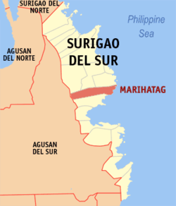 Map of Surigao del Sur with Marihatag highlighted | |
OpenStreetMap 
| |
.svg.png) Marihatag Location within the Philippines | |
| Coordinates: 8°48′N 126°18′E | |
| Country | |
| Region | Caraga (Region XIII) |
| Province | Surigao del Sur |
| District | 1st district |
| Barangays | 12 (see Barangays) |
| Government | |
| • Type | Sangguniang Bayan |
| • Mayor | Justin Marc L. Pelenio |
| • Vice Mayor | Jovita S. Umapas |
| • Congressman | Prospero A. Pichay Jr. |
| • Electorate | 13,155 voters (2019) |
| Area | |
| • Total | 312.50 km2 (120.66 sq mi) |
| Population (2015 census)[3] | |
| • Total | 18,518 |
| • Density | 59/km2 (150/sq mi) |
| • Households | 3,668 |
| Economy | |
| • Income class | 3rd municipal income class |
| • Poverty incidence | 45.64% (2015)[4] |
| • Revenue (₱) | 95,826,705.30 (2016) |
| Time zone | UTC+8 (PST) |
| ZIP code | 8306 |
| PSGC | |
| IDD : area code | +63 (0)86 |
| Climate type | tropical rainforest climate |
| Native languages | Surigaonon Agusan language Cebuano Kamayo Tagalog |
| Website | www |
It was known as Oteiza until 1955.[5]
The municipality hosts the "Balik-Marihatag" Festival which literally means going back home to Marihatag.
Etymology
Its name is a concatenation of Maria Ihatag.
Barangays
Marihatag is politically subdivided into 12 barangays.
- Alegria
- Amontay
- Antipolo
- Arorogan
- Bayan
- Mahaba
- Mararag
- Poblacion
- San Antonio
- San Isidro
- San Pedro
- Sta Cruz
Demographics
| Year | Pop. | ±% p.a. |
|---|---|---|
| 1960 | 12,391 | — |
| 1970 | 7,254 | −5.21% |
| 1975 | 9,636 | +5.86% |
| 1980 | 10,779 | +2.27% |
| 1990 | 10,663 | −0.11% |
| 1995 | 13,254 | +4.16% |
| 2000 | 16,394 | +4.66% |
| 2007 | 17,622 | +1.00% |
| 2010 | 17,926 | +0.62% |
| 2015 | 18,518 | +0.62% |
| Source: Philippine Statistics Authority[3][6][7][8] | ||
Climate
| Climate data for Marihatag, Surigao del Sur | |||||||||||||
|---|---|---|---|---|---|---|---|---|---|---|---|---|---|
| Month | Jan | Feb | Mar | Apr | May | Jun | Jul | Aug | Sep | Oct | Nov | Dec | Year |
| Average high °C (°F) | 27 (81) |
27 (81) |
28 (82) |
29 (84) |
30 (86) |
29 (84) |
30 (86) |
30 (86) |
30 (86) |
29 (84) |
29 (84) |
28 (82) |
29 (84) |
| Average low °C (°F) | 23 (73) |
22 (72) |
22 (72) |
23 (73) |
23 (73) |
23 (73) |
23 (73) |
23 (73) |
23 (73) |
23 (73) |
23 (73) |
23 (73) |
23 (73) |
| Average precipitation mm (inches) | 152 (6.0) |
116 (4.6) |
90 (3.5) |
68 (2.7) |
88 (3.5) |
96 (3.8) |
78 (3.1) |
73 (2.9) |
70 (2.8) |
96 (3.8) |
125 (4.9) |
132 (5.2) |
1,184 (46.8) |
| Average rainy days | 20.8 | 17.7 | 18.5 | 17.2 | 20.8 | 22.5 | 22.5 | 22.7 | 22.0 | 23.7 | 22.5 | 19.9 | 250.8 |
| Source: Meteoblue [9] | |||||||||||||
gollark: osmarks.tk's experiment pages are just HTML/CSS/JS with no title bar or comment box or anything, plus metadata, and the blog stuff is Markdown. The static site generator compiles the markdown to HTML, and puts the HTML into templates, embeds styles and stuff, adds the achievement system code, and all that sort of thing, and produces HTML/CSS/JS for upload to my server.
gollark: APNG good, MP4 good, etc.
gollark: GIFs are just an awful format which only stuck around because animation.
gollark: GIFS BAD
gollark: Apart from being PHP, I guess.
See also
- List of renamed cities and municipalities in the Philippines
References
- "Municipality". Quezon City, Philippines: Department of the Interior and Local Government. Retrieved 31 May 2013.
- "Province: Surigao del Sur". PSGC Interactive. Quezon City, Philippines: Philippine Statistics Authority. Retrieved 12 November 2016.
- Census of Population (2015). "Caraga". Total Population by Province, City, Municipality and Barangay. PSA. Retrieved 20 June 2016.
- "PSA releases the 2015 Municipal and City Level Poverty Estimates". Quezon City, Philippines. Retrieved 12 October 2019.
- Republic Act No. 1261, PhilippineLaw.info, retrieved 2012
- Census of Population and Housing (2010). "Caraga". Total Population by Province, City, Municipality and Barangay. NSO. Retrieved 29 June 2016.
- Censuses of Population (1903–2007). "Caraga". Table 1. Population Enumerated in Various Censuses by Province/Highly Urbanized City: 1903 to 2007. NSO.
- "Province of Surigao del Sur". Municipality Population Data. Local Water Utilities Administration Research Division. Retrieved 17 December 2016.
- "Marihatag: Average Temperatures and Rainfall". Meteoblue. Retrieved 19 November 2019.
External links
- Marihatag Profile at PhilAtlas.com
- Philippine Standard Geographic Code
- Philippine Census Information
- Local Governance Performance Management System
Places adjacent to Marihatag, Surigao del Sur | ||||||||||
|---|---|---|---|---|---|---|---|---|---|---|
| ||||||||||
Tandag (capital) | |
| Municipalities | |
| Component cities | |
This article is issued from Wikipedia. The text is licensed under Creative Commons - Attribution - Sharealike. Additional terms may apply for the media files.