Carrascal
Carrascal, officially the Municipality of Carrascal (Surigaonon: Lungsod nan Carrascal; Tagalog: Bayan ng Carrascal), is a 4th class municipality in the province of Surigao del Sur, Philippines. According to the 2015 census, it has a population of 22,479 people.[3]
Carrascal | |
|---|---|
| Municipality of Carrascal | |
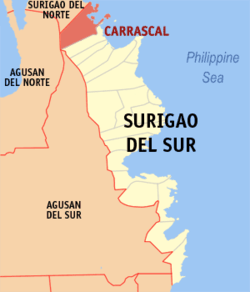
 Map of Surigao del Sur with Carrascal highlighted | |
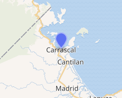
OpenStreetMap 
| |
.svg.png) Carrascal Location within the Philippines | |
| Coordinates: 9°22′13″N 125°56′57″E | |
| Country | |
| Region | Caraga (Region XIII) |
| Province | Surigao del Sur |
| District | 1st District |
| Barangays | 14 (see Barangays) |
| Government | |
| • Type | Sangguniang Bayan |
| • Mayor | Vicente H. Pimentel III |
| • Vice Mayor | Jessie James T. Valle |
| • Congressman | Prospero A. Pichay Jr. |
| • Electorate | 15,703 voters (2019) |
| Area | |
| • Total | 265.80 km2 (102.63 sq mi) |
| Population (2015 census)[3] | |
| • Total | 22,479 |
| • Density | 85/km2 (220/sq mi) |
| • Households | 5,003 |
| Economy | |
| • Income class | 4th municipal income class |
| • Poverty incidence | 35.56% (2015)[4] |
| • Revenue (₱) | 286,238,347.97 (2016) |
| Time zone | UTC+8 (PST) |
| ZIP code | 8318 |
| PSGC | |
| IDD : area code | +63 (0)86 |
| Climate type | tropical rainforest climate |
| Native languages | Surigaonon Agusan language Cebuano Tagalog |
| Website | www |
Geography
Unique physical features of Carrascal are the uneven distribution of its lowlands and rolling hills.[5] Carrascal is the boundary town of Surigao del Sur with Surigao del Norte.
Barangays
Carrascal is politically subdivided into 14 barangays. Babuyan, Dahican and Caglayag were converted into a barrio in 1956.[6]
Climate
| Climate data for Carrascal, Surigao del Sur | |||||||||||||
|---|---|---|---|---|---|---|---|---|---|---|---|---|---|
| Month | Jan | Feb | Mar | Apr | May | Jun | Jul | Aug | Sep | Oct | Nov | Dec | Year |
| Average high °C (°F) | 27 (81) |
28 (82) |
28 (82) |
30 (86) |
30 (86) |
30 (86) |
29 (84) |
30 (86) |
30 (86) |
29 (84) |
29 (84) |
28 (82) |
29 (84) |
| Average low °C (°F) | 23 (73) |
23 (73) |
23 (73) |
23 (73) |
25 (77) |
25 (77) |
25 (77) |
25 (77) |
25 (77) |
25 (77) |
24 (75) |
24 (75) |
24 (75) |
| Average precipitation mm (inches) | 210 (8.3) |
161 (6.3) |
123 (4.8) |
85 (3.3) |
148 (5.8) |
186 (7.3) |
164 (6.5) |
157 (6.2) |
141 (5.6) |
190 (7.5) |
223 (8.8) |
200 (7.9) |
1,988 (78.3) |
| Average rainy days | 21.0 | 16.8 | 18.5 | 18.2 | 24.9 | 27.7 | 28.4 | 27.0 | 26.1 | 27.6 | 24.6 | 22.0 | 282.8 |
| Source: Meteoblue (Use with caution: this is modeled/calculated data, not measured locally.) [7] | |||||||||||||
Demographics
| Year | Pop. | ±% p.a. |
|---|---|---|
| 1903 | 2,489 | — |
| 1939 | 5,557 | +2.26% |
| 1948 | 5,988 | +0.83% |
| 1960 | 7,898 | +2.33% |
| 1970 | 8,240 | +0.42% |
| 1975 | 9,230 | +2.30% |
| 1980 | 12,810 | +6.77% |
| 1990 | 12,693 | −0.09% |
| 1995 | 12,018 | −1.02% |
| 2000 | 13,157 | +1.96% |
| 2007 | 14,283 | +1.14% |
| 2010 | 16,529 | +5.46% |
| 2015 | 22,479 | +6.03% |
| Source: Philippine Statistics Authority[3][8][9][10] | ||
Economy
Mining industry
Carrascal, known for its mining economy, is home to a number of large-scale mining firms. In early 2017, CTP Construction and Mining Corporation and Carrascal Nickel Corporation that operated near coastal areas while Marcventures Mining and Development Corporation in a declared watershed were found violating the Department of Environment and Natural Resources (DENR) policy, thus sanctioned for closure.[11] Economic pressures felt immediately by its local stakeholders; controversially and concurrently, the Philippine political machinery intervened at the national stage. Short-lived environmental court sanctions was then rescinded later that same year due to an injunctive relief from "filed motions and appeal for reconsideration" allowing mining re-operations that environmental group Caraga Watch vehemently contested as "inutile and bankrupt mining law and policies;" [12] further prompting for pre-emptive, sensible environmental watch and on-going national/local discussions before waking-up to extractive gas drill operations in its shorelines.
Special areas of economic considerations
The ideal candidate site of proposed wind power projects is located approximately 300 meter masl in the mining area near Carrascal. It is accessible from a highway under perpetual reconstruction and further made accessible by exploration roads constructed by mining companies. The terrain is mostly flat, with minimal vegetation, causing minimal turbulence to wind flow in the area. It overlooks the Philippine Sea from the southeast and the north-west directions. Some permanent deformations of small trees indicate that the wind typically comes from the north-east direction. Ground measurements yielded wind speeds of 8–11 m/s, which, by industry standards has excellent wind power potential. However, further validation studies of at least one year of wind data gathered from the site is nonexistent. Transmission lines of the local cooperative pass through this wind power candidate site, making it more attractive for wind and/ solar energy development to alleviate badly needed energy infrastructure to sustain large scale industrialization and its lofty bid to become the northernmost "city" of Surigao del Sur.[13]
References
- "Municipality". Quezon City, Philippines: Department of the Interior and Local Government. Retrieved 31 May 2013.
- "Province: Surigao del Sur". PSGC Interactive. Quezon City, Philippines: Philippine Statistics Authority. Retrieved 12 November 2016.
- Census of Population (2015). "Caraga". Total Population by Province, City, Municipality and Barangay. PSA. Retrieved 20 June 2016.
- "PSA releases the 2015 Municipal and City Level Poverty Estimates". Quezon City, Philippines. Retrieved 12 October 2019.
- http://www.carrascal.gov.ph/content.php?id=1&sub_id=4
- "An Act Converting into Barrios Certain Sitios in the Province of Surigao, and Dividing the Barrio of Macalaya into Two Barrios, Municipality of Placer, in the Same Province". LawPH.com. Archived from the original on 2012-07-11. Retrieved 2011-04-12.
- "Carrascal: Average Temperatures and Rainfall". Meteoblue. Retrieved 19 November 2019.
- Census of Population and Housing (2010). "Caraga". Total Population by Province, City, Municipality and Barangay. NSO. Retrieved 29 June 2016.
- Censuses of Population (1903–2007). "Caraga". Table 1. Population Enumerated in Various Censuses by Province/Highly Urbanized City: 1903 to 2007. NSO.
- "Province of Surigao del Sur". Municipality Population Data. Local Water Utilities Administration Research Division. Retrieved 17 December 2016.
- "Archived copy". Archived from the original on 2017-02-12. Retrieved 2017-02-11.CS1 maint: archived copy as title (link)
- http://www.interaksyon.com/15-mining-firms-in-caraga-suspended-by-lopez-allowed-to-operate-again
- "Archived copy" (PDF). Archived from the original (PDF) on 2011-07-16. Retrieved 2008-05-02.CS1 maint: archived copy as title (link)