Mansurchak Block
Mansurchak Block (Hindi: मंसूरचक प्रखंड) is one of the eighteen Blocks of Begusarai District of Bihar state, India. As per the government register, the block number of Mansurchak is 297. The block has 41 villages and one town of Mansurchak. It is the headquarters of Begusarai District.It is a part of Darbhanga Division.
Mansurchak Block मंसूरचक प्रखंड | |
|---|---|
Community Development Block | |
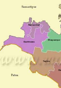 | |
 Mansurchak Block Location in Bihar, India | |
| Coordinates: 25.6254°N 85.9215°E | |
| Country | India |
| State | Bihar |
| District | Begusarai |
| Lok Sabha constituency | Begusarai |
| Assembly constituency | Bachhwara |
| Region | Mithila |
| Government | |
| • Type | Community Development Block |
| • Body | Mansurchak Block |
| • member of parliament | Bhola Singh |
| • member of legislative assembly | Ramdev Rai |
| Area | |
| • Total | 26 km2 (10 sq mi) |
| Elevation | 49 m (161 ft) |
| Population (2011) | |
| • Total | 80,510 |
| • Density | 3,100/km2 (8,000/sq mi) |
| Time zone | UTC+5:30 (IST) |
| PIN | 851128 |
| Telephone code | 06278 |
| ISO 3166 code | IN-BR |
| Vehicle registration | BR-09 |
| Sex ratio | 935 |
| Language | Hindi, Maithili, Urdu |
| Additional language | English |
| Website | begusarai |
Geography
Mansurchak block is a city situated in Begusarai district of Bihar which falls in India. The geographical coordinates i.e. latitude and longitude of Mansurchak is 25.631262 and 85.907322 respectively. Mansurchak observes Indian Standard Time. The currency code for Indian rupee is INR. The currency used in Mansurchak block is Indian rupee.
Demographics
Transport
Roadways
Mansurchak block is connected by road. This town is situated on Dalsinghsarai to zero mile-malti road which links zero mile to city of Dalsinghsarai, Samastipur. It is also connected to Bachwara NH-28.
Railways
Bachwara Jn railway station is the nearest railway station from Mansurchak. The straight line distance from Mansurchak to Bachwara Jn railway station is 5.3 kilometers. The nearest railway station and its distance from Mansurchak are:
- Bachwara Jn railway station 5.3 km
- Sathajagat railway station 5.4 km
- Dalsingh Sarai railway station 9.1 km[2]
Climate
It is hot in summer. Mansurchak block summer highest day temperature is between 29°C to 45°C . The average temperature in January is 16°C . February is 20°C. March is 27°C. April is 32°C. May is 36°C. June is 39°C.
Education
D. B. M. Inter College was established in 1981 and it is managed by the Department of Education. The school is taught in Hindi and consists of grades 11 and 12. The school is co-educational and does not have an attached pre-primary section.[[3]]
10+2 high school
N N Shina 10+2
10+2 SBD Girls Higher Secondary School
T P C High School Nayatol Agapur
CBSE Pattern
Udaan the 7 habits Foundation School
Career Public School
Raj Public School Kastoli
Hospital
Village
|
Politics
Mansurchak block comes under the Bachwara assembly constituency. The major political parties in this area are:
- Indian National Congress
- Janata Dal (United)
- Lok Janshakti Party
- Rashtriya Janata Dal
- Bharatiya Janata Party
- Communist Party of India
- Communist Party of India (Marxist)
References
- "Mansurchak Block Census 2011 data". Census 2011 India. Retrieved 6 February 2019.
- "Mansurchak". Retrieved 25 October 2018.
- Infosystems, Yora. "D. B. M. Inter College, Manshoorchak - Satha, District Begusarai (Bihar)". schools.org.in. Retrieved 21 October 2018.