Mandoto
Mandoto is a town and commune in Madagascar. It belongs to the district of Batafo, which is a part of Vakinankaratra Region. The population of the commune was estimated to be approximately 37,000 in 2001 commune census.[2]
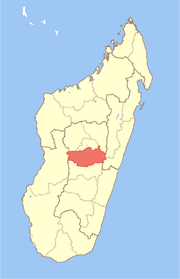
Mandoto | |
|---|---|
 Mandoto Location in Madagascar | |
| Coordinates: 19°34′S 46°17′E | |
| Country | |
| Region | Vakinankaratra |
| District | Batafo |
| Elevation | 817 m (2,680 ft) |
| Population (2001)[2] | |
| • Total | 37,000 |
| • Ethnicities | Merina |
| Time zone | UTC3 (EAT) |
Primary and junior level secondary education are available in town. The majority 80% of the population of the commune are farmers, while an additional 18% receives their livelihood from raising livestock. The most important crop is rice, while other important products are maize and cassava. Services provide employment for 2% of the population.[2]
Geography
This town is situated on the route nationale No.34 at 117 km West of Antsirabe and 129 km East of Miandrivazo.[3]
References and notes
- Estimated based on DEM data from Shuttle Radar Topography Mission
- "ILO census data". Cornell University. 2002. Retrieved 2008-04-22.
- Atlas Mondial, France Loisir, page 158
gollark: That's actually why I'm hollark and not gollark.
gollark: There was that h giveaway a while a go.
gollark: Hmm, so they were actually right. Troubling.
gollark: A smart bot would of course have a hot spare running which would take over if their main instance stopped existing somehow.
gollark: Obviously you would just detect that in advance and migrate to another server.
This article is issued from Wikipedia. The text is licensed under Creative Commons - Attribution - Sharealike. Additional terms may apply for the media files.