Manjakatompo
Manjakatompo is a town and commune in Madagascar. It belongs to the district of Ambatolampy, which is a part of Vakinankaratra Region. The population of the commune was estimated to be approximately 6,000 in 2001 commune census.[2][2]
Manjakatompo | |
|---|---|
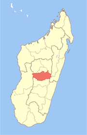
 Manjakatompo Location in Madagascar | |
| Coordinates: 19°20′S 47°26′E | |
| Country | |
| Region | Vakinankaratra |
| District | Ambatolampy |
| Elevation | 1,552 m (5,092 ft) |
| Population (2001)[2] | |
| • Total | 6,000 |
| Time zone | UTC3 (EAT) |
The town is situated near the Ankaratra massif and the third highest peak of Madagascar, the Mount Tsiafajavona (2643 meters).
There is a forest station near the town covering 8320 ha.[3]
References and notes
- Estimated based on DEM data from Shuttle Radar Topography Mission
- "ILO census data". Cornell University. 2002. Retrieved 2008-04-22.
- www.madagascar-guide.com
gollark: There's generally the common issue of trying to teach people stuff they often do not actually care about in very boring ways.
gollark: I think most of it does, really, but often in different ways.
gollark: The grammar appears to be missing things like flat earth, COVID-19 secretly not actually being contagious because something or other, Bill Gates, birds as government spy drones, government-generated cognitohazards in Facebook, periodic table "skepticism", and all that.
gollark: Artificial intelligence is hard and annoying to do, but artificial stupidity is really easy. Although it is harder to match the full range of stupidity of humans.
gollark: It has too many spaces in it, but I guess bad grammar is a conspiracy thing too.
This article is issued from Wikipedia. The text is licensed under Creative Commons - Attribution - Sharealike. Additional terms may apply for the media files.