Manambato
Manambato is a municipality (French: commune, Malagasy: kaominina) in Madagascar. It belongs to the district of Ambilobe, which is a part of Diana Region. It is situated at the Mahavavy River.
Manambato | |
|---|---|
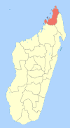
 Manambato Location in Madagascar | |
| Coordinates: 13°42′S 49°7′E | |
| Country | |
| Region | Diana |
| District | Ambilobe |
| Elevation | 268 m (879 ft) |
| Population (2001)[2] | |
| • Total | 7,000 |
| Time zone | UTC3 (EAT) |
According to 2001 census the population of Manambato was 7000.[2]
Only primary schooling is available in town. The majority (99%) of the population are farmers. The most important crop is rice, while other important products are maize, seeds of catechu and vanilla. Services provide employment for 1% of the population.[2]
References and notes
- Estimated based on DEM data from Shuttle Radar Topography Mission
- "ILO census data". Cornell University. 2002. Retrieved 2008-02-13.
| Ambanja |
|  |
|---|---|---|
| Ambilobe | ||
| Antsiranana I | ||
| Antsiranana II | ||
| Nosy Be | ||
gollark: I have many anti-Intel memes.
gollark: They're generally behind on price to performance, and have all those !!FUN!! speculative execution exploits.
gollark: I would not recommend Intel.
gollark: You can also get little fans.
gollark: Not *really*, but it does help.
This article is issued from Wikipedia. The text is licensed under Creative Commons - Attribution - Sharealike. Additional terms may apply for the media files.