Ampondralava
Ampondralava is a municipality (French: commune, Malagasy: kaominina) in Madagascar. It belongs to the district of Ambilobe, which is a part of Diana Region. According to 2001 census the population of Ampondralava was 6381.[2]
Ampondralava | |
|---|---|
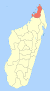
 Ampondralava Location in Madagascar | |
| Coordinates: 13°10′S 48°56′E | |
| Country | |
| Region | Diana |
| District | Ambilobe |
| Elevation | 20 m (70 ft) |
| Population (2001)[2] | |
| • Total | 6,381 |
| Time zone | UTC3 (EAT) |
Primary and junior level secondary education are available in town. The majority (99%) of the population are farmers. The most important crops are rice and sugarcane; also cotton is an important agricultural product. Services provide employment for 1% of the population.[2]
References and notes
- Estimated based on DEM data from Shuttle Radar Topography Mission
- "ILO census data". Cornell University. 2002. Retrieved 2008-02-13.
| Ambanja |
|  |
|---|---|---|
| Ambilobe | ||
| Antsiranana I | ||
| Antsiranana II | ||
| Nosy Be | ||
gollark: Suuuuuuure.
gollark: I have no idea how to assist with this so far!
gollark: Great! Go on.
gollark: You should, like ABR, use SQLite.
gollark: Anyway, this is bad.
This article is issued from Wikipedia. The text is licensed under Creative Commons - Attribution - Sharealike. Additional terms may apply for the media files.