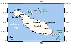
Makira
The island of Makira (also known as San Cristobal) is the largest island of Makira-Ulawa Province in the Solomon Islands. The island is located east of Guadalcanal and south of Malaita. The largest and capital city is Kirakira.
 Makira and nearby islands | |
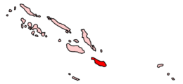 Location of Makira in Solomon Islands | |
| Geography | |
|---|---|
| Location | Solomon Islands |
| Coordinates | 10°33′04″S 161°49′41″E |
| Area | 3,190 km2 (1,230 sq mi) |
| Administration | |
Solomon Islands | |
| Province | Makira-Ulawa Province |
| Largest settlement | Kirakira |
| Demographics | |
| Population | ~10,000 (1999) |
The first recorded sighting by Europeans of Makira was by the Spanish expedition of Álvaro de Mendaña in June 1568. More precisely the sighting and also landing in San Cristobal was due to a local voyage that set out from Guadalcanal in a small boat, in the accounts the brigantine Santiago, commanded by Alférez Hernando Enriquez and having Hernán Gallego as pilot. They charted it as San Cristóbal.[1][2]
Gallery
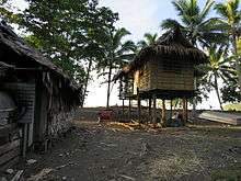 Some of the local houses next to the beach at Kirakira
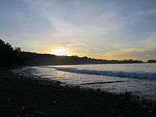 A kirakira beach at sunset
gollark: I know my code is probably maybe safe, but it doesn't.
gollark: BEE rustc.
gollark: For... Minoteaur...?
gollark: My code is valid and does *not* try and mutably borrow the same subthings of my thing twice, but the borrow checker does not know that.
gollark: This is very h.
References
- Sharp, Andrew The discovery of the Pacific Islands Oxford, 1960, pp.46,47.
- Brand, Donald D. The Pacific Basin: A History of its Geographical Explorations The American Geographical Society, New York, 1967, p.133.
External links

This article is issued from Wikipedia. The text is licensed under Creative Commons - Attribution - Sharealike. Additional terms may apply for the media files.