Maha Rat District
Maha Rat (Thai: มหาราช, pronounced [māhǎː râːt]) is a district (amphoe) in the northern part of Ayutthaya Province in Thailand.
Maha Rat มหาราช | |
|---|---|
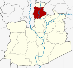 District location in Ayutthaya Province | |
| Coordinates: 14°32′3″N 100°31′37″E | |
| Country | Thailand |
| Province | Ayutthaya |
| Seat | Hua Phai |
| Tambon | 12 |
| Muban | 58 |
| Area | |
| • Total | 120.156 km2 (46.392 sq mi) |
| Population (2010) | |
| • Total | 23,525 |
| • Density | 193.9/km2 (502/sq mi) |
| Time zone | UTC+7 (ICT) |
| Postal code | 13150 |
| Geocode | 1415 |
History
Originally the district was named Khwaeng Nakhon Yai. It was converted to an amphoe in 1914 and changed its name to Maha Rat in 1917.[1]
Geography
Neighboring districts are (from the north clockwise) Ban Phraek of Ayutthaya Province, Don Phut of Saraburi Province, Bang Pahan of Ayutthaya Province, and Pa Mok, Mueang Ang Thong, and Chaiyo of Ang Thong Province.
Administration
The district is divided into 12 sub-districts tambon, which are further subdivided into 58 villages muban. There are two sub-district municipalities (thesaban tambon). Maha Rat covers the whole tambon Hua Phai and Maha Rat. Rong Chang covers the whole tambon Nam Tao, Rong Chang, Chao Pluk, and Phit Phian. There are a further five tambon administrative organizations.
| No. | Name | Thai | Villages | Pop.[2] |
|---|---|---|---|---|
| 1. | Hua Phai | หัวไผ่ | 6 | 2,156 |
| 2. | Kathum | กะทุ่ม | 5 | 1,272 |
| 3. | Maha Rat | มหาราช | 4 | 1,317 |
| 4. | Nam Tao | น้ำเต้า | 4 | 1,295 |
| 5. | Bang Na | บางนา | 5 | 1,973 |
| 6. | Rong Chang | โรงช้าง | 4 | 1,820 |
| 7. | Chao Pluk | เจ้าปลุก | 5 | 1,571 |
| 8. | Phit Phian | พิตเพียน | 7 | 1,874 |
| 9. | Ban Na | บ้านนา | 6 | 4,053 |
| 10. | Ban Khwang | บ้านขวาง | 4 | 2,052 |
| 11. | Tha To | ท่าตอ | 4 | 2,084 |
| 12. | Ban Mai | บ้านใหม่ | 4 | 2,058 |
References
- ประกาศกระทรวงมหาดไทย เรื่อง เปลี่ยนชื่ออำเภอ (PDF). Royal Gazette (in Thai). 34 (0 ก): 40–68. 1917-04-29.
- "Population statistics 2010". Department of Provincial Administration.
External links
- amphoe.com (Thai)