Madocsa
Madocsa | |
|---|---|
 Coat of arms | |
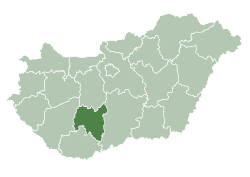
 Madocsa Location of Madocsa in Hungary | |
| Coordinates: 46.688°N 18.949°E | |
| Country | Hungary |
| Region | Southern Transdanubia |
| County | Tolna |
| Area | |
| • Total | 43.33 km2 (16.73 sq mi) |
| Population (2012)[2] | |
| • Total | 1,881 |
| • Density | 43/km2 (110/sq mi) |
| Time zone | UTC+1 (CET) |
| • Summer (DST) | UTC+2 (CEST) |
| Postal code | 7026 |
| Area code | +36 75 |
| Website | http://www.madocsa.hu/ |
Madocsa is a village in Tolna County, Hungary.
Location
Madocsa situated 1.5 km to the west direction from Danube river, 5–6 km to the east direction form the border of Tolna hilly country, on a higher point of the flood area. Can be reached from Dunaföldvár (14 km) to the south direction on an almost parallel road with Danube via Bölcske, or from Paks (11 km) to the north-east direction leaving the main road No. 6 at Dunakömlőd.

Madocsa, church from a bird's eye view
gollark: Yes, indeed.
gollark: ...
gollark: - My stuff... isn't CSV, how would that even work.- I'd also want to encrypt it because I do not trust Discord.
gollark: That would be really stupid.
gollark: A script to do what, backup to Discord?
References
- Madocsa at the Hungarian Central Statistical Office (Hungarian).
- Madocsa at the Hungarian Central Statistical Office (Hungarian). 2012
External links

- Street map (in Hungarian)
| City with county rights |
|   |
|---|---|---|
| Towns | ||
| Large villages | ||
| Villages |
| |
| Other topics |
| |
This article is issued from Wikipedia. The text is licensed under Creative Commons - Attribution - Sharealike. Additional terms may apply for the media files.