Lovongai Rural LLG
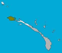
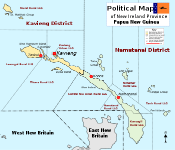
Lovongai Rural LLG (also spelled Lavongai) is a local government area in New Ireland Province, Papua New Guinea. The LLG administers the island of New Hanover and a few surrounding islands. The LLG is located in Kavieng District and the LLG headquarters is Taskul. Some population centres in the LLG are: Taskul, Patiagaga, Patipai, Ungakum, Tsoi, Tukulisava, and Ungalik. This LLG has 19 wards, comprising a population of 29,005 (Census 2011). Current LLG President is John Aini.
Lovongai Rural LLG | |
|---|---|
 | |
| Country | Papua New Guinea |
| Province | New Ireland Province |
| Time zone | UTC+10 (AEST) |

District map of New Ireland Province
Wards
- 01. Taskul
- 02. Patiagaga
- 03. Patipai
- 04. Ungakum
- 05. Tsoi
- 06. Tukulisava
- 07. Ungalik
- 08. Meterankasing
- 09. Noipuas
- 10. Sosson
- 11. Tingwon
- 12. Umbukul
- 13. Kone
- 14. Meteselen
- 15. Tioputuk
- 16. Lovongai
- 17. Meterangkang
- 18. Lungatang
- 19. Kulingei
gollark: You could set up scripts to read them out to you via TTS at random times.
gollark: You really should follow these things by RSS reader.
gollark: I can compress images nicely for thumbnails so it isn't really a huge issue. I'm mostly concerned about actually having good images.
gollark: Indeed.
gollark: Me. Bee you.
References
- "Census Figures by Wards - Islands Region". www.nso.gov.pg. 2011 National Population and Housing Census: Ward Population Profile. Port Moresby: National Statistical Office, Papua New Guinea. 2014.
- "Final Figures". www.nso.gov.pg. 2011 National Population and Housing Census: Ward Population Profile. Port Moresby: National Statistical Office, Papua New Guinea. 2014.
- OCHA FISS (2018). "Papua New Guinea administrative level 0, 1, 2, and 3 population statistics and gazetteer". Humanitarian Data Exchange. 1.31.9.
- United Nations in Papua New Guinea (2018). "Papua New Guinea Village Coordinates Lookup". Humanitarian Data Exchange. 1.31.9.
This article is issued from Wikipedia. The text is licensed under Creative Commons - Attribution - Sharealike. Additional terms may apply for the media files.