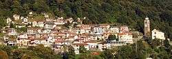
Loreglia
Loreglia is a comune (municipality) in the Province of Verbano-Cusio-Ossola in the Italian region Piedmont, located about 110 kilometres (68 mi) northeast of Turin and about 9 kilometres (6 mi) southwest of Verbania. As of 31 December 2004, it had a population of 279 and an area of 9.2 square kilometres (3.6 sq mi).[3]
Loreglia | |
|---|---|
| Comune di Loreglia | |
 | |
Location of Loreglia 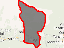
| |
 Loreglia Location of Loreglia in Italy 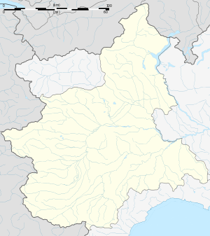 Loreglia Loreglia (Piedmont) | |
| Coordinates: 45°53′N 8°27′E | |
| Country | Italy |
| Region | Piedmont |
| Province | Province of Verbano-Cusio-Ossola (VB) |
| Frazioni | Chesio |
| Area | |
| • Total | 9.2 km2 (3.6 sq mi) |
| Population (Dec. 2004)[2] | |
| • Total | 279 |
| • Density | 30/km2 (79/sq mi) |
| Time zone | UTC+1 (CET) |
| • Summer (DST) | UTC+2 (CEST) |
| Postal code | 28020 |
| Dialing code | 0323 |
| Website | Official website |
Loreglia borders the following municipalities: Casale Corte Cerro, Germagno, Ornavasso, Quarna Sopra, Valstrona.
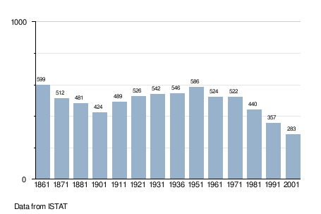
Demographic evolution
gollark: Good, gooooood.
gollark: The 3D version used something *basically* like that, with a bonus for longer lines.
gollark: I might already do that in the current implementation.
gollark: Removing unusable lines from consideration might be good, yes.
gollark: The current time is fine. It just needs to be able to do more searching, to be actually smart.
References
- "Superficie di Comuni Province e Regioni italiane al 9 ottobre 2011". Istat. Retrieved 16 March 2019.
- "Popolazione Residente al 1° Gennaio 2018". Istat. Retrieved 16 March 2019.
- All demographics and other statistics: Italian statistical institute Istat.
This article is issued from Wikipedia. The text is licensed under Creative Commons - Attribution - Sharealike. Additional terms may apply for the media files.