List of recreational walks in Cheshire
This is a list of recreational walks in the ceremonial county of Cheshire. The list includes walks that are wholly inside Cheshire and also those that pass through to another county. The walks are generally through countryside on a variety of trails and footpaths. Small walks of local interest only are not included. There are 1,864 miles[1] (3,000 km) of public rights of way in Cheshire, England.
List of walking trails in Cheshire
| Name | Image | Route | Length | Notes | Refs |
|---|---|---|---|---|---|
| Baker Way | 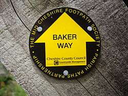 | Chester to Delamere Forest | 13 miles (19km) | Starts at Chester railway station and finishes at Delamere railway station | |
| Bishop Bennet Way |  | Beeston to Wirswall | 34 miles (55 km) | ||
| Bollin Valley Way | Macclesfield to Partington | 25 miles (40km) | Follows the River Bollin | [2] | |
| Cheshire Ring | 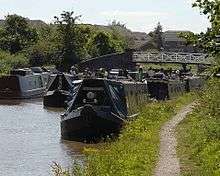 | Dukinfield and Marple | 97-mile (156 km) | Circular walk alongside six canals | |
| Crewe and Nantwich Circular Walk |  | Crewe and Nantwich | 29 miles (47km) | A circular walk around the two towns | [3] |
| Dane Valley Way | 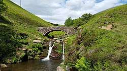 | Buxton to Northwich | 48 miles
(77km) |
Between Derbyshire and Cheshire partly along the River Dane | [4] |
| Delamere Way | 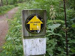 | Frodsham to Stockton Heath | 21 miles (33 km) | Goes via Delamere Forest | |
| Eddisbury Way | 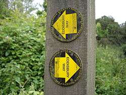 | Frodsham to Burwardsley | 16 miles (26 km) | Links up with the Sandstone Trail | |
| Goyt Way | .jpg) | Etherow Country Park to Whaley Bridge | 10 miles (16 km) | Links up with Midshires Way | |
| Great English Walk | Chepstow to Berwick-upon-Tweed | 583 miles (938 km) | Passes through Cheshire between the Shropshire border at Grindley Brook and the Staffordshire border near Congleton | [5] | |
| Gritstone Trail | 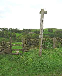 | Disley to Kidsgrove, Staffordshire | 35 miles (56 km) | Passes through Teggs Nose Country Park | |
| Ladybrook Valley Interest Trail | Disley to Cheadle | 12 miles (20km) | Finishes at the National Trust's Lyme Park | [6] | |
| Longster Trail | 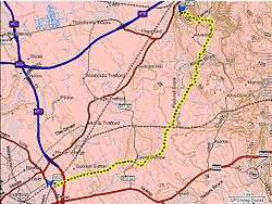 | Helsby Hill to Chester | 10 miles (16 km) | ||
| Maelor Way | 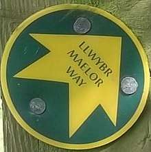 | Bronygarth to Whitchurch | 24 miles (39 km) | Finishes in Shropshire | |
| Marches Way | 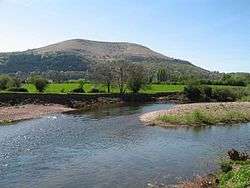 | Chester railway station to Cardiff | 200 miles (320 km) | Initially following the River Dee to Farndon, then passing through the border counties | |
| Middlewood Way | 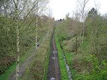 | Macclesfield to Marple | 10 miles (16 km) | ||
| Midshires Way | Bledlow, Buckinghamshire, to Stockport | 230 miles (370 km) | |||
| North Cheshire Way | 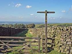 | Hooton to Disley | 71 miles (114 km) | Linking the Wirral Way, Sandstone Trail and Gritstone Trail | |
| Salter's Way | Rudheath (near Northwich) to Jenkin Chapel, Rainow | 25 miles (40 km) | [7] | ||
| Sandstone Trail | .jpg) | Frodsham to Whitchurch, Shropshire | 34 miles (55 km) | ||
| South Cheshire Way | 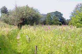 | Grindley Brook to Mow Cop | 32 miles (51 km) | Can be used as a link between the Sandstone Trail and the Gritstone Trail | |
| Trans Pennine Trail | Southport to Hornsea | 207 miles (333 km) | From Yorkshire to Merseyside passing through Widnes | ||
| Two Saints Way | Chester to Lichfield | 92 miles | |||
| Weaver Way | Frodsham to Audlem | 40 miles (65 km), | Via the River Weaver, the Trent and Mersey Canal and Shropshire Union Canal | [8] | |
| Wirral Way | 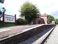 | Wirral | A circular trail around the Wirral Peninsula taking in part of West Cheshire and Hadlow Road railway station |
gollark: I have a very rough untested idea of how it operates. How coral could know I have no clue.
gollark: How would I know?
gollark: Technically, your preferred ones are a subset of that.
gollark: Oh. I only have all possible programs.
gollark: It uses algorithms and coding.
See also
- Long-distance footpaths in the UK
- List of parks and open spaces in Cheshire
References
- "Public Rights of Way". Cheshire County Council. Archived from the original on 8 May 2008. Retrieved 27 January 2007.
- "Bollin Valley Way". www.bollinvalley.org.uk.
- "Crewe and Nantwich Circular Walk Home". Cheshire County Council. Archived from the original on 29 August 2008.
- "Dane Valley Way - LDWA Long Distance Paths". www.ldwa.org.uk.
- "Great English Walk - LDWA Long Distance Paths". www.ldwa.org.uk.
- "Ladybrook Valley Interest Trail - LDWA Long Distance Paths". www.ldwa.org.uk.
- "Salter's Way - LDWA Long Distance Paths". www.ldwa.org.uk.
- "Weaver Way (Cheshire) - LDWA Long Distance Paths". www.ldwa.org.uk.
External links
This article is issued from Wikipedia. The text is licensed under Creative Commons - Attribution - Sharealike. Additional terms may apply for the media files.