Middlewood Way
The Middlewood Way is an 11-mile (16 km)[1] "linear park" in England, between Macclesfield (53.2601°N 2.1229°W) and Rose Hill, Marple (53.3950°N 2.0774°W), opened on 30 May 1985 by Dr David Bellamy.[2]
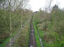
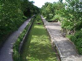
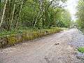
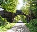
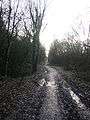
The Middlewood Way follows the route of the former Macclesfield, Bollington and Marple railway,[1] which had operated between 1869 and 1970. The Middlewood Way serves the needs of walkers, dog walkers, cyclists, joggers and horse riders and plays host to a wide range of flora and fauna. It runs approximately parallel to the Macclesfield Canal and passes through Bollington and Higher Poynton. It can be reached by rail at Macclesfield, Middlewood, Rose Hill Marple and Romiley via the Goyt Valley Connect 2 scheme.
The trail forms part of National Cycle Network Route 55 from Ironbridge to Preston.[3]
See also
- Recreational walks in Cheshire
Gallery
References
- "Middlewood Way". Cheshire East Council. Retrieved 19 April 2018.
- Maconie, Stuart (2012). Never Mind the Quantocks. David & Charles. ISBN 1446301656. Retrieved 19 April 2018.
- "Route 55". Sustrans. Retrieved 19 April 2018.