List of listed buildings in Ayr, South Ayrshire
List
| Name | Location | Date Listed | Grid Ref. [note 1] | Geo-coordinates | Notes | LB Number [note 2] | Image |
|---|---|---|---|---|---|---|---|
| 1-17 (Odd Nos) Queen's Terrace Including Boundary Walls And Railings | 55°27′44″N 4°38′25″W | Category B | 21724 |  | |||
| 19-33 (Odd Nos) Queen's Terrace Including Boundary Walls And Railings | 55°27′48″N 4°38′25″W | Category B | 21725 |  | |||
| 1 And 3 Racecourse Road Including Gatepiers And Boundary Wall | 55°27′30″N 4°38′05″W | Category B | 21728 | | |||
| 19 Racecourse Road, Pickwick Hotel Including Gatepiers And Boundary Wall | 55°27′20″N 4°38′08″W | Category C(S) | 21737 | | |||
| 36 Racecourse Road Including Gatepiers And Boundary Wall | 55°27′11″N 4°38′17″W | Category B | 21746 | | |||
| 94-104 (Even Nos) Midton Road, The Knowe Including Gatepiers And Boundary Wall | 55°26′57″N 4°37′57″W | Category B | 21757 | | |||
| 2 And 4 River Terrace | 55°27′54″N 4°37′44″W | Category B | 21761 |  | |||
| 14 And 16 Rosebank Crescent, Rosebank House Including Boundary Wall | 55°27′00″N 4°37′50″W | Category B | 21762 | | |||
| 2, 4A-4D, 6A-6D, 8A-8D, 10A-10D St Leonard's Wynd (Former School) | 55°26′57″N 4°37′35″W | Category C(S) | 21768 | | |||
| 67-71 (Odd Nos) Sandgate | 55°27′45″N 4°38′02″W | Category C(S) | 21781 | | |||
| 112 And 114 High Street And 1 Kirk Port | 55°27′47″N 4°37′47″W | Category B | 21627 | | |||
| 128 And 130 High Street | 55°27′46″N 4°37′47″W | Category B | 21630 | | |||
| 172-176 (Even Nos) High Street And 1-7 (Odd Nos) Mill Street, Wallace Tower | 55°27′42″N 4°37′45″W | Category B | 21636 |  | |||
| Main Street, Newton Tower Including Gates | 55°28′01″N 4°37′48″W | Category B | 21659 |  | |||
| Main Street, Newton Cross | 55°27′57″N 4°37′50″W | Category B | 21660 |  | |||
| 56 Midton Road, Normanhurst Including Gatepiers And Boundary Wall | 55°27′04″N 4°37′57″W | Category C(S) | 21672 | | |||
| 25 And 27 Miller Road Including Boundary Wall | 55°27′29″N 4°37′59″W | Category C(S) | 21675 | | |||
| 10-24 (Even Nos) Miller Road Including Gatepiers, Gates, Railings And Boundary Wall | 55°27′30″N 4°37′50″W | Category B | 21680 | | |||
| 22 Mount Charles Crescent Including Boundary Wall | 55°26′03″N 4°38′46″W | Category C(S) | 21686 | | |||
| 53 Greenfield Avenue, The Lodge Including Gatepiers, Railings And Boundary Wall | 55°26′12″N 4°38′44″W | Category B | 21687 | | |||
| 13-17 (Odd Nos) New Bridge Street | 55°27′53″N 4°37′54″W | Category C(S) | 21691 | | |||
| 12 And 14 New Bridge Street | 55°27′53″N 4°37′57″W | Category B | 21695 | | |||
| 40 And 42 Newmarket Street | 55°27′15″N 4°37′52″W | Category C(S) | 21716 | | |||
| 21 And 23 Park Circus Including Gatepiers, Gates, Railings And Boundary Wall | 55°27′26″N 4°37′58″W | Category C(S) | 21719 | | |||
| 1-8A (Inclusive Nos) Park Terrace Including Boundary Walls, Gatepiers, Gates And Railings | 55°27′36″N 4°38′12″W | Category C(S) | 21723 | | |||
| 16 And 18 Cathcart Street | 55°27′50″N 4°38′03″W | Category C(S) | 21532 | | |||
| Chapelpark Road (Se Corner), Circular Armorial Panel Including Boundary Wall | 55°26′41″N 4°37′46″W | Category C(S) | 21535 | | |||
| Ailsa Place, Arran Terrace, Bruce Crescent (Rear), Citadel Lane, Mountgomerie Terrace (Rear) And South Harbour Street, Citadel Fortifications Including Miller's Folly | 55°27′53″N 4°38′21″W | Category B | 21547 | | |||
| 5 And 7 Citadel Place Including Gates | 55°27′49″N 4°38′08″W | Category B | 21550 | | |||
| 19-25 (Odd Nos) Citadel Place Including Boundary Wall, Gatepiers And Railings | 55°27′49″N 4°38′10″W | Category C(S) | 21552 | | |||
| 27-39 (Odd Nos) Dalblair Road | 55°27′34″N 4°37′53″W | Category C(S) | 21561 | | |||
| Doonholm Road, Doonholm Estate, North Lodge Including Gatepiers, Railings And Boundary Wall | 55°25′38″N 4°37′35″W | Category C(S) | 21571 | | |||
| 1-27 (Inclusive Nos) Eglinton Terrace Including Boundary Walls, Gatepiers, Railings And Gates | 55°27′50″N 4°38′16″W | Category B | 21573 | | |||
| Esplanade, Steven Memorial Fountain | 55°27′41″N 4°38′28″W | Category B | 21574 | 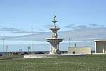 | |||
| 62-74 (Even Nos) Fort Street And 2-10 (Even Nos) Fullarton Street, Wellington Chambers | 55°27′42″N 4°38′05″W | Category B | 21584 | | |||
| 4-16 (Even Nos) And 20 George Street | 55°27′54″N 4°37′42″W | Category C(S) | 21588 | | |||
| 123 High Street | 55°27′45″N 4°37′49″W | Category B | 21610 | | |||
| Alloway, Alloway Public Halls Including Gatepiers, Gate And Boundary Wall | 55°25′57″N 4°38′00″W | Category B | 21473 | | |||
| High Maybole Road, Doonside Lodge Including Gatepiers, Gates, Railings And Boundary Wall | 55°25′32″N 4°38′19″W | Category C(S) | 21482 | | |||
| Alloway, Railway Bridge Over River Doon | 55°25′40″N 4°38′21″W | Category C(S) | 21487 | | |||
| 10-14 (Inclusive Nos) Alloway Place Including Boundary Walls | 55°27′31″N 4°38′08″W | Category B | 21490 | | |||
| 2 Barns Street | 55°27′39″N 4°38′04″W | Category B | 21502 | | |||
| 1-14 (Inclusive Nos) Barns Terrace Including Boundary Wall And Gatepiers | 55°27′32″N 4°38′05″W | Category B | 21503 | | |||
| 1-7 (Odd Nos) Burns Statue Square | 55°27′31″N 4°37′43″W | Category B | 21517 | | |||
| 10, 10A, 12, 14, 16, 16A, 18 And 20 Carrick Avenue | 55°27′07″N 4°37′50″W | Category C(S) | 21521 | | |||
| Auchincruive Estate, Gibbsyard (Former Stables) | 55°28′42″N 4°33′45″W | Category B | 995 | | |||
| Auchincruive Estate, Walled Garden, Including Greenhouses And Ancillary Structures | 55°28′49″N 4°32′51″W | Category B | 998 | | |||
| Auchincruive Estate, Wilson Hall | 55°28′47″N 4°33′50″W | Category C(S) | 47006 | | |||
| Alloway, Burns Cottage, Burns Museum | 55°25′59″N 4°38′00″W | Category C(S) | 47134 | | |||
| 19 And 21 Barns Street | 55°27′38″N 4°38′00″W | Category B | 47141 | | |||
| 23 And 25 Barns Street Including Railings | 55°27′38″N 4°37′59″W | Category B | 47142 | | |||
| 4 Barns Street | 55°27′39″N 4°38′04″W | Category B | 47144 | | |||
| 6 Barns Street | 55°27′39″N 4°38′03″W | Category B | 47145 | | |||
| 16 Barns Street And 32 Fullarton Street | 55°27′39″N 4°37′59″W | Category B | 47159 | | |||
| 22 And 24 Barns Street | 55°27′39″N 4°37′57″W | Category C(S) | 47162 | | |||
| 12 And 14 Cassilis Street Including Railings And Gate | 55°27′44″N 4°38′16″W | Category B | 47168 | | |||
| 6 And 8 Cromwell Road | 55°27′47″N 4°38′19″W | Category C(S) | 47173 | | |||
| 22 And 24 Fullarton Street | 55°27′41″N 4°38′02″W | Category C(S) | 47187 | | |||
| Greenfield Avenue (Off), Alloway Mill Cottage | 55°25′59″N 4°39′00″W | Category C(S) | 47189 | | |||
| Railway Viaduct Over River Ayr, To Nw Of Victoria Bridge | 55°27′38″N 4°37′24″W | Category C(S) | 47231 | | |||
| 40-46 (Even Nos) Smith Street | 55°27′30″N 4°37′39″W | Category C(S) | 47239 | | |||
| 5 And 6 Wellington Square Including Railings And Gates | 55°27′42″N 4°38′10″W | Category B | 47244 | | |||
| 11 Wellington Square Including Railings And Gate | 55°27′42″N 4°38′13″W | Category B | 47248 | | |||
| 17 Wellington Square | 55°27′39″N 4°38′14″W | Category C(S) | 47251 | | |||
| 18 Wellington Square | 55°27′39″N 4°38′14″W | Category B | 47252 | | |||
| 24 Wellington Square | 55°27′39″N 4°38′13″W | Category B | 47258 | | |||
| Auchincruive Estate, Dairy Research Department | 55°28′42″N 4°33′35″W | Category C(S) | 50014 | | |||
| 35 Racecourse Road, Including Gatepiers And Boundary Wall | 55°27′10″N 4°38′13″W | Category B | 21739 | | |||
| 38 Racecourse Road, Blair Lodge Including Gatepiers And Boundary Wall | 55°27′11″N 4°38′18″W | Category C(S) | 21747 | | |||
| 4 Racecourse View And 73 Midton Road Including Gatepiers And Boundary Wall | 55°26′58″N 4°38′05″W | Category B | 21756 | | |||
| Racecourse View, Shalimar And Shalimar Wing Including Gatepiers And Boundary Wall | 55°26′45″N 4°38′00″W | Category B | 21758 | | |||
| Racecourse View, Hartley House Including Former Stable, Gatepiers And Boundary Wall | 55°26′44″N 4°38′00″W | Category B | 21759 | | |||
| King Street, Monument To John Taylor Including Railings And Boundary Wall | 55°28′02″N 4°37′18″W | Category C(S) | 21765 | | |||
| St Leonard's Road, St Leonard's Parish Church (Church Of Scotland) And Hall Including Lamp Standards, Postbox And Boundary Wall | 55°27′00″N 4°37′44″W | Category B | 21767 | | |||
| 1 And 1A Seabank Road Including Boundary Wall, Gatepiers And Railings | 55°27′54″N 4°38′21″W | Category C(S) | 21797 | | |||
| Turner's Bridge (Footbridge) Over River Ayr | 55°27′45″N 4°37′35″W | Category C(S) | 21809 | | |||
| 16 Wellington Square | 55°27′39″N 4°38′15″W | Category C(S) | 21816 | | |||
| 26 Wellington Square | 55°27′40″N 4°38′05″W | Category C(S) | 21818 | | |||
| 2 Westfield Road, Wellington School Including Gatepiers, Gates, Railings And Boundary Wall | 55°27′13″N 4°38′29″W | Category B | 21824 | | |||
| 54 High Street And 1 Old Bridge Street | 55°27′51″N 4°37′50″W | Category B | 21621 | | |||
| 148-156 (Even Nos) High Street | 55°27′44″N 4°37′46″W | Category B | 21633 | | |||
| 30 And 32 Midton Road Including Gatepiers, Railings And Boundary Wall | 55°27′11″N 4°37′53″W | Category C(S) | 21669 | | |||
| 1-5 (Odd Nos) Miller Road Including Gatepiers And Boundary Wall | 55°27′28″N 4°37′48″W | Category B | 21673 | | |||
| 7 And 9 Miller Road Including Boundary Wall | 55°27′28″N 4°37′49″W | Category C(S) | 21674 | | |||
| 33-43 (Odd Nos) Miller Road Including Gatepiers, Railings And Boundary Wall | 55°27′29″N 4°38′02″W | Category C(S) | 21677 | | |||
| 1 And 3 New Bridge Street | 55°27′54″N 4°37′53″W | Category A | 21689 | | |||
| 21-25 (Odd Nos) Newmarket Street | 55°27′47″N 4°37′53″W | Category C(S) | 21706 | | |||
| 41 And 43 Newmarket Street | 55°27′47″N 4°37′55″W | Category C(S) | 21708 | | |||
| 4 Newmarket Street | 55°27′48″N 4°37′50″W | Category C(S) | 21711 | | |||
| 18-22 (Even Nos) Newmarket Street | 55°27′48″N 4°37′52″W | Category C(S) | 21714 | | |||
| Carrick Street, Gaiety Theatre | 55°27′41″N 4°37′54″W | Category B | 21522 | | |||
| 7 And 9 Cathcart Street | 55°27′50″N 4°38′01″W | Category C(S) | 21528 | | |||
| 8 Cathcart Street | 55°27′50″N 4°38′02″W | Category C(S) | 21530 | | |||
| 3 Charlotte Street And 45B Fort Street | 55°27′45″N 4°38′08″W | Category C(S) | 21536 | | |||
| 9 Charlotte Street, Shangri-La | 55°27′45″N 4°38′10″W | Category C(S) | 21539 | | |||
| 8-12 (Even Nos) Citadel Place And 1 Montgomerie Terrace Including Boundary Walls, Gatepiers And Railings | 55°27′50″N 4°38′09″W | Category C(S) | 21553 | | |||
| 17-25 (Odd Nos) Dalblair Road Including Boundary Wall | 55°27′35″N 4°37′53″W | Category C(S) | 21560 | | |||
| 16, 16A And 16B Ewenfield Road Including Sundial, Gatepiers, Gates And Boundary Wall | 55°26′39″N 4°37′34″W | Category B | 21576 | | |||
| George Street, Ayr (Martyrs) Free Church And Hall Including Gatepiers, Gates, Railings And Boundary Wall | 55°27′54″N 4°37′40″W | Category C(S) | 21589 | | |||
| 35-39 (Odd Nos) High Street | 55°27′50″N 4°37′51″W | Category C(S) | 21596 | | |||
| 71 And 73 High Street | 55°27′48″N 4°37′50″W | Category C(S) | 21602 | | |||
| 85 And 87 High Street | 55°27′47″N 4°37′51″W | Category C(S) | 21605 | | |||
| 211-217 (Odd Nos) High Street | 55°27′39″N 4°37′45″W | Category C(S) | 21613 | | |||
| 16 And 18 Academy Street | 55°27′52″N 4°38′00″W | Category C(S) | 21468 | | |||
| Alloway, Alloway Kirk Graveyard Including Hughes Mausoleum, Gatepiers, Gates And Boundary Wall | 55°25′40″N 4°38′15″W | Category B | 21471 | | |||
| Alloway (Off), Brig O'Doon | 55°25′33″N 4°38′12″W | Category A | 21474 | 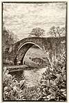 | |||
| 6, 6A And 8 Barns Crescent Including Boundary Wall | 55°27′33″N 4°38′02″W | Category C(S) | 21497 | | |||
| 1-4 (Inclusive Nos) Barns Park Including Gatepiers, Railings And Boundary Wall | 55°27′36″N 4°38′03″W | Category B | 21498 | | |||
| 3 Barns Street Including Railings | 55°27′38″N 4°38′03″W | Category B | 21500 | | |||
| 7 Barns Street Including Railings | 55°27′38″N 4°38′02″W | Category B | 21501 | | |||
| 17-23 (Odd Nos) Burns Statue Square | 55°27′30″N 4°37′42″W | Category C(S) | 21519 | | |||
| 1-7 (Odd Nos) Carrick Avenue And 44 Midton Road Including Railings And Boundary Wall | 55°27′09″N 4°37′55″W | Category C(S) | 21520 | | |||
| Auchincruive Estate, East Lodge | 55°28′56″N 4°32′56″W | Category B | 997 | | |||
| 2 Academy Street Lane | 55°27′51″N 4°37′59″W | Category C(S) | 47131 | | |||
| 21-31 (Odd Nos) Alloway Including Railings And Boundary Wall | 55°25′59″N 4°37′58″W | Category C(S) | 47132 | | |||
| 18 Barns Street | 55°27′39″N 4°37′58″W | Category C(S) | 47160 | | |||
| 8 And 10 Cassilis Street Including Railings And Gates | 55°27′45″N 4°38′16″W | Category B | 47167 | | |||
| Doonfoot Road, Belleisle Estate, Walled Garden | 55°26′17″N 4°38′28″W | Category C(S) | 47183 | | |||
| 212-218 (Even Nos) High Street | 55°27′40″N 4°37′43″W | Category C(S) | 47206 | | |||
| 45-51 (Odd Nos) Newmarket Street | 55°27′47″N 4°37′55″W | Category C(S) | 47223 | | |||
| 32-38 (Even Nos) Smith Street | 55°27′30″N 4°37′38″W | Category C(S) | 47238 | | |||
| 48-56 (Even Nos) Smith Street | 55°27′30″N 4°37′39″W | Category B | 47240 | | |||
| 7 And 8 Wellington Square Including Railings And Gate | 55°27′42″N 4°38′10″W | Category B | 47245 | | |||
| 21 Wellington Square Including Railings | 55°27′39″N 4°38′11″W | Category B | 47255 | | |||
| 54 And 54A Sandgate | 55°27′47″N 4°38′02″W | Category C(S) | 47576 | | |||
| St Quivox, St Quivox Parish Church (Church Of Scotland) | 55°29′00″N 4°34′22″W | Category A | 48638 | 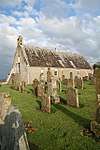 | |||
| 2 Queen's Terrace And 18 Bath Place Including Boundary Wall | 55°27′42″N 4°38′24″W | Category B | 21726 | | |||
| 8-16 (Even Nos) Queen's Terrace | 55°27′44″N 4°38′24″W | Category C(S) | 21727 | | |||
| 5 Racecourse Road, Meteor Hotel Including Railings And Boundary Wall | 55°27′28″N 4°38′06″W | Category C(S) | 21729 | | |||
| 46 Racecourse Road Including Boundary Wall | 55°27′05″N 4°38′20″W | Category B | 21751 | | |||
| 1 Racecourse View, Hartfield House Including Gatepiers And Boundary Wall | 55°27′01″N 4°38′18″W | Category B | 21753 | | |||
| Monument Road (Off) , Rozelle Estate, Rozelle Including Lamp Standards | 55°26′11″N 4°37′43″W | Category A | 21763 | | |||
| 14 Sandgate | 55°27′50″N 4°37′59″W | Category B | 21785 | | |||
| 22 Sandgate And 2 And 4 Cathcart Street | 55°27′50″N 4°38′00″W | Category A | 21788 | 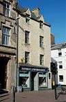 | |||
| 58A Sandgate, Former Sandgate Church And Church Hall, Including Gatepiers, Gates, Railings And Boundary Wall | 55°27′46″N 4°38′04″W | Category B | 21794 | | |||
| 3 Savoy Park, Savoy Croft Including Sundial, Gatepiers, Gates And Boundary Wall | 55°27′22″N 4°38′18″W | Category A | 21795 | | |||
| 1 Wellington Square Including Railings And Gate | 55°27′42″N 4°38′09″W | Category B | 21815 | | |||
| 25 Wellington Square | 55°27′39″N 4°38′07″W | Category B | 21817 | | |||
| 1 Wheatfield Road, Wheatfield House Including Walled Garden, Sundial, Gatepiers, Gates, Railings And Boundary Wall | 55°27′17″N 4°38′17″W | Category B | 21825 | | |||
| 219-223 (Odd Nos) High Street | 55°27′39″N 4°37′45″W | Category C(S) | 21615 | | |||
| 225-231 (Odd Nos) High Street | 55°27′38″N 4°37′44″W | Category C(S) | 21616 | | |||
| 120 And 122 High Street | 55°27′46″N 4°37′47″W | Category C(S) | 21629 | | |||
| Holmston Road, Council Offices (Former Holmston House Hospital) | 55°27′29″N 4°37′25″W | Category B | 21642 | | |||
| 28 And 30 John Street Including Gatepiers And Boundary Wall | 55°27′50″N 4°37′33″W | Category C(S) | 21649 | | |||
| 10 And 12 Kirk Port | 55°27′47″N 4°37′46″W | Category C(S) | 21651 | | |||
| 12 And 14 Main Street, Carnegie Public Library Including Railings, Gates And Boundary Wall | 55°27′58″N 4°37′48″W | Category B | 21657 |  | |||
| 29 Midton Road, Elgin House Including Gatepiers And Boundary Wall | 55°27′13″N 4°37′52″W | Category C(S) | 21664 | | |||
| 59 And 61 Midton Road Including Gatepiers, Gates And Boundary Wall | 55°27′04″N 4°38′00″W | Category C(S) | 21666 | | |||
| 65, 65A Midton Road And 13 Victoria Park Including Gatepiers, Gates, Railings And Boundary Wall | 55°27′02″N 4°38′02″W | Category B | 21668 | | |||
| 34 And 36 Midton Road Including Gatepiers, Railings And Boundary Wall | 55°27′10″N 4°37′53″W | Category C(S) | 21670 | | |||
| 4 And 6 Miller Road Including Railings And Boundary Wall | 55°27′29″N 4°37′48″W | Category B | 21678 | | |||
| 26 And 28 Miller Road Including Boundary Wall | 55°27′30″N 4°37′53″W | Category B | 21681 | | |||
| Mount Charles Crescent, Mount Charles | 55°25′59″N 4°38′43″W | Category B | 21685 | | |||
| New Bridge Over River Ayr Including Lamp Standards | 55°27′55″N 4°37′53″W | Category B | 21688 | 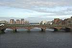 | |||
| 8 And 10 New Bridge Street | 55°27′53″N 4°37′55″W | Category B | 21694 | | |||
| 28 And 30 New Bridge Street | 55°27′52″N 4°37′57″W | Category C(S) | 21698 | | |||
| 34 New Bridge Street And 2, 2A Academy Street Including Boundary Wall | 55°27′51″N 4°37′58″W | Category A | 21700 | | |||
| 12 Newmarket Street | 55°27′48″N 4°37′51″W | Category C(S) | 21713 | | |||
| 30-38 (Even Nos) Newmarket Street | 55°27′48″N 4°37′54″W | Category C(S) | 21715 | | |||
| 17 Cathcart Street, Flats A-N, (Former Relief Church) Including Boundary Wall And Gatepiers | 55°27′51″N 4°37′58″W | Category B | 21534 | | |||
| 11 Charlotte Street | 55°27′45″N 4°38′11″W | Category B | 21540 | | |||
| Citadel Lane (Rear Of 2 Montgomerie Terrace), Citadel Gate | 55°27′51″N 4°38′09″W | Category B | 21548 | 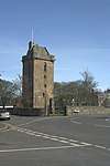 | |||
| 36-40 (Even Nos) Dalblair Road Including Boundary Wall | 55°27′33″N 4°37′55″W | Category C(S) | 21564 | | |||
| Esplanade, Ayr Pavilion Including Boundary Walls | 55°27′38″N 4°38′25″W | Category B | 21575 | 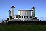 | |||
| Fullarton Street, Holy Trinity Church (Scottish Episcopal) Including Church Hall, Gatepiers, Gates, Railings And Boundary Wall | 55°27′41″N 4°37′59″W | Category A | 21586 | .jpg) | |||
| 25 Greenfield Avenue Including Gatepiers, Railings And Boundary Wall | 55°26′04″N 4°38′26″W | Category C(S) | 21591 | | |||
| 11-15 (Odd Nos) High Street | 55°27′51″N 4°37′54″W | Category B | 21593 | | |||
| 17-21 (Odd Nos) High Street | 55°27′50″N 4°37′53″W | Category B | 21594 | | |||
| 47 And 49 High Street | 55°27′50″N 4°37′51″W | Category C(S) | 21597 | | |||
| 55-59 (Odd Nos) High Street | 55°27′49″N 4°37′50″W | Category B | 21600 | | |||
| 93 And 95 High Street | 55°27′46″N 4°37′50″W | Category C(S) | 21607 | | |||
| Alloway, Brig O'Doon House | 55°25′37″N 4°38′14″W | Category C(S) | 21479 | | |||
| Alloway (Off), Dutch Mill House | 55°25′31″N 4°38′03″W | Category C(S) | 21483 | | |||
| 1-5A (Inclusive Nos) Alloway Place Including Boundary Walls | 55°27′35″N 4°38′08″W | Category B | 21488 | | |||
| Doonfoot Road, Belleisle Estate, South Lodge Including Gatepiers And Boundary Wall | 55°26′27″N 4°38′31″W | Category C(S) | 21507 | | |||
| 65 Bellevue Crescent, Kensal Tower Including Boundary Wall | 55°27′21″N 4°38′09″W | Category C(S) | 21509 | | |||
| 9-15 (Odd Nos) Burns Statue Square | 55°27′31″N 4°37′42″W | Category B | 21518 | | |||
| Auchincruive Estate, Ice House | 55°28′47″N 4°33′20″W | Category C(S) | 4873 | | |||
| Doonholm Estate, Stables, Including Ancillary Structures And Loupin'-On Stane | 55°25′24″N 4°37′36″W | Category C(S) | 4874 | | |||
| Shaw Monument | 55°30′06″N 4°35′09″W | Category B | 994 | 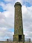 | |||
| Auchincruive Estate, Oswald's Temple (Tea House) | 55°28′49″N 4°33′42″W | Category A | 996 | 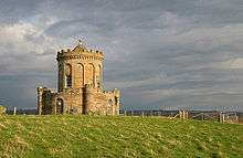 | |||
| Doonholm Estate, Doonholm, Including Wall And Archway | 55°25′22″N 4°37′38″W | Category B | 1001 | | |||
| 12 Barns Street | 55°27′39″N 4°38′00″W | Category B | 47157 | | |||
| 20 Barns Street | 55°27′39″N 4°37′58″W | Category C(S) | 47161 | | |||
| 26 And 28 Barns Street Including Railings | 55°27′39″N 4°37′56″W | Category C(S) | 47163 | | |||
| 4 Bath Place, Wellington Lodge, Including Boundary Wall, Gatepiers And Railings | 55°27′43″N 4°38′20″W | Category C(S) | 47164 | | |||
| Dalmellington Road, Castlehill Gatepiers, Gates, Railings And Boundary Wall | 55°26′54″N 4°36′51″W | Category C(S) | 47177 | | |||
| Damside, Labour Party Offices | 55°28′07″N 4°37′44″W | Category C(S) | 47180 | | |||
| Mount Charles Crescent, Mount Charles, Walled Garden | 55°25′58″N 4°38′47″W | Category B | 47218 | | |||
| 2 Racecourse View, Morrison House Including Ancillary Structures, Walled Garden, Greenhouses, Gatepiers, Gates And Boundary Wall | 55°26′59″N 4°38′11″W | Category C(S) | 21754 | | |||
| 33 And 35 Sandgate | 55°27′49″N 4°37′58″W | Category B | 21775 | | |||
| 37 Sandgate | 55°27′49″N 4°37′58″W | Category B | 21776 | | |||
| 10 And 12 Sandgate | 55°27′51″N 4°37′59″W | Category C(S) | 21784 | | |||
| 24 Sandgate | 55°27′49″N 4°38′00″W | Category C(S) | 21789 | | |||
| 7 South Harbour Street | 55°27′54″N 4°37′56″W | Category C(S) | 21801 | | |||
| Smith Street, Ayr Station And Station Hotel Including Canopies, Footbridge, Lamp Standards, Gatepiers, Railings And Boundary Wall | 55°27′29″N 4°37′34″W | Category B | 21808 | | |||
| 3 And 3A Victoria Park Including Gatepiers, Gates And Boundary Wall | 55°27′04″N 4°38′15″W | Category C(S) | 21811 | | |||
| 27 Wellington Square | 55°27′41″N 4°38′05″W | Category B | 21819 | | |||
| 3 And 3A Marchmont Road Including Gatepiers And Boundary Wall | 55°27′17″N 4°37′55″W | Category C(S) | 21661 | | |||
| 63 Midton Road, Brownhill Including Gatepiers And Boundary Wall | 55°27′04″N 4°38′01″W | Category B | 21667 | | |||
| 32 New Bridge Street | 55°27′51″N 4°37′57″W | Category C(S) | 21699 | | |||
| 11 And 13 Newmarket Street | 55°27′47″N 4°37′52″W | Category C(S) | 21705 | | |||
| 53-57 (Odd Nos) Newmarket Street | 55°27′47″N 4°37′56″W | Category C(S) | 21709 | | |||
| 6-10 (Even Nos) Newmarket Street | 55°27′48″N 4°37′51″W | Category C(S) | 21712 | | |||
| 17 Charlotte Street | 55°27′45″N 4°38′13″W | Category B | 21543 | | |||
| 6 And 8 Charlotte Street | 55°27′46″N 4°38′07″W | Category C(S) | 21546 | | |||
| 77-85 (Odd Nos) Dalblair Road And 54-62 (Even Nos) Alloway Street | 55°27′32″N 4°37′45″W | Category B | 21563 | | |||
| Doonfoot Road, Former Seafield Hospital | 55°26′54″N 4°38′28″W | Category B | 21565 | | |||
| 8 Dunure Road, The Balgarth Including Boundary Wall | 55°26′08″N 4°39′00″W | Category C(S) | 21572 | | |||
| 52 And 54 Fort Street | 55°27′45″N 4°38′06″W | Category B | 21581 | | |||
| 2 George Street | 55°27′54″N 4°37′43″W | Category C(S) | 21587 | | |||
| George Street, Former Morrison Congregational Church Including Gate And Railings | 55°27′56″N 4°37′33″W | Category C(S) | 21590 | | |||
| Ayr Harbour Including North, South And Compass Piers, North Breakwater, Harbour Walls, Griffin Dock And Lighthouses | 55°28′07″N 4°38′25″W | Category B | 21592 | 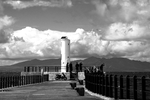 | |||
| 23 And 25 High Street | 55°27′50″N 4°37′53″W | Category B | 21595 | | |||
| 77-81 (Odd Nos) High Street And 1 Newmarket Street | 55°27′47″N 4°37′50″W | Category B | 21604 | | |||
| 9 And 11 Academy Street | 55°27′51″N 4°38′00″W | Category C(S) | 21466 | | |||
| Brigend Castle | 55°25′29″N 4°38′04″W | Category C(S) | 21475 | | |||
| Alloway, Burns Monument, Statue House | 55°25′36″N 4°38′12″W | Category B | 21478 | | |||
| 38 And 40 Alloway, Doonbrae Cottage And Doonbrae House Including Garage, Grotto, Railings And Boundary Wall | 55°25′39″N 4°38′15″W | Category B | 21480 | | |||
| Greenfield Avenue (Off), Alloway Mill And Ancillary Structure Including Entrance Boundary Wall | 55°25′59″N 4°38′58″W | Category B | 21484 | | |||
| Alloway, Monument Cottage Including Gates, Gatepiers, Railings, Drinking Fountain And Boundary Wall | 55°25′39″N 4°38′13″W | Category B | 21485 | | |||
| 1 Barns Crescent, Barns House Including Ancillary Structures, Walled Garden, Gatepiers, Gates And Boundary Wall | 55°27′35″N 4°38′00″W | Category A | 21496 | | |||
| 4 Broomfield Road, Broomfield Lodge Including Gatepiers, Gate And Boundary Wall | 55°27′05″N 4°37′54″W | Category C(S) | 21510 | | |||
| St Quivox, St Quivox Parish Church, Graveyard Including Gatepiers, Gates, Railings And Boundary Wall | 55°29′00″N 4°34′21″W | Category B | 47010 | | |||
| St Quivox, St Quivox Parish Church, Mausoleum | 55°28′59″N 4°34′21″W | Category A | 47011 | 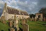 | |||
| 15 And 17 Barns Street Including Railings | 55°27′38″N 4°38′01″W | Category B | 47140 | | |||
| 27 And 29 Barns Street Including Railings | 55°27′38″N 4°37′57″W | Category B | 47143 | | |||
| 8 Barns Street | 55°27′39″N 4°38′02″W | Category B | 47146 | | |||
| 59 Castlehill Road Including Gatepiers, Gate And Boundary Wall | 55°27′09″N 4°37′18″W | Category C(S) | 47169 | | |||
| 49-53 (Odd Nos) Dalblair Road | 55°27′32″N 4°37′51″W | Category C(S) | 47174 | | |||
| Dalmilling Crescent, Cathedral Of The Good Shepherd (Roman Catholic) Including Gatepiers, Gates, Railings And Boundary Wall | 55°28′12″N 4°35′57″W | Category C(S) | 47178 | | |||
| Doonfoot Road, Belleisle Estate, Greenhouse | 55°26′19″N 4°38′24″W | Category B | 47181 | | |||
| 18 Ewenfield Road, Fenwick Lodge Including Gatepiers And Boundary Wall | 55°26′38″N 4°37′28″W | Category C(S) | 47185 | | |||
| 155, 157 High Street And 2, 4 Carrick Street | 55°27′43″N 4°37′47″W | Category B | 47200 | | |||
| 28 Maybole Road Including Ancillary Structures | 55°26′33″N 4°37′18″W | Category C(S) | 47210 | | |||
| 10 And 12 Midton Road Including Gatepiers, Railings And Boundary Wall | 55°27′16″N 4°37′49″W | Category C(S) | 47211 | | |||
| 58 Midton Road, Midton Cottage Including Gatepiers And Boundary Wall | 55°27′03″N 4°37′57″W | Category C(S) | 47212 | | |||
| 24 Racecourse Road, Derclach Including Sundial, Gatepiers, Gates And Boundary Wall | 55°27′18″N 4°38′14″W | Category C(S) | 47230 | | |||
| 10 Wellington Square Including Railings And Gate | 55°27′42″N 4°38′12″W | Category B | 47247 | | |||
| 22 Wellington Square Including Carriage-House | 55°27′38″N 4°38′10″W | Category B | 47256 | | |||
| Wellington Square, War Memorial | 55°27′40″N 4°38′11″W | Category C(S) | 47259 | | |||
| 1 South Lodge Court, Flats A-G, Including Boundary Wall | 55°27′14″N 4°38′06″W | Category C(S) | 21738 | | |||
| 35 Racecourse Road, Former Coach-House | 55°27′09″N 4°38′13″W | Category B | 21740 | | |||
| 41 Sandgate, Queen's Court Centre, Including Lamp Standards, Railings And Boundary Wall | 55°27′47″N 4°37′59″W | Category B | 21778 | | |||
| 16 And 18 Sandgate | 55°27′50″N 4°37′59″W | Category C(S) | 21786 | | |||
| 5 Savoy Park, Wellsbourne House Including Gatepiers And Boundary Wall | 55°27′21″N 4°38′22″W | Category B | 21796 | | |||
| 1-5 (Odd Nos) South Harbour Street | 55°27′54″N 4°37′56″W | Category B | 21800 | | |||
| 88-98 (Even Nos) High Street | 55°27′48″N 4°37′48″W | Category B | 21623 | | |||
| 116 And 118 High Street | 55°27′47″N 4°37′47″W | Category C(S) | 21628 | | |||
| 134-142 (Even Nos) High Street | 55°27′45″N 4°37′47″W | Category B | 21631 | | |||
| 146 High Street | 55°27′45″N 4°37′47″W | Category B | 21632 | | |||
| 158 And 160 High Street | 55°27′44″N 4°37′46″W | Category C(S) | 21634 | | |||
| Old Hillfoot Road 1-10 (Inclusive Numbers), Castlehill Court (Former) Castlestlehill Stables Including Boundary Wall | 55°26′57″N 4°36′38″W | Category C(S) | 21640 | | |||
| Holmston Road, Council Offices, (Former Holmston House Hospital) Lodge Including Gatepiers, Gates, Railings And Boundary Wall | 55°27′28″N 4°37′23″W | Category C(S) | 21643 | | |||
| 14 Kirk Port | 55°27′47″N 4°37′46″W | Category C(S) | 21652 | | |||
| 54 Midton Road, Clova Lodge And 6 Broomfield Road, Barrcraigs Including Postbox, Gatepiers And Boundary Wall | 55°27′06″N 4°37′56″W | Category B | 21671 | | |||
| 8 Miller Road | 55°27′29″N 4°37′48″W | Category C(S) | 21679 | | |||
| 30 And 31 Montgomerie Terrace Including Boundary Walls And Gatepiers | 55°27′56″N 4°38′20″W | Category C(S) | 21684 | | |||
| 7-11 (Odd Nos) New Bridge Street | 55°27′53″N 4°37′54″W | Category B | 21690 | | |||
| 6 New Road, Salvation Army Citadel | 55°28′08″N 4°37′45″W | Category C(S) | 21702 | | |||
| 5-9 (Odd Nos) Newmarket Street | 55°27′47″N 4°37′51″W | Category C(S) | 21704 | | |||
| 29 Park Circus Including Gatepiers, Gates And Boundary Wall | 55°27′26″N 4°37′53″W | Category C(S) | 21720 | | |||
| 39 Park Circus, St Andrew's Church (Church Of Scotland) And Church Hall Including Gatepiers And Boundary Wall | 55°27′24″N 4°37′49″W | Category B | 21722 | 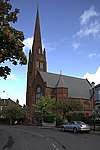 | |||
| 7 Charlotte Street, Grant House | 55°27′45″N 4°38′09″W | Category C(S) | 21538 | | |||
| 13 Charlotte Street | 55°27′45″N 4°38′11″W | Category C(S) | 21541 | | |||
| 2, 4 Charlotte Street And 43 Fort Street | 55°27′46″N 4°38′10″W | Category C(S) | 21545 | | |||
| 1, 3 Citadel Place And 19 Fort Street | 55°27′49″N 4°38′07″W | Category B | 21549 | | |||
| 15 And 17 Citadel Place Including Gates And Railings | 55°27′49″N 4°38′09″W | Category B | 21551 | | |||
| 2 Corsehill Road, The Gables Including Ancillary Structure, Gatepiers, Gates And Boundary Wall | 55°26′55″N 4°37′45″W | Category B | 21554 | | |||
| Doonfoot Road, View House Including Gatepiers, Gate And Boundary Wall | 55°26′53″N 4°38′22″W | Category C(S) | 21568 | | |||
| Fort Street, Ayr Academy | 55°27′52″N 4°38′05″W | Category B | 21582 | .jpg) | |||
| 51 High Street | 55°27′49″N 4°37′51″W | Category C(S) | 21598 | | |||
| Alloway, Alloway Auld Kirk | 55°25′40″N 4°38′15″W | Category A | 21470 | 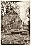 | |||
| Alloway, Burns Monument Including Lamp Standards, Sundial, Railings, Gates And Boundary Wall | 55°25′37″N 4°38′12″W | Category A | 21477 | 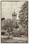 | |||
| 6-9 (Inclusive Nos) Alloway Place Including Boundary Walls And Railings | 55°27′34″N 4°38′08″W | Category B | 21489 | | |||
| Auld Brig Over River Ayr, Including Lamp Standards | 55°27′52″N 4°37′46″W | Category A | 21495 | .jpg) | |||
| 1 Barns Street, Berkeley House, Including Boundary Walls | 55°27′38″N 4°38′06″W | Category B | 21499 | | |||
| 4 Bruce Crescent Including Boundary Wall And Gatepiers | 55°27′47″N 4°38′12″W | Category C(S) | 21513 | | |||
| St Quivox, Mount Hamilton | 55°28′59″N 4°34′14″W | Category B | 993 | | |||
| Mount Oliphant | 55°25′16″N 4°35′56″W | Category B | 999 | | |||
| Monkwood Bridge Over River Doon | 55°24′17″N 4°37′51″W | Category B | 1000 | | |||
| Auchincruive Estate, Oswald Hall | 55°28′42″N 4°33′09″W | Category A | 99 | 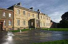 | |||
| St Quivox, Former Manse Including Boundary Wall | 55°28′58″N 4°34′18″W | Category B | 47009 | | |||
| 30 Alloway Street | 55°27′35″N 4°37′45″W | Category C(S) | 47137 | | |||
| 5 And 5A Barns Street Including Railings | 55°27′38″N 4°38′03″W | Category B | 47138 | | |||
| 10 Barns Street | 55°27′39″N 4°38′01″W | Category B | 47156 | | |||
| 18 And 20 Fullarton Street | 55°27′41″N 4°38′02″W | Category C(S) | 47186 | | |||
| 224 And 226 High Street | 55°27′39″N 4°37′43″W | Category C(S) | 47207 | | |||
| 2 Kyle Street And 1 And 3 Alloway Street | 55°27′36″N 4°37′43″W | Category C(S) | 47208 | | |||
| Monument Road And Racecourse View, Corsehill Walled Garden Including Gatepiers, Gates And Boundary Wall | 55°26′48″N 4°37′47″W | Category C(S) | 47216 | | |||
| 31-39 (Odd Nos) Newmarket Street | 55°27′47″N 4°37′54″W | Category C(S) | 47222 | | |||
| 44 And 46 Newmarket Street | 55°27′48″N 4°37′55″W | Category C(S) | 47224 | | |||
| 4 Wellington Square Including Railings And Gate | 55°27′42″N 4°38′09″W | Category B | 47243 | | |||
| 12 Wellington Square Including Railings And Gates | 55°27′42″N 4°38′13″W | Category B | 47249 | | |||
| Wellington Square, Gatepiers, Gates And Boundary Walls | 55°27′41″N 4°38′11″W | Category C(S) | 47260 | | |||
| Craigie, Ayrshire Management Centre, Including Screen Wall | 55°27′30″N 4°36′41″W | Category A | 21556 | 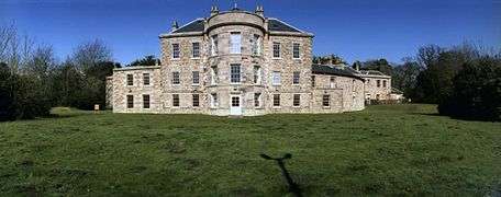 | |||
| 9 Racecourse Road And 1 Park Circus Including Gatepiers, Gates And Boundary Wall | 55°27′26″N 4°38′06″W | Category B | 21732 | | |||
| 16 Racecourse Road, Savoy Park Hotel Including Garden Outhouse, Gatepiers, Gate, Postbox And Boundary Wall | 55°27′23″N 4°38′13″W | Category B | 21744 | | |||
| 44 Racecourse Road, Gartferry Hotel Including Boundary Wall | 55°27′07″N 4°38′20″W | Category B | 21750 | | |||
| Monument Road (Off), Rozelle Estate, Rozelle Lodge, Including Gatepiers And Boundary Wall | 55°26′17″N 4°37′51″W | Category B | 21764 | | |||
| Bruce Crescent, St John The Baptist's Tower Including Gatepiers, Gates And Boundary Wall | 55°27′49″N 4°38′14″W | Category B | 21766 | | |||
| 21-25 (Odd Nos) Sandgate | 55°27′49″N 4°37′57″W | Category B | 21773 | | |||
| 27 And 29 Sandgate | 55°27′49″N 4°37′57″W | Category C(S) | 21774 | | |||
| 2 And 4 Sandgate And 1 Academy Street | 55°27′51″N 4°37′58″W | Category B | 21782 | | |||
| 2 And 3 Seabank Road Including Boundary Wall And Gatepiers | 55°27′54″N 4°38′22″W | Category C(S) | 21798 | | |||
| 9-13 (Odd Nos) South Harbour Street | 55°27′54″N 4°37′57″W | Category B | 21802 | | |||
| 14 Wellington Square, Sheriff Court | 55°27′41″N 4°38′19″W | Category A | 21820 | 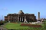 | |||
| 237-241 (Odd Nos) High Street | 55°27′37″N 4°37′44″W | Category C(S) | 21619 | | |||
| 106 And 110 High Street | 55°27′48″N 4°37′48″W | Category C(S) | 21626 | | |||
| 234 High Street | 55°27′39″N 4°37′43″W | Category C(S) | 21639 | | |||
| Holmston Road And Ashgrove Street, Holmston Primary School Including Gatepiers, Gates, Railings And Boundary Wall | 55°27′26″N 4°37′25″W | Category C(S) | 21645 | | |||
| Kirk Port, Auld Kirk Of Ayr, Church Of Scotland | 55°27′46″N 4°37′43″W | Category A | 21653 | 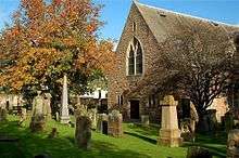 | |||
| Kirk Port, Auld Kirk Of Ayr Graveyard Including Boundary Walls And Lamp Standard | 55°27′47″N 4°37′43″W | Category B | 21655 |  | |||
| 57 Midton Road, Melling Including Gatepiers And Boundary Wall | 55°27′06″N 4°38′00″W | Category C(S) | 21665 | | |||
| 32 Miller Road Including Gatepiers And Boundary Wall | 55°27′30″N 4°38′00″W | Category C(S) | 21683 | | |||
| 2-6 (Even Nos) New Bridge Street | 55°27′54″N 4°37′55″W | Category B | 21693 | | |||
| 24 And 26 New Bridge Street | 55°27′52″N 4°37′57″W | Category B | 21697 | | |||
| 50-66 (Even Nos) Newmarket Street | 55°27′48″N 4°37′56″W | Category C(S) | 21717 | | |||
| 5 Cathcart Street | 55°27′50″N 4°38′00″W | Category C(S) | 21527 | | |||
| 10, 12, 12A And 14 Cathcart Street | 55°27′50″N 4°38′02″W | Category C(S) | 21531 | | |||
| 15 Charlotte Street | 55°27′45″N 4°38′12″W | Category C(S) | 21542 | | |||
| 3 Craigweil Road, Craigweil House Including Gatepiers And Boundary Wall | 55°27′18″N 4°38′28″W | Category B | 21558 | 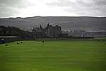 | |||
| Fort Street, Former Cathcart Church Including Archway, Gatepiers, Gates, Railings And Boundary Wall | 55°27′50″N 4°38′06″W | Category B | 21583 | .jpg) | |||
| 89 And 91 High Street | 55°27′46″N 4°37′51″W | Category C(S) | 21606 | | |||
| 97 And 99 High Street | 55°27′46″N 4°37′50″W | Category C(S) | 21608 | | |||
| 10-14 (Even Nos) Academy Street | 55°27′52″N 4°38′00″W | Category C(S) | 21467 | | |||
| 20 And 22 Academy Street | 55°27′52″N 4°38′01″W | Category C(S) | 21469 | | |||
| 1 Doonholm Road Including Gatepiers, Gates And Boundary Wall | 55°25′56″N 4°38′01″W | Category C(S) | 21481 | | |||
| 57 Doonfoot Road, Belleisle Estate, North Lodge Including Gatepiers, Gates, Railings And Boundary Wall | 55°26′37″N 4°38′26″W | Category C(S) | 21508 | | |||
| 3 Bruce Crescent Including Boundary Wall And Gatepiers | 55°27′48″N 4°38′12″W | Category C(S) | 21512 | | |||
| Burns Statue Square, Monument To Robert Burns Including Railings | 55°27′29″N 4°37′43″W | Category B | 21515 | | |||
| Ladykirk Estate, Gate Lodge Including Gates, Gatepiers And Adjoining Walls | 55°30′11″N 4°33′17″W | Category B | 19475 | | |||
| St Quivox, Cottar House Including Boundary Wall | 55°28′59″N 4°34′22″W | Category C(S) | 992 | | |||
| Auchincruive Estate, Hanging Garden | 55°28′40″N 4°33′07″W | Category B | 47000 | | |||
| Auchincruive Estate, West Lodge, Including Boundary Walls | 55°28′48″N 4°34′00″W | Category C(S) | 47001 | | |||
| 6 Alloway | 55°26′01″N 4°37′58″W | Category C(S) | 47133 | | |||
| 22-28 (Even Nos) Alloway Street | 55°27′35″N 4°37′45″W | Category C(S) | 47136 | | |||
| 9 And 11 Barns Street, Town Hotel | 55°27′38″N 4°38′01″W | Category B | 47139 | | |||
| Boswell Park, Bingo Hall (Former Ayr Playhouse) | 55°27′44″N 4°38′01″W | Category B | 47166 | | |||
| 14 Craigie Road Including Gatepiers, Railings And Boundary Wall | 55°27′41″N 4°37′10″W | Category C(S) | 47171 | | |||
| Dam Park Stadium, Stand | 55°27′32″N 4°37′07″W | Category B | 47179 | | |||
| Doonfoot Road, Belleisle Estate, South Lodge Bridge Crossing Slaphouse Burn | 55°26′27″N 4°38′31″W | Category C(S) | 47182 | | |||
| Doonholm Road, Doonholm Estate, Doonholm Farmhouse | 55°25′31″N 4°37′11″W | Category C(S) | 47184 | | |||
| 15-19 (Odd Nos) Newmarket Street | 55°27′47″N 4°37′52″W | Category C(S) | 47221 | | |||
| 48 Newmarket Street | 55°27′48″N 4°37′56″W | Category C(S) | 47225 | | |||
| 17 River Street, Former Mission Hall | 55°27′55″N 4°37′45″W | Category C(S) | 47232 | | |||
| 2 And 3 Wellington Square Including Railings And Gates | 55°27′42″N 4°38′08″W | Category B | 47242 | | |||
| Wellington Square, County Buildings Including Gates | 55°27′41″N 4°38′19″W | Category B | 47250 | | |||
| 19 Wellington Square Including Railings | 55°27′39″N 4°38′12″W | Category B | 47253 | | |||
| 20 Wellington Square | 55°27′39″N 4°38′12″W | Category B | 47254 | | |||
| 23 And 25 South Harbour Street | 55°27′54″N 4°38′02″W | Category C(S) | 47577 | | |||
| Midton Road, Ayr Grammar Primary School Including Caretakers Cottage, Gatepiers, Gates, Railings And Boundary Wall | 55°27′19″N 4°37′47″W | Category C(S) | 49027 | | |||
| 35 Racecourse Road, Former Dovecot | 55°27′11″N 4°38′12″W | Category B | 21741 | | |||
| 3 Racecourse View, Inverdon House Including Boundary Wall | 55°26′59″N 4°38′08″W | Category B | 21755 | | |||
| 1 And 3 Sandgate | 55°27′51″N 4°37′56″W | Category B | 21769 | | |||
| 39 Sandgate, Queen's Court House | 55°27′48″N 4°37′58″W | Category A | 21777 | | |||
| 20 Sandgate And 1 Cathcart Street | 55°27′50″N 4°37′59″W | Category B | 21787 | | |||
| 34 And 34A Sandgate | 55°27′48″N 4°38′01″W | Category B | 21790 | | |||
| 18 Smith Street | 55°27′32″N 4°37′37″W | Category B | 21799 | | |||
| 1 Victoria Park, Carston House Including Ancillary Structure, Gatepiers And Boundary Wall | 55°27′04″N 4°38′17″W | Category B | 21810 | | |||
| Wellington Square, Monument To Sir James Fergusson Of Kilkerran | 55°27′41″N 4°38′07″W | Category B | 21823 | | |||
| 2 Wheatfield Road, Sheninghurst Including Gatepiers, Gates, Railings And Boundary Wall | 55°27′19″N 4°38′18″W | Category B | 21826 | | |||
| 2 Castlehill Road, Market Inn Including Gate | 55°27′26″N 4°37′29″W | Category C(S) | 21827 | | |||
| 50 High Street | 55°27′51″N 4°37′50″W | Category B | 21620 | | |||
| 162-170 (Even Nos) High Street | 55°27′43″N 4°37′45″W | Category C(S) | 21635 | | |||
| 18 And 20 Hope Street | 55°27′48″N 4°37′51″W | Category C(S) | 21646 | | |||
| 23 John Street, St Margaret's Roman Catholic Church And Graveyard Including Boundary Wall | 55°27′53″N 4°37′34″W | Category B | 21647 | | |||
| 9 Kirk Port | 55°27′47″N 4°37′46″W | Category C(S) | 21650 | | |||
| Main Street And North Harbour Street, Former Darlington Place Church Including Hall, Gatepiers, Gates, Railings And Boundary Wall | 55°27′57″N 4°37′52″W | Category B | 21658 | 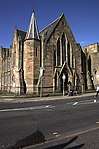 | |||
| 30 Miller Road Including Gatepiers, Gates And Boundary Wall | 55°27′30″N 4°37′56″W | Category B | 21682 | | |||
| 27 And 29 Newmarket Street | 55°27′47″N 4°37′53″W | Category C(S) | 21707 | | |||
| 6 And 6A Cassilis Street Including Railings And Gate | 55°27′45″N 4°38′16″W | Category B | 21525 | | |||
| 6 Cathcart Street | 55°27′50″N 4°38′01″W | Category C(S) | 21529 | | |||
| 39 Charlotte Street, Almont Hotel, Including Boundary Wall And Postbox | 55°27′45″N 4°38′23″W | Category C(S) | 21544 | | |||
| 4 Abercromby Drive, Gearholm House Including Ancillary Structures And Boundary Wall | 55°26′27″N 4°38′58″W | Category B | 21559 | | |||
| 71-75 (Odd Nos) Dalblair Road | 55°27′32″N 4°37′47″W | Category C(S) | 21562 | | |||
| Doonfoot Road, Former Seafield Lodge Including Gatepiers, Railings And Boundary Wall | 55°26′52″N 4°38′25″W | Category C(S) | 21566 | | |||
| Dunure Road, Doonfoot Bridge Crossing River Doon | 55°26′12″N 4°38′49″W | Category B | 21569 | | |||
| 207 And 209 High Street | 55°27′40″N 4°37′45″W | Category C(S) | 21612 | | |||
| Alloway, Burns Cottage Including Boundary Wall | 55°25′58″N 4°38′00″W | Category A | 21476 | 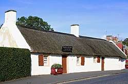 | |||
| Alloway, New Bridge Of Doon | 55°25′37″N 4°38′17″W | Category B | 21486 | | |||
| Alloway Place, Dereel, Ayr Ex-Servicemen's Club Including Gatepier, Gates And Boundary Wall | 55°27′36″N 4°38′05″W | Category B | 21491 | | |||
| 1, (Clyde Cottage) And 1A Arran Terrace Including Boundary Wall, Gatepiers And Gates | 55°27′54″N 4°38′19″W | Category C(S) | 21492 | | |||
| 14 And 16 Bath Place Including Boundary Wall, Gatepiers, Gates And Railings | 55°27′43″N 4°38′23″W | Category B | 21504 | | |||
| Doonfoot Road, Belleisle Estate, Belleisle House Hotel Including Mounting Block, Piers And Boundary Wall | 55°26′22″N 4°38′22″W | Category B | 21505 | | |||
| 1 And 2 Bruce Crescent Including Boundary Wall And Gatepiers | 55°27′48″N 4°38′11″W | Category C(S) | 21511 | | |||
| 5 Bruce Crescent Including Boundary Wall, Gatepiers And Postbox | 55°27′47″N 4°38′13″W | Category C(S) | 21514 | | |||
| Brickrow Farm, Including Farmhouse And Ancillary Structure | 55°29′00″N 4°33′24″W | Category C(S) | 47007 | | |||
| Doonholm Estate, Sundial | 55°25′19″N 4°37′38″W | Category B | 47008 | | |||
| 14 Barns Street And 30 Fullarton Street | 55°27′39″N 4°38′00″W | Category B | 47158 | | |||
| 66 Craigie Road, Western House | 55°28′01″N 4°36′59″W | Category B | 47172 | | |||
| 65-69 (Odd Nos) Dalblair Road | 55°27′32″N 4°37′48″W | Category C(S) | 47176 | | |||
| 124 And 126 High Street | 55°27′46″N 4°37′47″W | Category C(S) | 47201 | | |||
| Main Street, Newton On Ayr Church (Church Of Scotland) Including Boundary Wall | 55°28′02″N 4°37′44″W | Category C(S) | 47209 | | |||
| 2, 4 New Road And 1 Weaver Street Including Boundary Wall | 55°28′07″N 4°37′45″W | Category C(S) | 47219 | | |||
| Nile Court, Former Masonic Hall | 55°27′45″N 4°37′45″W | Category B | 47226 | | |||
| Prestwick Road, St James' Parish Church, Church Hall And Manse (Church Of Scotland) Including Gatepiers, Gates, Lamp Standards, Railings And Boundary Wall | 55°28′27″N 4°37′30″W | Category C(S) | 47227 | | |||
| 88 Prestwick Road | 55°28′40″N 4°37′17″W | Category C(S) | 47228 | | |||
| 4 And 6 Queen's Terrace Including Railings | 55°27′43″N 4°38′24″W | Category C(S) | 47229 | | |||
| 23 Wellington Square | 55°27′39″N 4°38′09″W | Category B | 47257 | | |||
| Auchencruive Estate, Dairy School | 55°28′42″N 4°33′31″W | Category C(S) | 49838 | | |||
| 7 Racecourse Road, Elmsley Including Gatepiers And Boundary Wall | 55°27′27″N 4°38′07″W | Category C(S) | 21731 | | |||
| 34 Racecourse Road And 1A And 1B Blackburn Road Including Gatepiers And Boundary Wall | 55°27′12″N 4°38′17″W | Category B | 21745 | | |||
| 50 Racecourse Road, Strathdoon House Including Gatepiers And Boundary Wall | 55°27′03″N 4°38′21″W | Category B | 21752 | | |||
| 7-11 (Odd Nos) Sandgate | 55°27′50″N 4°37′56″W | Category B | 21770 | | |||
| 13 Sandgate | 55°27′50″N 4°37′57″W | Category C(S) | 21771 | | |||
| 15 And 17 Sandgate | 55°27′49″N 4°37′56″W | Category B | 21772 | | |||
| 43 Sandgate | 55°27′47″N 4°38′00″W | Category B | 21779 | | |||
| 8 Sandgate | 55°27′51″N 4°37′58″W | Category B | 21783 | | |||
| Wellington Square, Monument To James George Smith Neill, Cb | 55°27′40″N 4°38′07″W | Category B | 21821 | 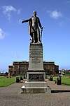 | |||
| Wellington Square, Monument To Archibald William, Earl Of Eglinton And Wintoun | 55°27′40″N 4°38′14″W | Category B | 21822 |  | |||
| 233 And 235 High Street | 55°27′38″N 4°37′44″W | Category C(S) | 21618 | | |||
| 84 And 86 High Street | 55°27′49″N 4°37′48″W | Category C(S) | 21622 | | |||
| 228 High Street | 55°27′39″N 4°37′43″W | Category C(S) | 21637 | | |||
| 230 High Street | 55°27′39″N 4°37′43″W | Category B | 21638 | 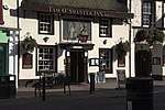 | |||
| Holmston Road, Ayr Cemetery Entrance And Lodge (No 56 Holmston Road) Including Ancillary Structures, Gates, Gatepiers, Railings And Boundary Wall | 55°27′23″N 4°37′02″W | Category C(S) | 21644 | | |||
| John Street, Wallacetown Parish Church (Church Of Scotland) Including Church Hall, Gatepiers, Gates, Railings And Boundary Wall | 55°27′49″N 4°37′30″W | Category B | 21648 | 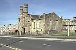 | |||
| Kirk Port, Auld Kirk Of Ayr Gateway | 55°27′47″N 4°37′45″W | Category A | 21654 | 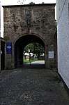 | |||
| Boat Vennal, Loudoun Hall | 55°27′53″N 4°37′57″W | Category A | 21656 | 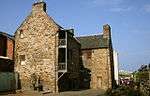 | |||
| Midton Road, Ayr St Columba's Church (Church Of Scotland) And Church Hall Including Boundary Wall | 55°27′11″N 4°37′51″W | Category B | 21662 | | |||
| 25 Midton Road, Dolphin House Including Ancillary Structure, Gatepiers And Boundary Wall | 55°27′15″N 4°37′51″W | Category B | 21663 | | |||
| 21 And 29 New Bridge Street And 1-9 (Odd Nos) High Street, Town Buildings | 55°27′51″N 4°37′55″W | Category A | 21692 | | |||
| 22 New Bridge Street | 55°27′52″N 4°37′56″W | Category C(S) | 21696 | | |||
| 1 And 3 New Road Including Railings And Boundary Wall | 55°28′08″N 4°37′46″W | Category C(S) | 21701 | | |||
| 3 Newmarket Street | 55°27′48″N 4°37′51″W | Category C(S) | 21703 | | |||
| 71 Newmarket Street | 55°27′48″N 4°37′58″W | Category C(S) | 21710 | | |||
| 5 Cassilis Street Including Boundary Wall | 55°27′44″N 4°38′14″W | Category B | 21526 | | |||
| 20 Cathcart Street, Cathcart House Including Boundary Wall And Railings | 55°27′50″N 4°38′04″W | Category B | 21533 | | |||
| 5 Charlotte Street | 55°27′45″N 4°38′09″W | Category C(S) | 21537 | | |||
| 2 Craigie Avenue Including Gatepiers, Gate, Railings And Boundary Wall | 55°27′47″N 4°37′22″W | Category B | 21555 | | |||
| 1 Craigweil Road, Wellington School (Carleton Turrets, Senior Department) Including Gatepiers, Gates, Railings And Boundary Wall | 55°27′16″N 4°38′28″W | Category C(S) | 21557 | | |||
| 18 And 20 Doonfoot Road, Nightingale House Including Gatepiers And Boundary Wall | 55°26′48″N 4°38′26″W | Category C(S) | 21567 | | |||
| 2 Doonholm Road Including Gatepiers, Gates And Boundary Wall | 55°25′56″N 4°38′03″W | Category B | 21570 | | |||
| 47 And 49 Fort Street | 55°27′44″N 4°38′07″W | Category B | 21578 | | |||
| 2 Fort Street, Old Custom House Including Boundary Wall | 55°27′53″N 4°38′00″W | Category B | 21579 | | |||
| 25 And 27 Fullarton Street Including Boundary Wall | 55°27′41″N 4°37′58″W | Category C(S) | 21585 | | |||
| 53 And 53A High Street | 55°27′49″N 4°37′50″W | Category B | 21599 | | |||
| 61 And 63 High Street | 55°27′49″N 4°37′50″W | Category B | 21601 | | |||
| 75 High Street And 2 Newmarket Street | 55°27′48″N 4°37′50″W | Category B | 21603 | | |||
| 101 And 103 High Street | 55°27′46″N 4°37′50″W | Category C(S) | 21609 | | |||
| Alloway, Alloway Parish Church (Church Of Scotland) Including Graveyard, Gatepiers, Gates, Railings And Boundary Wall | 55°25′39″N 4°38′12″W | Category B | 21472 | | |||
| Burns Statue Square, South African War Memorial | 55°27′29″N 4°37′40″W | Category B | 21516 | | |||
| St Quivox, St Evox Including Boundary Wall | 55°29′00″N 4°34′24″W | Category C(S) | 4872 | | |||
| 55-63 (Odd Nos) Dalblair Road | 55°27′32″N 4°37′49″W | Category C(S) | 47175 | | |||
| 73 Monument Road, The Neuk Including Gatepiers And Boundary Wall | 55°26′35″N 4°37′44″W | Category C(S) | 47217 | | |||
| 56 And 58 Sandgate | 55°27′47″N 4°38′03″W | Category C(S) | 47236 | | |||
| 24-30 (Even Nos) Smith Street | 55°27′31″N 4°37′38″W | Category C(S) | 47237 | | |||
| 2 And 4 Springvale Road Including Gatepiers, Gate And Boundary Wall | 55°27′13″N 4°37′54″W | Category C(S) | 47241 | | |||
| 9 Wellington Square Including Railings | 55°27′42″N 4°38′11″W | Category B | 47246 | |
Key
The scheme for classifying buildings in Scotland is:
- Category A: "buildings of national or international importance, either architectural or historic; or fine, little-altered examples of some particular period, style or building type."[1]
- Category B: "buildings of regional or more than local importance; or major examples of some particular period, style or building type, which may have been altered."[1]
- Category C: "buildings of local importance; lesser examples of any period, style, or building type, as originally constructed or moderately altered; and simple traditional buildings which group well with other listed buildings."[1]
In March 2016 there were 47,288 listed buildings in Scotland. Of these, 8% were Category A, and 50% were Category B, with the remaining 42% being Category C.[2]
Notes
- Sometimes known as OSGB36, the grid reference (where provided) is based on the British national grid reference system used by the Ordnance Survey.
• "Guide to National Grid". Ordnance Survey. Retrieved 2007-12-12.
• "Get-a-map". Ordnance Survey. Retrieved 2007-12-17. - Historic Environment Scotland assign a unique alphanumeric identifier to each designated site in Scotland, for listed buildings this always begins with "LB", for example "LB12345".
gollark: a 🐝 b
gollark: However, gladiators who had nice stuff going on *were not the majority*.
gollark: Why should I have to CONSUME FOOD to CONTINUE EXISTING?
gollark: CONSTANTLY!
gollark: Why should I be FORCED to experience 9.81N/kg of downward force?!
References
- All entries, addresses and coordinates are based on data from Historic Scotland. This data falls under the Open Government Licence
- "What is Listing?". Historic Environment Scotland. Retrieved 29 May 2018.
- Scotland's Historic Environment Audit 2016 (PDF). Historic Environment Scotland and the Built Environment Forum Scotland. pp. 15–16. Retrieved 29 May 2018.
This article is issued from Wikipedia. The text is licensed under Creative Commons - Attribution - Sharealike. Additional terms may apply for the media files.