List of Indiana state historical markers in Johnson County
This is a list of the Indiana state historical markers in Johnson County.
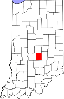
Location of Johnson County in Indiana
This is intended to be a complete list of the official state historical markers placed in Johnson County, Indiana, United States by the Indiana Historical Bureau. The locations of the historical markers and their latitude and longitude coordinates are included below when available, along with their names, years of placement, and topics as recorded by the Historical Bureau. There are 2 historical markers located in Johnson County.[1]
Historical markers
| Marker title | Image | Year placed | Location | Topics |
|---|---|---|---|---|
| Birthplace of Paul Vories McNutt[2] | 1992 | 200 N. Walnut Street (north of W. King Street) in Franklin 39°28′57″N 86°3′34″W |
Politics | |
| Birthplace of Roger D. Branigin[3] | 2000 | 250 N. Yandes Street (north of E. King Street on the western side of the street) in Franklin 39°29′0″N 86°3′0″W |
Politics |
gollark: 11 hours 51 minutes.
gollark: Slightly less now.
gollark: When lyric demotion occurs we might.
gollark: You have burned through about 200 seconds.
gollark: ++remind -1m44000s (slightly later than that, but you know, be there early)
See also
References
- "Indiana Historical Markers by County". State of Indiana. Retrieved 2012-03-15.
- Birthplace of Paul Vories McNutt, Indiana Historical Bureau, n.d. Accessed 2012-03-14.
- Birthplace of Roger D. Branigin, Indiana Historical Bureau, n.d. Accessed 2012-03-14.
External links
Municipalities and communities of Johnson County, Indiana, United States | ||
|---|---|---|
| Cities | Map of Indiana highlighting Johnson County | |
| Towns | ||
| Townships | ||
| Unincorporated communities | ||
| Footnotes | ‡This populated place also has portions in an adjacent county or counties | |
This article is issued from Wikipedia. The text is licensed under Creative Commons - Attribution - Sharealike. Additional terms may apply for the media files.