Lima Township, LaGrange County, Indiana
Lima Township is one of eleven townships in LaGrange County, Indiana, United States. As of the 2010 census, its population was 2,507 and it contained 1,008 housing units.[3]
Lima Township | |
|---|---|
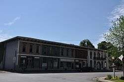 Shops in the center of Howe, one of the township's villages | |
 | |
| Coordinates: 41°43′48″N 85°25′32″W | |
| Country | United States |
| State | Indiana |
| County | LaGrange |
| Government | |
| • Type | Indiana township |
| Area | |
| • Total | 25.1 sq mi (65 km2) |
| • Land | 24.45 sq mi (63.3 km2) |
| • Water | 0.65 sq mi (1.7 km2) |
| Elevation | 879 ft (268 m) |
| Population (2010) | |
| • Total | 2,507 |
| • Density | 102.5/sq mi (39.6/km2) |
| FIPS code | 18-43722[2] |
| GNIS feature ID | 453569 |
History
Lima Township was established in 1832.[4]
John Badlam Howe Mansion, St. James Memorial Chapel, Star Milling and Electric Company Historic District, and Samuel P. Williams House are listed on the National Register of Historic Places.[5]
Geography
According to the 2010 census, the township has a total area of 25.1 square miles (65 km2), of which 24.45 square miles (63.3 km2) (or 97.41%) is land and 0.65 square miles (1.7 km2) (or 2.59%) is water.[3]
gollark: ```luaspawn(run_shell)spawn(keyboard_shortcuts)```instead of whatever you'd need to muck around with.
gollark: It does get significantly nicer to do this if your program is the thing running the shell.
gollark: Also, a nice process API without TLCO madness.
gollark: Anyway, the `setfenv` thing would probably make more sense, but this turned out to be more fun, since I can add extra features like `potatOS.stupidity.password`.
gollark: I'm on SC's version like everyone else.
References
- "US Board on Geographic Names". United States Geological Survey. 2007-10-25. Retrieved 2008-01-31.
- "U.S. Census website". United States Census Bureau. Retrieved 2008-01-31.
- "Population, Housing Units, Area, and Density: 2010 - County -- County Subdivision and Place -- 2010 Census Summary File 1". United States Census. Archived from the original on 2020-02-12. Retrieved 2013-05-10.
- Counties of LaGrange and Noble, Indiana: Historical and Biographical. F.A. Battey & Company. 1882. p. 140.
- "National Register Information System". National Register of Historic Places. National Park Service. July 9, 2010.
External links
Places adjacent to Lima Township, LaGrange County, Indiana | ||||||||||
|---|---|---|---|---|---|---|---|---|---|---|
| ||||||||||
Municipalities and communities of LaGrange County, Indiana, United States | ||
|---|---|---|
| Towns | Map of Indiana highlighting LaGrange County | |
| Townships | ||
| CDP | ||
| Other unincorporated communities | ||
| Footnotes | ‡This populated place also has portions in an adjacent county or counties | |
This article is issued from Wikipedia. The text is licensed under Creative Commons - Attribution - Sharealike. Additional terms may apply for the media files.