Le Verdier
Le Verdier (Occitan: Lo Verdièr, meaning the orchard) is a commune in the Tarn department in southern France.
Le Verdier | |
|---|---|
Location of Le Verdier 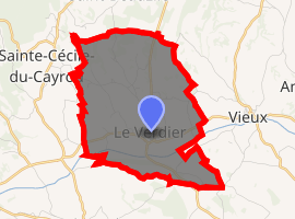
| |
 Le Verdier  Le Verdier | |
| Coordinates: 43°59′22″N 1°50′33″E | |
| Country | France |
| Region | Occitanie |
| Department | Tarn |
| Arrondissement | Albi |
| Canton | Vignobles et Bastides |
| Intercommunality | Vère Grésigne |
| Area 1 | 9.54 km2 (3.68 sq mi) |
| Population (2017-01-01)[1] | 224 |
| • Density | 23/km2 (61/sq mi) |
| Time zone | UTC+01:00 (CET) |
| • Summer (DST) | UTC+02:00 (CEST) |
| INSEE/Postal code | 81313 /81140 |
| Elevation | 169–290 m (554–951 ft) (avg. 180 m or 590 ft) |
| 1 French Land Register data, which excludes lakes, ponds, glaciers > 1 km2 (0.386 sq mi or 247 acres) and river estuaries. | |
Geography
The Vère flows west-southwestward through the southern part of the commune.
gollark: Plus, the recoil propels you forward!
gollark: Oh, solution: mount a railgun on your electric bike with its own low-capacity batteries, so when your motor's batteries are exhausted you can load them into the railgun (with the motor itself) and fire it to dispose of them.
gollark: They're still, like most things, situational.
gollark: Really, what we need is magic low-energy-use personal teleporters.
gollark: Except you're also now lugging around the weight of the batteries and motors.
See also
References
- "Populations légales 2017". INSEE. Retrieved 6 January 2020.
| Wikimedia Commons has media related to Le Verdier. |
| Authority control |
|
|---|
This article is issued from Wikipedia. The text is licensed under Creative Commons - Attribution - Sharealike. Additional terms may apply for the media files.