Giroussens
Giroussens is a commune in the department of Tarn in southern France. It is particularly famous for its market of European pottery that attracts many tourists in the spring.
Giroussens | |
|---|---|
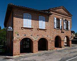 The town hall in Giroussens. | |
 Coat of arms | |
Location of Giroussens 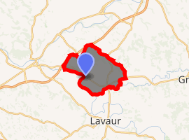
| |
 Giroussens  Giroussens | |
| Coordinates: 43°45′47″N 1°46′37″E | |
| Country | France |
| Region | Occitanie |
| Department | Tarn |
| Arrondissement | Castres |
| Canton | Les Portes du Tarn |
| Intercommunality | Pays Rabastinois |
| Government | |
| • Mayor (2008–2014) | Jean-Louis Claustre |
| Area 1 | 41.67 km2 (16.09 sq mi) |
| Population (2017-01-01)[1] | 1,484 |
| • Density | 36/km2 (92/sq mi) |
| Time zone | UTC+01:00 (CET) |
| • Summer (DST) | UTC+02:00 (CEST) |
| INSEE/Postal code | 81104 /81500 |
| Elevation | 95–272 m (312–892 ft) (avg. 175 m or 574 ft) |
| 1 French Land Register data, which excludes lakes, ponds, glaciers > 1 km2 (0.386 sq mi or 247 acres) and river estuaries. | |
Geography
The commune is traversed by the river Dadou.
Points of interest
gollark: I also don't get what you mean by doing it in radial layers.
gollark: I'm not sure what you mean by abstract structures, but it has... tables and such.
gollark: I want to do some degree of procedural generation, hence why I'm using an actual programming language.
gollark: Lua, actually.
gollark: How might I go about implementing a simple text adventure thing on a {4,5} tiling? I think it should probably just be represented as a graph for most operations, but I have no idea how to actually build one (incrementally/lazily) for it. Some page on the HyperRogue says that you can identify tiles by a path from the origin, but I don't know how you would make a canonical form for those/check if they are equal to each other.
See also
References
- "Populations légales 2017". INSEE. Retrieved 6 January 2020.
| Wikimedia Commons has media related to Giroussens. |
| Authority control |
|
|---|
This article is issued from Wikipedia. The text is licensed under Creative Commons - Attribution - Sharealike. Additional terms may apply for the media files.