Langley Centre
Langley Centre is the major public transit exchange serving the City of Langley and the Township of Langley in British Columbia, Canada. Opened on October 31, 1975,[1] it is home to Langley's bus routes and community shuttle routes; some of Langley's bus routes connect to the SkyTrain system at Surrey Central station.
Langley Centre | |
|---|---|
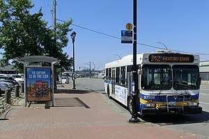 Bus bays located on Logan Avenue | |
| Location | Glover Road & Logan Avenue Langley, British Columbia Canada |
| Coordinates | 49°06′23″N 122°39′16″W |
| Operated by | TransLink |
| Bus routes | 15 |
| Bus stands | 7 |
| Bus operators | Coast Mountain Bus Company |
| Other information | |
| Fare zone | 3 |
| History | |
| Opened | October 31, 1975 |
| Previous names | Langley Bus Terminal |
Structure and location
The exchange is located at the intersection of Logan Avenue and Glover Road, in the City of Langley. It is less than a kilometre from the main commercial centre of the City of Langley (including its city hall) on Fraser Highway, and a few kilometres from Langley's largest shopping mall, Willowbrook Shopping Centre in the Township of Langley.
It is located on the curb lanes of Logan and Glover, and not separated from regular traffic. It can handle regular-length diesel buses and the smaller community shuttles. Beside the exchange is the Rainbow Mall, a small shopping complex.
All routes in Langley service Langley Centre, except for route #370 (which terminates in the Willowbrook area), and routes #388, #509 and #555 (which terminate at Carvolth Exchange in Walnut Grove).
Transit connections
Bay assignments are as follows:[2]
| Bay | Location | Routes | Notes |
|---|---|---|---|
| 1 | Glover Road (west) | 503 Surrey Central Station |
|
| 2 | Logan Avenue (south) | 320 Surrey Central Station |
|
| 342 Newton Exchange | |||
| 3 | Logan Avenue (south) | 501 Surrey Central Station |
|
| 502 Surrey Central Station |
| ||
| 4 | Logan Avenue (south) | 364 Scottsdale | |
| 531 White Rock Centre | |||
| 595 Maple Meadows Station | |||
| 5 | Logan Avenue (south) | 395 King George Station |
|
| 503 Aldergrove | |||
| 6 | Logan Avenue (south) | 372 Clayton Heights | |
| 560 Murrayville | |||
| 561 Brookswood | |||
| 562 Walnut Grove |
| ||
| 563 Fernridge | |||
| 564 Willowbrook | |||
| 7 | Logan Avenue (north) | 531 Willowbrook |
References
- "Surrey-North Delta Expanded Transit Services" (PDF). The Buzzer. B.C. Hydro Transportation. October 28, 1975. Retrieved February 14, 2017.
- Langley Centre Map (PDF) (Map). TransLink. September 2019. Retrieved November 10, 2019.
External links

- Langley Centre map (PDF file)
TransLink services in Metro Vancouver | |||||||||||||||||
|---|---|---|---|---|---|---|---|---|---|---|---|---|---|---|---|---|---|
| |||||||||||||||||
| |||||||||||||||||
| |||||||||||||||||
| |||||||||||||||||