Langenleuba-Niederhain
Langenleuba-Niederhain is a municipality in the district Altenburger Land, in Thuringia, Germany.
Langenleuba-Niederhain | |
|---|---|
 Coat of arms | |
Location of Langenleuba-Niederhain within Altenburger Land district 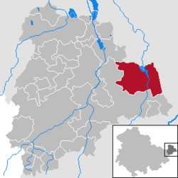 | |
 Langenleuba-Niederhain  Langenleuba-Niederhain | |
| Coordinates: 50°57′33″N 12°35′45″E | |
| Country | Germany |
| State | Thuringia |
| District | Altenburger Land |
| Subdivisions | 8 |
| Government | |
| • Mayor | Jürgen Schneider (CDU) |
| Area | |
| • Total | 39.65 km2 (15.31 sq mi) |
| Elevation | 205 m (673 ft) |
| Population (2018-12-31)[1] | |
| • Total | 1,740 |
| • Density | 44/km2 (110/sq mi) |
| Time zone | CET/CEST (UTC+1/+2) |
| Postal codes | 04618 |
| Dialling codes | 034497 u.a. |
| Vehicle registration | ABG |
| Website | www.wieratal.de |
History
Within the German Empire (1871–1918), Langenleuba-Niederhain was part of the Duchy of Saxe-Altenburg.
gollark: Aren't "smart" TVs *wonderful*?
gollark: But can it run ~~Doom~~ PotatOS?
gollark: I use a webcam and some predictive algorithms to guess when my computer is about to be turned on and boot it accordingly, meaning it has -10 second boot times.
gollark: Security updates without rebooting!
gollark: Also, updates run in the background, yes. Well, can and should.
References
- "Bevölkerung der Gemeinden, erfüllenden Gemeinden und Verwaltungsgemeinschaften nach Geschlecht in Thüringen Gebietsstand: 31.12.2018". Thüringer Landesamt für Statistik (in German). September 2019.
| Authority control |
|
|---|
This article is issued from Wikipedia. The text is licensed under Creative Commons - Attribution - Sharealike. Additional terms may apply for the media files.