Heyersdorf
Heyersdorf is a municipality in the Thuringian district of Altenburger Land.
Heyersdorf | |
|---|---|
Location of Heyersdorf within Altenburger Land district 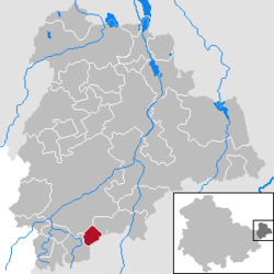 | |
 Heyersdorf  Heyersdorf | |
| Coordinates: 50°50′0″N 12°20′0″E | |
| Country | Germany |
| State | Thuringia |
| District | Altenburger Land |
| Government | |
| • Mayor | Helga Leitholdt |
| Area | |
| • Total | 3.78 km2 (1.46 sq mi) |
| Elevation | 290 m (950 ft) |
| Population (2018-12-31)[1] | |
| • Total | 123 |
| • Density | 33/km2 (84/sq mi) |
| Time zone | CET/CEST (UTC+1/+2) |
| Postal codes | 04626 |
| Dialling codes | 03762 |
| Vehicle registration | ABG |
Geography
Heyersdorf is located near the municipalities of Ponitz, the city of Schmölln, and Thonhausen in the district of Altenburger Land; as well as near the city of Crimmitschau in the Saxon district of Zwickauer Land.
History
Until 1920, Heyersdorf was part of the Kingdom of Saxony.
Politics
Together with Ponitz, Heyersdorf is the assigning municipality for Gößnitz.
Business and Infrastructure
Heyersdorf is located on Bundesautobahn 4.
Twin towns
Heyersdorf is twinned with:


gollark: I mean, it could, but in that case they would be out competed Anyway.
gollark: It probably won't actually kill player's shops.
gollark: My bot has said `hi` to me. How nice of it.
gollark: How much are they?
gollark: Ah, good to see my annoying greetings bot functions still.
References
- "Bevölkerung der Gemeinden, erfüllenden Gemeinden und Verwaltungsgemeinschaften nach Geschlecht in Thüringen Gebietsstand: 31.12.2018". Thüringer Landesamt für Statistik (in German). September 2019.
| Authority control |
|
|---|
This article is issued from Wikipedia. The text is licensed under Creative Commons - Attribution - Sharealike. Additional terms may apply for the media files.