Lake Harihari
Lake Harihari is a dune-dammed lake 10 km south of Kawhia in the Waikato region of New Zealand. Its water quality is the best amongst the Waikato dune lakes. It is ranked eighth in importance in the region.[1] Its quality has been attributed to its remoteness.[2]
| Lake Harihari | |
|---|---|
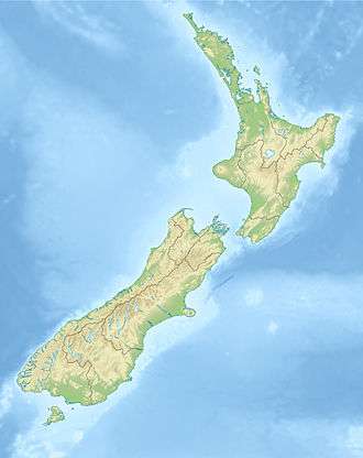
 Lake Harihari Lake Harihari is in the Waikato region of the North Island | |
| Location | Waitomo District, Waikato region, North Island |
| Coordinates | 38°12′35″S 174°43′23″E |
| Lake type | oligomesotrophic lake |
| Primary outflows | seepage |
| Catchment area | 134 ha (330 acres) |
| Basin countries | New Zealand |
| Surface area | 18.39 ha (45.4 acres) |
| Max. depth | 9 m (30 ft) |
| Surface elevation | 20 m (66 ft) |
Geology
The lake is dammed by the dunes, though in wet weather a stream flows from it.[1] Under the dunes a hard strong friable greywacke sandstone forms most of the coastline from Albatross Point to Awakino.[3] It is part of the Late Triassic (Oretian-Otapirian) rocks of the Newcastle Group.[4]
The lake bed belongs to Taharoa Lakes Trust and the land around it is private. Waikato Biodiversity Forum said, "We know of only one other shallow lake in the region that is comparable in terms of water quality."[5] It is ranked eighth in regional importance as a Category Two Lake – high condition, high vulnerability.[6]
Biota
Lake Harihari has the best quality of all the Waikato dune lakes[7] with oligomesotrophic water quality.[1] Works such as a trial fish passage structure (installed in 2009), fencing a 37 to 80m buffer (started in 2005),[8] and about 10,000[9][10] new plants, selected to withstand the harsh coastal winds and dry summers,[11] aim to improve the lake's value.[1] Biota recorded include dabchicks,[1] shells, a large freshwater mussel population,[1] freshwater sponges (common), native snails,[1] native fish, the common bully and New Zealand smelt.[1]
The health of the lake is indicated by the variety of zooplankton in it - rotifers (Anuraeopsis fissa, Synchaeta grandis, S. longipes, Ascomorpha ovalis, Brachionus angularis, B. caliciflorus, Keratella cochlearis, K. tecta, Polyarthra dolichoptera, Trichocerca similis), Bosmina meridionalis, Calamoecia lucasi, Mesocyclops leuckarti, nauplii.[12] Harihari has the lowest non-native zooplankton of all Waikato lakes,[2] though alligator weed control was carried out in 2018.[13] There are also other weed species such as willow, pampas, kikuyu[1] and Canadian pondweed.[7]
History
The archaeology map shows a dozen sites around and near the lake.[14]
See also
- List of lakes in New Zealand
References
- "Significant Natural Areas of the Waikato Region – Lake Ecosystems" (PDF). Waikato Regional Council. 2011.
- Duggan, Ian C (July 2016). "Zooplankton monitoring for TLI and lake health assessment of the Waikato lakes" (PDF). Waikato Regional Council.
- "West Coast Hazard Project: Environment Waikato 2008" (PDF). Retrieved 2013-10-26.
- Geology of the Waikato Area: IGNS 2005 page 21
- "NZARM Broadsheet Newsletter Aug 2011". Issuu. Retrieved 2018-07-14.
- Waikato Regional Policy Statement (November 2010)
- "The condition of lakes in the Waikato Region using SPI" (PDF). Waikato Regional Council.
- "2013 WRC update with map and photos" (PDF). Retrieved 2013-10-26.
- "Regional Pest Management Committee Aug 2013 with before and after photos" (PDF). Retrieved 2013-10-26.
- "West Coast Catchments Committee Open Agenda" (PDF). Waikato Regional Council. 21 May 2018.
- "Waikato BioForum Newsletter August 2011 Number 32". Waikato Biodiversity Forum.
- "An Assessment of the Water Quality of Ten Waikato Lakes Based on Zooplankton Community Composition 2007" (PDF). Retrieved 2013-10-26.
- "Pest plant control over water operations under Resource Consent 124871". Waikato Regional Council. Retrieved 2018-07-14.
- "archaeology map". Nzaa.eaglegis.co.nz.