Labudovo Brdo
Labudovo Brdo (Serbian Cyrillic: Лабудово брдо) is an urban neighborhood of Belgrade, the capital of Serbia. It is located in Belgrade's municipality of Rakovica.
Labudovo Brdo Лабудово брдо | |
|---|---|
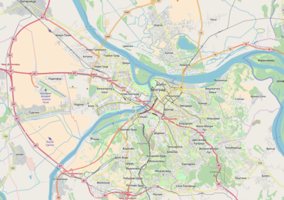 Labudovo Brdo Location within Belgrade | |
| Coordinates: 44°43′35″N 20°25′27″E | |
| Country | |
| Region | Belgrade |
| Municipality | Rakovica |
| Area | |
| • Total | 0.52 km2 (0.20 sq mi) |
| Time zone | UTC+1 (CET) |
| • Summer (DST) | UTC+2 (CEST) |
| Area code | +381(0)11 |
| Car plates | BG |
Location
Labudovo Brdo is located in the central part of the municipality, on the hill of the same name, and bordered by the municipalities of Rakovica on the north, Straževica on the west and Petlovo Brdo and Kijevo on the south. The neighborhood stretches from the street of the Liberation and the Topčiderka river on the east to the "Ibarska magistrala" on the west. The area is mostly residential, with some industrial facilities (Rudnik clothing factory) and a population of 11,647 in 2002.
The name of the hill and neighborhood, labudovo brdo, is Serbian for "swan's hill". The name of the hill appeared after 1950.[1]
References
- Marija Brakočević (21 May 2014). "Beograd leži na 23 brda" [Belgrade lays on 23 hills]. Politika (in Serbian).
External links
|