La Cueva, Sandoval County, New Mexico
La Cueva is a census-designated place in Sandoval County, New Mexico, United States. Its population was 168 as of the 2010 census.[1] New Mexico State Road 126 passes through the community.
La Cueva, New Mexico | |
|---|---|
 La Cueva | |
| Coordinates: 35°52′27″N 106°38′38″W | |
| Country | United States |
| State | New Mexico |
| County | Sandoval |
| Area | |
| • Total | 1.647 sq mi (4.27 km2) |
| • Land | 1.647 sq mi (4.27 km2) |
| • Water | 0 sq mi (0 km2) |
| Elevation | 7,680 ft (2,340 m) |
| Population | |
| • Total | 168 |
| • Density | 100/sq mi (39/km2) |
| Time zone | UTC-7 (Mountain (MST)) |
| • Summer (DST) | UTC-6 (MDT) |
| Area code(s) | 575 |
| GNIS feature ID | 902763[2] |
Geography
La Cueva is located at 35.8742400°N 106.6439000°W.[2] According to the U.S. Census Bureau, the community has an area of 1.647 square miles (4.27 km2), all of it land.[1]
gollark: I have a 1.1KB blob of CSS styling everything and an optional user theming thing which just injects CSS.
gollark: It's small enough to practically inline so I get a performance boost.
gollark: I don't like the gibsonoformic "essentially just plain HTML" thing entirely, so I wrote mine to have a few nice things like minor changes to lists and indentation, a 40em or something limit to make it narrower on desktop for easier reading, that sort of thing.
gollark: I personally handwrite all my CSS and my stuff looks fine. If I subscribed to one of the trendy "design languages" this could be less practical.
gollark: Amazing.
References
- "2010 Census Gazetteer Files - Places: New Mexico". U.S. Census Bureau. Retrieved December 31, 2016.
- "La Cueva". Geographic Names Information System. United States Geological Survey.
Municipalities and communities of Sandoval County, New Mexico, United States | ||
|---|---|---|
| City | 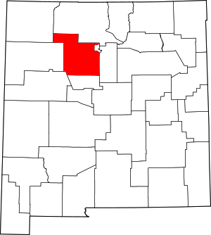 Map of New Mexico highlighting Sandoval County | |
| Towns | ||
| Villages | ||
| CDPs | ||
| Unincorporated community | ||
| Indian reservations |
| |
| Footnotes | ‡This populated place also has portions in an adjacent county or counties | |
This article is issued from Wikipedia. The text is licensed under Creative Commons - Attribution - Sharealike. Additional terms may apply for the media files.