Kuzuryū River
The Kuzuryū River (九頭竜川, Kuzuryū-gawa) is a river flowing through Fukui Prefecture, Japan. It has its source at the Aburasaka Pass (油坂峠 Aburasaka-tōge) in the city of Ōno and empties into the Sea of Japan near the city of Sakai.
| Kuzuryū River | |
|---|---|
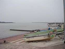 Mouth of the Kuzuryū River | |
| Native name | 九頭竜川 |
| Location | |
| Country | Japan |
| Physical characteristics | |
| Source | |
| • location | Aburasaka Pass Ōno, Fukui |
| • elevation | 717 m (2,352 ft) |
| Mouth | |
• location | Sea of Japan |
• elevation | 0 m (0 ft) |
| Length | 116 km (72 mi) |
| Basin size | 2,930 km2 (1,130 sq mi) |
| Discharge | |
| • average | 86.4 m3/s (3,050 cu ft/s) |
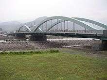
The Kuzuryū River flowing beneath Katsuyama Bridge in Fukui
River system
Some of the main rivers that flow into the Kuzuryū River include: the Itoshiro River, the Hino River, the Asuwa River and the Takeda River
River communities
The river passes through or forms the boundary of the communities listed below.
gollark: YOu brought it up first.
gollark: Well, a computer, not just a device.
gollark: A server is some sort of device which provides some kind of service.
gollark: ↑
gollark: Not really!
References
External links
- 36°13′09″N 136°08′04″E (confluence with Ibi River)
| |||||||||||||||
| |||||||||||||||
| |||||||||||||||
| |||||||||||||||
| |||||||||||||||
| Authority control |
|
|---|
This article is issued from Wikipedia. The text is licensed under Creative Commons - Attribution - Sharealike. Additional terms may apply for the media files.