Krasang District
Krasang (Thai: กระสัง, pronounced [krā.sǎŋ]) is a district (amphoe) in the eastern part of Buriram Province, northeastern Thailand.
Krasang กระสัง | |
|---|---|
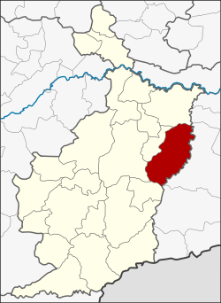 District location in Buriram Province | |
| Coordinates: 14°55′18″N 103°18′6″E | |
| Country | Thailand |
| Province | Buriram |
| Seat | Krasang |
| Area | |
| • Total | 652.700 km2 (252.009 sq mi) |
| Population (2005) | |
| • Total | 103,043 |
| • Density | 157.9/km2 (409/sq mi) |
| Time zone | UTC+7 (ICT) |
| Postal code | 31160 |
| Geocode | 3103 |
Geography
Neighboring districts are (from the south clockwise) Phlapphla Chai, Mueang Buriram, Huai Rat, Satuek of Buriram Province and Mueang Surin of Surin Province.
History
Originally part of tambon Song Chan of Mueang Buriram District, Krasang was made a tambon in 1937. On 26 April 1952 the three tambons Krasang, Song Chang, and Lamduan were placed together to form the minor district (king amphoe) Krasang.[1] It was upgraded to a full district on 23 July 1958.[2]
Administration
The district is divided into 11 sub-districts (tambons), which are further subdivided into 167 villages (mubans). Krasang is a township (thesaban tambon) which covers parts of tambon Krasang. There are a further 11 tambon administrative organizations (TAO).
| No. | Name | Thai name | Villages | Pop. | |
|---|---|---|---|---|---|
| 1. | Krasang | กระสัง | 21 | 15,150 | |
| 2. | Lamduan | ลำดวน | 18 | 11,372 | |
| 3. | Song Chan | สองชั้น | 17 | 11,929 | |
| 4. | Sung Noen | สูงเนิน | 19 | 10,473 | |
| 5. | Nong Teng | หนองเต็ง | 18 | 11,871 | |
| 6. | Mueang Phai | เมืองไผ่ | 13 | 7,103 | |
| 7. | Chum Saeng | ชุมแสง | 12 | 6,538 | |
| 8. | Ban Prue | บ้านปรือ | 15 | 8,674 | |
| 9. | Huai Samran | ห้วยสำราญ | 14 | 6,992 | |
| 10. | Kantharom | กันทรารมย์ | 12 | 8,467 | |
| 11. | Si Phum | ศรีภูมิ | 8 | 4,474 |
References
- ประกาศกระทรวงมหาดไทย เรื่อง ยกฐานะตำบลขึ้นเป็นกิ่งอำเภอ (PDF). Royal Gazette (in Thai). 71 (35 ง): 1314. June 1, 1958.
- พระราชกฤษฎีกาจัดตั้งอำเภอกระสัง ... (PDF). Royal Gazette (in Thai). 75 (55 ก): 321–327. July 22, 1958.