Ban Kruat District
Ban Kruat (Thai: บ้านกรวด, pronounced [bâːn krùa̯t]) is a district (amphoe) of Buriram Province, northeastern Thailand.
Ban Kruat บ้านกรวด | |
|---|---|
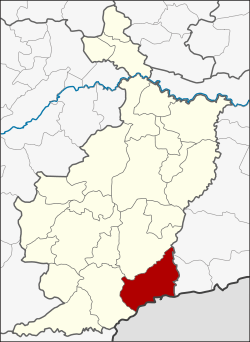 District location in Buriram Province | |
| Coordinates: 14°25′18″N 103°6′0″E | |
| Country | Thailand |
| Province | Buriram |
| Seat | Ban Kruat |
| Area | |
| • Total | 583.9 km2 (225.4 sq mi) |
| Population (2005) | |
| • Total | 72,124 |
| • Density | 123.5/km2 (320/sq mi) |
| Time zone | UTC+7 (ICT) |
| Postal code | 31180 |
| Geocode | 3108 |
History
The district was created in 1938 by splitting the single tambon Ban Kruat from Prakhon Chai District.[1] It was, at first, a minor district (king amphoe). In 1965 it was upgraded to a full district.[2]
Geography
The district is bounded in the south by the Dangrek Range. Neighboring districts are (from the west clockwise) Lahan Sai and Prakhon Chai of Buriram Province, and Prasat and Phanom Dong Rak of Surin Province. To the south it borders the province Oddar Meancheay of Cambodia.
Motto
The Ban Kruat District's motto is "The city of metallurgy, ancient porcelain and quarry, beautiful Obok Viewpoint, Makha Dam and border in Phanomdong Rak mountain range."
Administration
The district is divided into nine sub-districts (tambons), which are further subdivided into 122 villages (mubans). There are two sub-district municipalities (thesaban tambons): Ban Kruat covers parts of tambon Ban Kruat and Prasat, and Talad Nikhom Prasat covers further parts of tambon Prasat. There are also nine tambon administrative organizations (TAO) responsible for the non-municipal areas.
| No. | Name | Thai name | Villages | Pop. | |
|---|---|---|---|---|---|
| 1. | Ban Kruat | บ้านกรวด | 26 | 9,838 | |
| 2. | Non Charoen | โนนเจริญ | 11 | 8,537 | |
| 3. | Nong Mai Ngam | หนองไม้งาม | 14 | 10,121 | |
| 4. | Prasat | ปราสาท | 13 | 10,341 | |
| 5. | Sai Taku | สายตะกู | 14 | 8,878 | |
| 6. | Hin Lat | หินลาด | 8 | 6,296 | |
| 7. | Bueng Charoen | บึงเจริญ | 14 | 7,000 | |
| 8. | Chanthop Phet | จันทบเพชร | 12 | 7,157 | |
| 9. | Khao Din Nuea | เขาดินเหนือ | 10 | 6,326 |
References
- ประกาศกระทรวงมหาดไทย เรื่อง ตั้งกิ่งอำเภอบ้านกรวด ขึ้นอำเภอตลุง จังหวัดบุรีรัมย์ (PDF). Royal Gazette (in Thai). 55 (0 ง): 3877. February 20, 1939.
- พระราชกฤษฎีกาตั้งอำเภอศรีสวัสดิ์ อำเภอสังขละบุรี อำเภอท่าคันโท อำเภอดอกคำใต้ อำเภอแม่ใจ อำเภอจุน อำเภอขามทะเลสอ อำเภอไพศาลี อำเภอท่าวังผา อำเภอบ้านกรวด อำเภอเด่นชัย อำเภอปทุมรัตน์ อำเภอกะเปอร์ อำเภออากาศอำนวย อำเภอดอนเจดีย์ อำเภอจอมพระ และอำเภอสามโก้ พ.ศ. ๒๕๐๘ (PDF). Royal Gazette (in Thai). 82 (59 ก): 565. July 27, 1965.