Kiulap
Kiulap is a neighbourhood and commercial area in Bandar Seri Begawan, the capital of Brunei. It is officially a village-level subdivision of Brunei under Gadong 'B' of Brunei-Muara District. Kiulap has an area of 176.53 hectares (436.2 acres); it has a population of 1,788.[3]
Kiulap | |
|---|---|
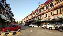 | |
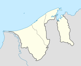 Location in Brunei | |
| Coordinates: 4°53′49″N 114°55′37″E | |
| Country | Brunei |
| District | Brunei-Muara |
| Mukim | Gadong 'B' |
| Government | |
| • Village head | Mohammad bin Abu Bakar |
| Area | |
| • Total | 176.53 ha (436.22 acres) |
| Population | |
| • Total | 1,788 |
| • Density | 1,000/km2 (2,600/sq mi) |
| Postcode | BE1518 |
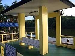
Kiulap is home to the country's general hospital, Raja Isteri Pengiran Anak Saleha Hospital.
Name
Kiulap is officially known in Malay as Kampung Kiulap (Kampung is sometimes spelt as Kampong), which literally means 'Kiulap Village'.
Geography
Kiulap is located in the heart of Bandar Seri Begawan, close to the City Centre as well as Gadong, another commercial area in the capital.[4] It is also contiguous with Kiarong, another neighbourhood-cum-commercial area. The Kedayan River flows along the eastern part Kiulap, which also serves its border with Kumbang Pasang.[4]
The construction of two parallel roads, namely the Sultan Hassanal Bolkiah Highway and Jalan Jame' Asr, have divided Kiulap into three sub-areas.[4] Two of the portions comprise the neighbourhoods, where as the other part constitutes the commercial area; it is located in the northern part of Kiulap as well as near the Kedayan River.[4]
Administration
The area of Kiulap is officially administered as village, the third- and lowest-level administrative division of Brunei, hence known as Kampung Kiulap (also Kampong Kiulap). It is one of the subdivisions under Gadong 'B', a mukim or subdistrict of Brunei-Muara. As a village, its community is headed by a ketua kampung or village head; the incumbent is Mohammad bin Abu Bakar.[1][2]
Kiulap is also a designated postcode area; its postcode is BE1518.[5]
Economy
Commercial area
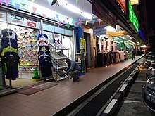
Kiulap is one of the few commercial areas in Bandar Seri Begawan. It mainly consists of complexes of shophouses which contain various types of businesses, most notably retail and eateries. There is a small shopping mall with a cineplex, a few hotels and offices.
Infrastructure
Roads
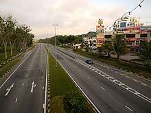
Two dual-carriageway, controlled-access highways traverse the Kiulap area. The Sultan Hassanal Bolkiah Highway and Jalan Jame' Asr run in parallel direction with each other in Kiulap but nevertheless converge at a roundabout junction in neighbouring Kiarong.[4] The roads cause Kiulap to be separated into three portions. The central part which is a neighbourhood is served by Jalan Kiulap and is accessible to both roads, although indirectly via Simpang 127. The northern part is the commercial area and served by Jalan Komersial Kiulap which has direct access to Jalan Jame' Asr. The southern part, the other neighbourhood, is not accessible from within Kiulap, it is served by Jalan Kiarong, hence only accessible from Kiarong.
School
There is a public primary school which serves the residents of Kiulap, namely Haji Mohammad Jaafar Maun Primary School.[6] It also shares grounds with a religious school of the namesake,[7] which provides the Ugama or Islamic religious primary education that is compulsory to Muslim pupils in the country.
Kiulap is also home to the International Graduate Studies College,[8] one of the few private post-secondary institutions in the country.
See also
References
- "Orphans receive donations, gifts – Borneo Bulletin Online". Borneo Bulletin Online. 2017-06-18. Retrieved 2018-02-21.
- "MUIB Presented Donations to 30 Orphans | Brunei's No.1 News Website". ftp.brudirect.com. Retrieved 2018-02-21.
- "Rencana - Bedudun ke Kampung Kiulap, RPN Lambak Kanan..." www.pelitabrunei.gov.bn (in Malay). Retrieved 2018-02-21.
- Brunei Darussalam street directory : quick & easy reference maps., Brunei Press Sdn. Bhd., 2014, p. 75, ISBN 9789991732411, OCLC 932264901
- "Brunei Postal Services - postcodes". post.gov.bn. Retrieved 2018-02-21.
- "Haji Mohd Jaafar Maun Primary School Emerged Champion of 40th Brunei Traditional Dance | Brunei's No.1 News Website". mail.brudirect.com. Retrieved 2018-02-21.
- "Laman Utama - Senarai Sekolah Ugama". www.kheu.gov.bn (in Malay). Retrieved 2018-02-21.
- "Our Contact". www.kolejigs.edu.bn. Retrieved 2018-02-21.