Kirkheaton, Northumberland
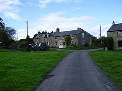
Kirkheaton is a village in Northumberland, England. The village lies about 10 miles (16 km) north east of Hexham and about 5 miles (8 km) west of Belsay.
| Kirkheaton | |
|---|---|
 Kirkheaton | |
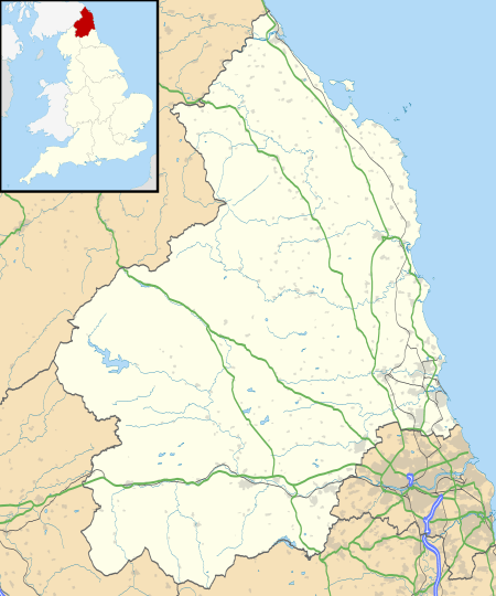 Kirkheaton Location within Northumberland | |
| OS grid reference | NZ015775 |
| Unitary authority | |
| Ceremonial county | |
| Region | |
| Country | England |
| Sovereign state | United Kingdom |
| Post town | NEWCASTLE UPON TYNE |
| Postcode district | NE19 |
| Dialling code | 01830 |
| Police | Northumbria |
| Fire | Northumberland |
| Ambulance | North East |
| UK Parliament | |
Governance
Kirkheaton is in the parliamentary constituency of Hexham.
Landmarks
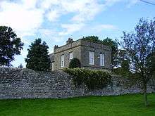
Pele Tower, Kirkheaton
Kirkheaton has a Pele tower.
The Devil's Causeway passes the village just over 1 mile (2 km) to the east. The causeway is a Roman road which starts at Port Gate on Hadrian's Wall, north of Corbridge, and extends 55 miles (89 km) northwards across Northumberland to the mouth of the River Tweed at Berwick-upon-Tweed.
Religious sites
The church is dedicated to St Bartholomew.[1] The chapel was rebuilt in 1775, at the expense of Mrs. H. D. Windsor, at that time lady of the manor.[2]
gollark: I mean, playing music in Minecraft is cool, but... some weird codec at 48kbps is not very good.
gollark: You should try listening to Computronics tape stuff.
gollark: I'm not sure if EWO is actually being worked on.
gollark: I doubt it beats Emu War.
gollark: Also Emu War, the most immersive and exciting gaming experience this millenium.
References
- Purves, Geoffrey (2006). Churches of Newcastle and Northumberland. Stroud, Gloucestershire, England: Tempus Publishing Limited. p. 163. ISBN 0 7524 4071 3. Archived from the original on 13 January 2016.
- "GENUKI (Retrieved: 20 November 2008)". Archived from the original on 8 January 2009. Retrieved 28 November 2008.
External links
![]()
- GENUKI (accessed: 19 November 2008)
This article is issued from Wikipedia. The text is licensed under Creative Commons - Attribution - Sharealike. Additional terms may apply for the media files.