Kharsawan
Kharsawan garh is a city and a notified area in Seraikela Kharsawan district in the Indian state of Jharkhand.
Kharsawan Garh | |
|---|---|
city | |
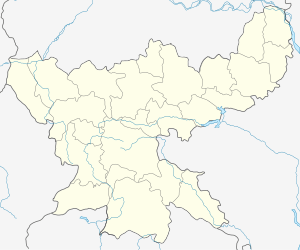
 Kharsawan Garh Location in Jharkhand, India  Kharsawan Garh Kharsawan Garh (India) | |
| Coordinates: 22°47′29″N 85°49′43″E | |
| Country | |
| State | Jharkhand |
| District | Seraikela Kharsawan |
| Elevation | 300 m (1,000 ft) |
| Population (2001) | |
| • Total | 6,790 |
| Languages | |
| • Official | Hindi, Oriya, Ho, Santali, |
| Time zone | UTC+5:30 (IST) |
| Telephone code | 06583 |
| Vehicle registration | JH |
History
Kharsawan (also spelt as Kharsuan) was founded around 1650.[1] It was one of the Oriya Princely states of India during the period of the British Raj, and its last ruler signed the accession to India after India gained independence. In 1911 it was one of two states of the Chota Nagpur Division.[2][3]. It is now a part of Jharkhand state and one of its districts is named Seraikela Kharsawan district. Kumar Aditya Narayan Singh Deo and his father Maharaj Kumar Rudra Pratap Singh Deo appreciated the name change of the district.
The Maharaja of Darbhanga used to visit this state to pay respects as the trade route to the east coast ran through the thick jungles of Singhbhum and safety was guaranteed only to those who were in the good books. The title of Raja was granted to Kharsawan rulers in 1902, beginning with Raja Ram Chandra Singh Deo. The state had a privy purse of 33,000 Rs. The present head of the royal family is Raja Pradeep Chandra Singh Deo.
Geography
Kharsawan Garh is located at 22.79°N 85.82°E.[4] It has an average elevation of 300 metres (1000 feet). It was also known as KHARASUAN GARH before the 1920s.
Demographics
As of 2001 India census,[5] Kharsawan had a population of 6790. Males constitute 52% of the population and females 48%. Kharsawan has an average literacy rate of 64%, higher than the national average of 59.5%: male literacy is 72%, and female literacy is 55%. In Kharsawan, 17% of the population is under 6 years of age.
References
- Princely States of India
- Chisholm, Hugh, ed. (1911). . Encyclopædia Britannica. 6 (11th ed.). Cambridge University Press. p. 272.
- Chisholm, Hugh, ed. (1911). . Encyclopædia Britannica. 15 (11th ed.). Cambridge University Press. p. 773.
- Falling Rain Genomics, Inc - Kharsawan
- "Census of India 2001: Data from the 2001 Census, including cities, villages and towns (Provisional)". Census Commission of India. Archived from the original on 16 June 2004. Retrieved 1 November 2008.