Kentucky Route 73
Kentucky Route 73 (KY 73) is a 30.031-mile-long (48.330 km) state highway in Kentucky that runs from White Road at the Kentucky-Tennessee state line southeast of Franklin to Kentucky Route 1038 northwest of South Union in rural Logan County via Franklin.
| ||||
|---|---|---|---|---|
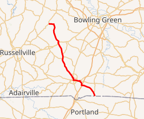
KY 73 highlighted in red | ||||
| Route information | ||||
| Maintained by KYTC | ||||
| Length | 30.031 mi[1] (48.330 km) | |||
| Major junctions | ||||
| South end | White Road at Kentucky-Tennessee state line | |||
| North end | ||||
| Location | ||||
| Counties | Simpson, Logan | |||
| Highway system | ||||
| ||||

Major intersections
| County | Location | mi[1] | km | Destinations | Notes |
|---|---|---|---|---|---|
| Simpson | | 0.000 | 0.000 | White Road | Southern terminus |
| Franklin | 7.169 | 11.537 | |||
| | 7.221 | 11.621 | Western terminus of KY 585 | ||
| Franklin | 8.228 | 13.242 | |||
| 9.234 | 14.861 | South end of US 31W overlap | |||
| 9.741 | 15.677 | Southern terminus of KY 1171 | |||
| 9.866 | 15.878 | North end of US 31W overlap | |||
| | 11.212 | 18.044 | Western terminus of KY 2592 | ||
| | 11.942 | 19.219 | Eastern terminus of KY 1170 | ||
| | 16.839 | 27.100 | South end of KY 621 overlap | ||
| | 17.640 | 28.389 | North end of KY 621 overlap | ||
| | 18.371 | 29.565 | Southern terminus of KY 2349 | ||
| | 20.789 | 33.457 | Northern terminus of KY 2591 | ||
| Logan | | 21.699 | 34.921 | Western terminus of KY 3172 | |
| | 21.936 | 35.303 | |||
| | 22.551 | 36.292 | Southern terminus of KY 1466 | ||
| | 30.031 | 48.330 | Northern terminus | ||
| 1.000 mi = 1.609 km; 1.000 km = 0.621 mi | |||||
gollark: Semiconductors are Very Important™ so a lot of money/political things would get spent on more resilient supply chains.
gollark: It still probably wouldn't actually work, at least for very long.
gollark: A lazy AI would simply build a nonlazy AI to achieve its goals.
gollark: Brute-force search of all possible jokes determined that this was simply the best one.
gollark: I am in 3 servers doing this. It is literally the funniest possible joke.
References
- Commonwealth of Kentucky. "Official DMI Route Log". Retrieved 26 June 2014.
This article is issued from Wikipedia. The text is licensed under Creative Commons - Attribution - Sharealike. Additional terms may apply for the media files.