Kentucky Route 140
Kentucky Route 140 (KY 140) is a 23.473-mile-long (37.776 km) state highway in Kentucky. It runs from KY 256 in rural McLean County northwest of Calhoun to U.S. Route 231 (US 231) in rural Daviess south of Owensboro.
| ||||
|---|---|---|---|---|
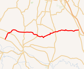
KY 140 highlighted in red | ||||
| Route information | ||||
| Maintained by KYTC | ||||
| Length | 23.473 mi[1] (37.776 km) | |||
| Major junctions | ||||
| West end | ||||
| East end | ||||
| Location | ||||
| Counties | McLean, Daviess | |||
| Highway system | ||||
| ||||

Major intersections
| County | Location | mi[1] | km | Destinations | Notes |
|---|---|---|---|---|---|
| McLean | | 0.000 | 0.000 | Western terminus; continues beyond KY 256 as Cane Run Road | |
| | 0.108 | 0.174 | Western terminus of KY 1792 | ||
| | 2.889 | 4.649 | West end of KY 136 overlap | ||
| | 3.116 | 5.015 | East end of KY 136 overlap | ||
| | 5.660 | 9.109 | Southern terminus of KY 2156 | ||
| | 7.476 | 12.031 | |||
| | 11.118 | 17.893 | |||
| | 11.415 | 18.371 | Northern terminus of KY 1046 | ||
| | 13.021 | 20.955 | Northern terminus of KY 798 | ||
| Daviess | Utica | 16.434 | 26.448 | Eastern terminus of KY 1207 | |
| | 16.991 | 27.344 | |||
| | 23.473 | 37.776 | Eastern terminus | ||
| 1.000 mi = 1.609 km; 1.000 km = 0.621 mi | |||||
gollark: They do not manage returns which are particularly high, generally speaking.
gollark: Consider: there are banks and funds and whatnot with large amounts of money, extremely smart people, and computing power.
gollark: Some offense, but I don't really think you can get *that much* money with a "strat".
gollark: The advice I've heard is just to be extremely boring but practical and shove your money into index funds and such. Not that I have much money to use that on.
gollark: Great?
References
- "Official DMI Route Log". Kentucky Transportation Cabinet. Retrieved June 26, 2015.
This article is issued from Wikipedia. The text is licensed under Creative Commons - Attribution - Sharealike. Additional terms may apply for the media files.