Kentucky Route 136
Kentucky Route 136 (KY 136) is a 32.342-mile-long (52.049 km) state highway in Kentucky. It runs from KY 56 in Beech Grove west of Sebree to U.S. Route 231 (US 231) north of Hartford via Calhoun and Livermore.
| ||||
|---|---|---|---|---|
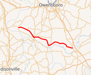
KY 136 highlighted in red | ||||
| Route information | ||||
| Maintained by KYTC | ||||
| Length | 32.342 mi[1] (52.049 km) | |||
| Major junctions | ||||
| West end | ||||
| North end | ||||
| Location | ||||
| Counties | McLean, Ohio | |||
| Highway system | ||||
| ||||

Major intersections
| County | Location | mi[1] | km | Destinations | Notes |
|---|---|---|---|---|---|
| McLean | Beech Grove | 0.000 | 0.000 | Western terminus | |
| 0.267 | 0.430 | Western terminus of KY 796 | |||
| | 2.328 | 3.747 | Northern terminus of KY 797 | ||
| | 2.912 | 4.686 | Eastern terminus of KY 593 | ||
| | 4.109 | 6.613 | West end of KY 140 overlap | ||
| | 4.336 | 6.978 | East end of KY 140 overlap | ||
| | 8.023 | 12.912 | Eastern terminus of KY 1792 | ||
| Calhoun | 9.819 | 15.802 | |||
| | 11.753 | 18.915 | Western terminus of KY 250 | ||
| | 13.112 | 21.102 | |||
| | 14.932 | 24.031 | Southern terminus of KY 798 | ||
| Livermore | 19.334 | 31.115 | West end of US 431 overlap | ||
| 19.458 | 31.315 | East end of US 431 overlap | |||
| Ohio | | 32.342 | 52.049 | Eastern terminus | |
1.000 mi = 1.609 km; 1.000 km = 0.621 mi
| |||||
gollark: And?
gollark: And solar panels degrade over a few decades anyway.
gollark: And needs loads of batteries to be any use whatsoever.
gollark: It also requires TONS of energy to make in the first place.
gollark: Hmm, more controversial politics:- human rights good- encryption good, trying to make stuff not end0to-end encrypted bad- government intervention in everyday life should be lower- school is bad and needs a rework
References
- "Official DMI Route Log". Kentucky Transportation Cabinet. Retrieved June 26, 2015.
This article is issued from Wikipedia. The text is licensed under Creative Commons - Attribution - Sharealike. Additional terms may apply for the media files.