Kamuiwakka River
Kamuiwakka River (カムイワッカ川, Kamuiwakka-kawa) is a river in Hokkaidō, Japan. Because of its volcanic origin, the water temperature reaches 30 °C (86 °F).[1]
| Kamuiwakka River カムイワッカ川 | |
|---|---|
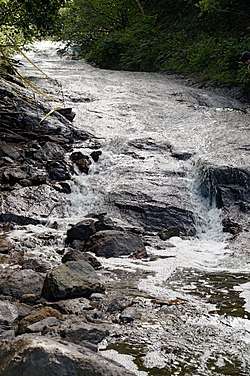 Kamuiwakka Falls (August 2002) | |
| Native name | Kamuiwakka-kawa |
| Location | |
| Country | Japan |
| State | Hokkaidō |
| Region | Abashiri |
| District | Shari |
| Municipality | Shari |
| Physical characteristics | |
| Source | Mount Iō |
| • location | Shari, Hokkaidō, Japan |
| • coordinates | 44°8′23″N 145°8′45″E |
| • elevation | 880 m (2,890 ft) |
| Mouth | Pacific Ocean |
• location | Shari, Hokkaidō, Japan |
• coordinates | 44°9′33″N 145°7′17″E |
• elevation | 0 m (0 ft) |
Course
The Kamuiwakka River rises on the slopes of Mount Iō on the Shiretoko Peninsula. It flows Northwest until it reaches the Pacific Ocean. Kamuiwakka Falls are on the Kamuiwakka River.
gollark: *Visual* BASIC? N00b.
gollark: Use CSS! That can bypass it.
gollark: Hashing IPs with SHA420? N00b. Real h4xx0rs use MD6.
gollark: They say that, but really it's a ploy to get you to ignore the 1337 h4xx.
gollark: After all. The human brain is far more complex than a mere computer.
References
- カムイワッカ湯の滝. Official Website (in Japanese and English). 斜里町. Retrieved 15 January 2010.
| |||||||||||||||
| |||||||||||||||
| |||||||||||||||
| |||||||||||||||
| |||||||||||||||
This article is issued from Wikipedia. The text is licensed under Creative Commons - Attribution - Sharealike. Additional terms may apply for the media files.