Jorgucat
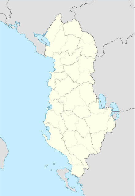
Jorgucat (Greek: Γεωργουτσάτι/Γεωργουτσάτες; romanized: Georgoutsáti/Georgoutsátes) is a village in Gjirokastër County, southern Albania.[1] At the 2015 local government reform it became part of the municipality of Dropull.[2] It is inhabited solely by Greeks.[3]
Jorgucat Georgoutsati/Georgoutsates | |
|---|---|
Settlement | |
 Jorgucat | |
| Coordinates: 39°56′07″N 20°15′49″E | |
| Country | |
| County | Gjirokastër |
| Municipality | Dropull |
| Elevation | 290 m (950 ft) |
| Time zone | UTC+1 (CET) |
| • Summer (DST) | UTC+2 (CEST) |
| Website | www.georgoutsates-deropolis.gr/ |
Demographics
According to Ottoman statistics, the village had 449 inhabitants in 1895.[4] The village had 1,015 inhabitants in 1993, all ethnically Greeks.[3] The village today has a permanent population of roughly 500 inhabitants, notably due to migration to Greece or other countries. Despite this, the population doubles in Easter, Summer and Christmas, as most people return to their village to celebrate or have holidays with their families.
Location
The village Jorgucat is one of the main settlements in the southern part of Dropull valley. It's located between the villages of Zervat to the south and Grapsh to the north. Jorgucat is situated at a cross-road which joins Ioannina, Gjirokastër and Sarandë.[5]
Name
The village received its name Jorgucat (Georgoutsates) as the result of the conversion of a surname to a toponym. In particurlar the name Georgoutsates applies to the descendants of a certain Georgoutsos.[5]
History
According to a local tradition Jorgucat was once called Gonates, a village mentioned in the Chronicle of Gjirokastër during the reign of Byzantine Emperor Alexios Komnenos (11th century). However, this theory remains disputed. Other accounts claim that the foundation of the settlement dates back to the first years of Ottoman rule (15th century). The village under its current name is recorded in an Ottoman document of 1520.[5] That year it consisted of 62 households.[6]
Jorgucat suffered dramatic population decline from the 17th to the first half of the 19th century.[7]
Monastery of Prophet Elias
The Monastery of the Prophet Elias next to the village is situated on a natural elevation in the mountain range of Mali i Gjerë named Hilomodhi, on the Marantoraq peak. According to a local tradition the monastery was founded in the 12th century, supposedly built by giants. Documentary and architectural evidence, however, supports that the year of its foundation was 1545. The monastery was repaired and enlarged several times between the 17th and 19th centuries. In the 20th century it was closed down by the authorities of the Albanian state.[8]
Notable individuals
- Kosmas Thesprotos (c. 1780-1852), Greek scholar, priest and theologian.
References
- "Location of Jorgucat".
- "Law nr. 115/2014" (PDF). Archived from the original (PDF) on 2015-09-24. Retrieved 2019-07-26.
- Kallivretakis, Leonidas (1995). "Η Ελληνική Κοινότητα της Αλβανίας υπό το Πρίσμα της Ιστορικής Γεωγραφίας και Δημογραφίας [The Greek Community of Albania in Terms of Historical Geography and Demography]" (in Greek). Εκδόσεις Σιδέρης. p. 58. Retrieved 2 February 2015.
- Μιχάλης Κοκολάκης, "Η τουρκική στατιστική της Ηπείρου στο Σαλναμέ του 1895" στο Βασίλης Παναγιωτόπουλος, Λεωνίδας Καλλιβρετάκης, Δημήτρης Δημητρόπουλος, Μιχάλης Κοκολάκης και Ευδοκία Ολυμπίτου (επιμ.), Πληθυσμοί και οικισμοί του ελληνικού χώρου. Ιστορικά μελετήματα, Ινστιτούτο Νεοελληνικών Ερευνών/Εθνικό Ίδρυμα Ερευνών, Athens 2003, p. 278
- Giakoumis, 2002, p. 77
- Giakoumis, 2002, p. 78
- Giakoumis, 2002, p. 80
- Giakoumis, 2002, p. 126
Sources
- Giakoumis, Konstantinos (2002). "The Monasteries of Jorgucat and Vanishtë in Dropull and of Spelaio in Lunxhëri as Monuments and Institutions During the Ottoman Period in Albania (16th-19th Centuries)". ResearchGate. University of Birmingham. Retrieved 29 July 2019.*
