Jim Jim Falls
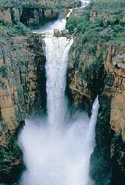
The Jim Jim Falls (Aboriginal: Barrkmalam) is a plunge waterfall on the Jim Jim Creek that descends over the Arnhem Land escarpment within the UNESCO World Heritage–listed Kakadu National Park in the Northern Territory of Australia. The Jim Jim Falls area is registered on the Australian National Heritage List.[2]
| Jim Jim Falls Barrkmalam | |
|---|---|
 Jim Jim Falls during the wet season, Kakadu National Park | |
 | |
| Location | Arnhem Land, Northern Territory, Australia |
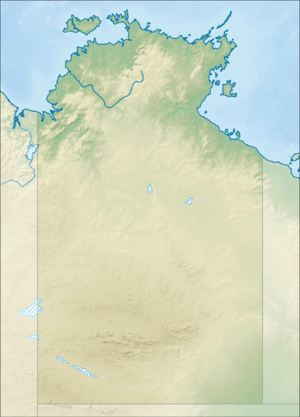
| Coordinates | 13°16′20″S 132°50′22″E[1] |
| Type | Plunge |
| Elevation | 259 metres (850 ft) AHD |
| Total height | 140–200 metres (460–660 ft) |
| Number of drops | 1 |
| Watercourse | Jim Jim Creek |
Etymology
The English name 'Jim Jim Falls' comes from the local Kundjeyhmi word andjimdjim, meaning 'water pandanus' (Pandanus aquaticus).[3] Andjimdjim (or mandjimdjim in the neighbouring Kunwinjku language[4]) lines the creek below Jim Jim Falls.
Location and features
The waterfall descends from an elevation of 259 metres (850 ft) above sea level via one drop that ranges in height between 140 and 200 metres (460 and 660 ft) into a plunge pool within the creek.[5] The falls are located near the eastern boundary of the national park and 28 kilometres (17 mi) south of Jabiru. In the dry season, access from the Kakadu Highway is possible via a 60-kilometre (37 mi) gravel road, with the final 11 kilometres (6.8 mi) suitable for four-wheel drive vehicles only. However, during much of this period the falls dry up and do not flow. In the wet season when the falls are at their most spectacular, it is impossible to drive any vehicle into the area and are best viewed from the air together with the nearby Twin Falls.[6]
It is believed that 140 million years ago much of Kakadu was under a shallow sea. The prominent escarpment wall formed sea cliffs and the Arnhem Land plateau formed a flat land above the sea. Today the escarpment, which rises to 330 metres (1,080 ft) above the plains, extends over 500 kilometres (310 mi) along the eastern side of the national park and into Arnhem Land. It varies from vertical cliffs in the Jim Jim Falls area to stepped cliffs and isolated outliers in the north.
See also
References
- "Twin Falls (NT)". Gazetteer of Australia online. Geoscience Australia, Australian Government.
- "World Heritage Places - Kakadu National Park". Department of the Environment. Commonwealth of Australia. Retrieved 17 May 2014.
- "Jim Jim Plunge Pool Walk". Kakadu National Park. Kakadu National Park. Retrieved 22 June 2019.
- Garde, Murray. "mandjimdjim". Bininj Kunwok Dictionary. Bininj Kunwok Regional Language Centre. Retrieved 22 June 2019.
- "Map of Jim Jim Falls (Barrkmalam), NT". Bonzle Digital Atlas of Australia. Retrieved 17 May 2014.
- "Jim Jim Falls". World of Waterfalls. Johnny T. Cheng. 6 June 2006. Retrieved 17 May 2014.
External links
- "An inventory of sites of international and national significance for biodiversity values in the Northern Territory" (PDF). Department of Natural Resources, Environment, The Arts and Sport (PDF). Government of the Northern Territory. 2009. pp. 303–308. ISBN 978-1-921519-19-2. Archived from the original (PDF) on 12 March 2014. Retrieved 17 May 2014.
- Tourist Information Kakadu National Park
- Google Map Map of Kakadu National Park with major camp sites