Jebel Shams
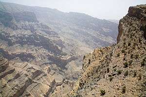
Jebel Shams (Arabic: جَبَل شَمْس, romanized: Mountain of Sun) is a mountain located in northeastern Oman north of Al Hamra town. It is the highest mountain of the Hajar range and the country[3]. The mountain is a popular sightseeing area located 240 km (150 mi) from Muscat. In the summer, temperature is around 20 °C (68 °F) and in the winter it drops to less than 0 °C (32 °F). Nearby is Jabal Akhdar, another prominent peak in the region.
| Jabal Shams | |
|---|---|
 | |
| Highest point | |
| Elevation | 2,997 to 3,009 m (9,833 to 9,872 ft) |
| Prominence | 2,818 m (9,245 ft) [1] Ranked 110th |
| Isolation | 523 km (325 mi) |
| Listing | Country high point Ultra |
| Coordinates | 23°14′13″N 57°15′50″E |
| Naming | |
| Native name | جَبَل شَمْس (Arabic) |
| English translation | Mountain of Sun |
| Geography | |
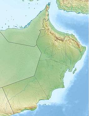
 Jabal Shams Location of Jabal Shams in Oman | |
| Location | Oman |
| Parent range | Al Hajar Mountains |
| Climbing | |
| Easiest route | (to South Summit) W4 route published by Ministry or Tourism, Oman (Grade 2 / 3)[2] |
Summits
The highest point of the mountain is the North Summit, which is occupied by a military base and is a restricted area. The Ministry of Tourism, Sultanate of Oman, states the North Summit to be 3,009 m (9,872 ft)) high.[3]
The mountain also has second summit, the South Summit, which is publicly accessible for trekking via the W4 Trail,[4] marked by the Oman Ministry of Tourism.[2] The elevation of the second south summit is 2,997 m (9,833 ft).[4]
Gallery

 A view from the top
References
- "Jabal ash Sham, Oman". Peakbagger.com. This prominence value is based on an elevation of 3,018 m.
- Trekking Route 3
- "Mountains in Oman". Ministry of Tourism, Sultanate of Oman.
- "Trekking". website. Ministry of Tourism, Sultanate of Oman.
External links
- Travel Blog on Jebel Shams
- http://www.enhg.org/field/jshams04/jshams04.htm
- Flickr Images
- https://www.webcitation.org/query?url=http://www.geocities.com/evertinoman/shams.htm&date=2009-10-25+21:57:14
| Wikimedia Commons has media related to Jebel Shams. |
.jpg)


