Jabal Masher
Jabal Masher (Arabic: جبل مسحر) is a mountain in Saudi Arabia.[1] , that is 2640m in height.
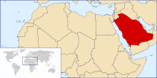
location of Saudi Arabia
Location
Mount Masar is located at 18°12′32″N 43°12′33E near the Yemen border and near al Jawf, in the area of Muammar, and has a height above sea level of more than 2600 metres.[2]
History
The mountain has an ancient history including many ancient carvings and the "path of the elephant", a route historically linked to the attempt by Abraha Al-Ashram, the Aksumite, Christian ruler of Yemen to demolish the Kaaba,[3] during the Year of the Elephant, described in the Quran.[4][5]
gollark: --choose asjhdasd
gollark: --choose 1
gollark: --choose 0
gollark: No. You could not in fact "hack" it through overflow.
gollark: --choose 9223372036854775807 bee ¬bee
References
- Google maps.
- شبكة قحطان.
- ^ الباحة اليوم.
- "Abraha." Archived 2016-01-13 at the Wayback Machine Dictionary of African Christian Biographies. 2007. (last accessed 11 April 2007)
- "Walter W. Müller, "Outline of the History of Ancient Southern Arabia," in Werner Daum (ed.), Yemen: 3000 Years of Art and Civilisation in Arabia Felix. 1987". Archived from the original on 2016-03-03. Retrieved 2017-07-18.
Template:Saudi Arabia-geo-stub
This article is issued from Wikipedia. The text is licensed under Creative Commons - Attribution - Sharealike. Additional terms may apply for the media files.