Jamalpur, Bhiwani
Jamalpur is a village in the Bawani Khera tehsil and Bawani Khera (Vidhan Sabha constituency) of Bhiwani district in Haryana state of India. It lies approximately 8 kilometres (5.0 mi) north west of Bawani Khera and 25 kilometres (16 mi) south east of the district headquarters town of Bhiwani.
Jamalpur Jamalpur | |
|---|---|
Village | |
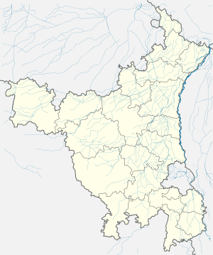 Jamalpur Location in Haryana, India  Jamalpur Jamalpur (India) | |
| Coordinates: 28°57′43″N 75°57′25″E | |
| india | |
| Founded by | Named a person jamaal |
| Named for | Jamalpur |
| Government | |
| • Type | BjP government |
| • Body | Panchayat |
| • Rajesh Yadav | MadanPal BJP |
| Area Types of brotherhood | |
| • Total | 541 km2 (209 sq mi) |
| Area rank | 1 Rank |
| Elevation | 215 m (705 ft) |
| Population (2011) | |
| • Total | 8,846 |
| • Density | 16/km2 (42/sq mi) |
| Languages | |
| • Official | Hindi |
| Time zone | UTC+5:30 (IST) |
| PIN | 127035[1] |
| Vehicle registration | HR 16 |
| Website | haryana |
History
Rao Shekha, a Shekhawat rajput (sub-branch of Kachwaha or Kushwaha), was the founder of Shekhawati, who originally divided Shekhawati into 33 Thikana (also called a Pargana). After him, additional thikanas were granted to the descendants of subsequent generations. [2][3] Tosham Thikana was granted as a thikana by Shekhawati ruler Maharaja Mukund Singh in 1870 to Kunwar Abhaya Singh, the son of Maharaja Raj Singh II. During the Indian Rebellion of 1857, Hindu Shekhawat rajput officials of British Raj based at Tosham killed the Bhati and Ranghar Muslim Rajputs of Jamalpur and Mangali. These Hindu thakurs (Shekhawat) were granted the Thikana of Tosham as a Pargana under Shekhawati in 1870 by the British raj and Maharaja Mukund Singh for their services.
Demographic
As of the 2011 Census of India, the village had 1723 households with a population of 8,846 of which 4,668 were male and 4,178 female.[4]
Economy
Economy is mainly agrarian, supported by small number of government job and minor local commercial activities such as Ishan Automobiles, an authorized service centre of Bajaj Two-wheeler.
See also
External links
References
- Pin codes of Jamalpur, mapsofindia.com
- Loharu State The Imperial Gazetteer of India, 1909, v. 16, p. 169.
- The State of Loharu Indian States: A Biographical, Historical, and Administrative Survey, by Somerset Playne, R. V. Solomon, J. W. Bond, Arnold Wright. Asian Educational Services, 2006. ISBN 81-206-1965-X.Page 691.
- "Jamalpur village". Census of India. Retrieved 19 July 2015.