Hunters Point Avenue station
Hunters Point Avenue is a station on the IRT Flushing Line of the New York City Subway. Located at 49th Avenue (formerly Hunters Point Avenue) and 21st Street in Long Island City, Queens, it is served by the 7 train at all times and the <7> train during rush hours in the peak direction.
Hunters Point Avenue | |||||||||
|---|---|---|---|---|---|---|---|---|---|
 | |||||||||
| Station statistics | |||||||||
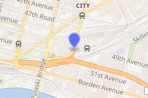
| Address | 49th Avenue & 21st Street Queens, NY 11101 | ||||||||
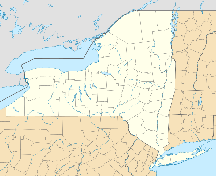
| Borough | Queens | ||||||||
| Locale | Long Island City | ||||||||
| Coordinates | 40°44′32.57″N 73°56′57.33″W | ||||||||
| Division | A (IRT) | ||||||||
| Line | IRT Flushing Line | ||||||||
| Services | 7 | ||||||||
| Transit connections | |||||||||
| Structure | Underground | ||||||||
| Platforms | 2 side platforms | ||||||||
| Tracks | 2 | ||||||||
| Other information | |||||||||
| Opened | February 15, 1916 | ||||||||
| Station code | 463[1] | ||||||||
| Wireless service | |||||||||
| Opposite-direction transfer available | Yes | ||||||||
| Former/other names | 49th Avenue | ||||||||
| Traffic | |||||||||
| Passengers (2019) | 1,885,928[4] | ||||||||
| Rank | 249 out of 424[4] | ||||||||
| Station succession | |||||||||
| Next north | Court Square: 7 | ||||||||
| Next south | Vernon Boulevard–Jackson Avenue: 7 | ||||||||
| |||||||||
| |||||||||
| |||||||||

History
The Flushing Line was extended one stop from Vernon–Jackson Avenues to Hunters Point Avenue on February 15, 1916.[5]
The platforms at Hunters Point Avenue were extended in 1955–1956 to accommodate 11-car trains.[6]
Station layout
| G | Street level | Entrances/exits |
| P Platform level |
Side platform | |
| Southbound | ← | |
| Northbound | | |
| Side platform | ||
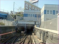
This station is the eastern-most (railroad north) underground station on the Flushing Line until the northbound terminal station (Flushing – Main Street). The tunnel portal is at the eastern end of the station. Just outside the portal is a diamond crossover linking the two tracks.
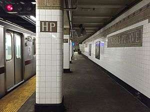
This station has two tracks and two side platforms. Its architecture is in an Italianate design of brown color. Tilework includes a trimline with "HP" tiles on it and name tablets reading "HUNTERS POINT AVE." in gold serif font. The platform columns also have a trim line with "HP" tiles below them.
Exits
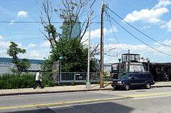
This station has one fare control area above the platforms and tracks near the north end. Two staircases from each platform go up to a waiting area/crossover, where a turnstile bank and several exit–only turnstiles provide access to and from the station. Outside fare control, there is a token booth and one staircase going up to the north side of 49th Avenue with 21st Street several hundred yards to the west. Two other staircases to the east go up to the north side of the same street and is near the Long Island Rail Road's Hunterspoint Avenue station.[7]
On October 29, 1982, a public hearing was scheduled concerning the planned closure of the entrance leading to the southeast corner of 49th Avenue and 21st Street as part of the New York City Transit Authority's Station Modernization Program.[8]
References
- "Station Developers' Information". Metropolitan Transportation Authority. Retrieved June 13, 2017.
- "NYC Subway Wireless – Active Stations". Transit Wireless Wifi. Retrieved November 13, 2019.
- More Subway Stations in Manhattan, Bronx in Line to Get Online, mta.info (March 25, 2015). "The first two phases included stations in Midtown Manhattan and all underground stations in Queens with the exception of the 7 Main St terminal."
- "Facts and Figures: Annual Subway Ridership 2014–2019". Metropolitan Transportation Authority. 2020. Retrieved May 26, 2020.
- "SUBWAY EXTENSION OPEN.; Many Use New Hunters Point Avenue Station" (PDF). Retrieved August 31, 2016.
- Authority, New York City Transit (January 1, 1955). Minutes and Proceedings.
- "MTA Neighborhood Maps: Long Island City" (PDF). Metropolitan Transportation Authority. 2015. Retrieved September 27, 2015.
- "Notice of Public Hearing". New York Daily News. September 21, 1982. Retrieved December 16, 2018.
External links

- nycsubway.org – IRT Flushing Line: Hunterspoint Avenue
- Station Reporter — 7 Train
- The Subway Nut — Hunters Point Avenue Pictures
- Hunters Point Avenue entrance from Google Maps Street View
- Platforms from Google Maps Street View
| |
| |
| Flushing Line |
|
|---|---|
| |