Huggate
Huggate is a village and civil parish in the East Riding of Yorkshire, England. It is situated approximately 13 miles (21 km) north-west of Beverley town centre and 9 miles (14 km) west of Driffield town centre. The village of North Dalton lies 4 miles (6 km) to the south-east.

| Huggate | |
|---|---|
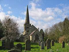 St Mary's Church, Huggate | |
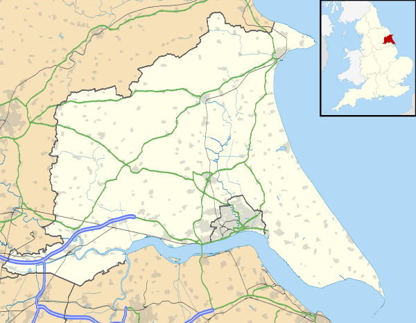 Huggate Location within the East Riding of Yorkshire | |
| Population | 342 (2011 census)[1] |
| OS grid reference | SE881551 |
| • London | 170 mi (270 km) S |
| Civil parish |
|
| Unitary authority | |
| Ceremonial county | |
| Region | |
| Country | England |
| Sovereign state | United Kingdom |
| Post town | YORK |
| Postcode district | YO42 |
| Dialling code | 01377 |
| Police | Humberside |
| Fire | Humberside |
| Ambulance | Yorkshire |
| UK Parliament | |
According to the 2011 UK census, Huggate parish had a population of 342,[1] an increase on the 2001 UK census figure of 317.[2]
Huggate has one of the deepest wells in England. The village contains the Wolds Inn public house on the Driffield road.
The parish church of St Mary is a Grade I listed building.[3]
The Yorkshire Wolds Way National Trail, a long distance footpath passes to the north of the village. There are walks through the local area.
History
'Huggate' is derived possibly from road to or near the mounds from the Old Norse haugr and gata.[4]
In 1823 Huggate was a civil parish in the Wapentake of Harthill. The parish church was under the patronage of the King; a Methodist chapel also existed. A well, 116 yards (106 m) deep, supplied the village with water. At the end of July each year were held races. Population at the time was 413, with occupations including fourteen farmers, one of whom was also a butcher, a carpenter, two shopkeepers, a tailor, and a shoemaker. The landlord of The Chaise Inn public house was also a blacksmith and gunsmith. The ecclesiastical parish rector and curate, and the vicar of the village of Warter resided in Huggate. A carrier operated between the village and Pocklington once a week.[5]
References
- UK Census (2011). "Local Area Report – Huggate Parish (1170211205)". Nomis. Office for National Statistics. Retrieved 20 February 2018.
- UK Census (2001). "Local Area Report – Huggate Parish (00FB076)". Nomis. Office for National Statistics. Retrieved 27 February 2020.
- Historic England. "Church of St Mary (1084147)". National Heritage List for England. Retrieved 5 February 2013.
- Mills, A. D. (2003). A Dictionary of British Place-Names. Oxford University Press. ISBN 9780198527589.
- Baines, Edward (1823). History, Directory and Gazetteer of the County of York. p. 224.
- Gazetteer — A–Z of Towns Villages and Hamlets. East Riding of Yorkshire Council. 2006. p. 7.
External links

- Huggate in the Domesday Book
- Huggate Parish Website
- Wold's Villages Website - Huggate
- Historic England. "St Mary's Church (1084147)". National Heritage List for England.