Hrastnik pri Trojanah
Hrastnik pri Trojanah (pronounced [ˈxɾaːstnik pɾi tɾɔˈjaːnax]; German: Hrastnigg[2]) is a settlement east of Trojane in central Slovenia. It lies in the Municipality of Zagorje ob Savi. The area is part of the traditional region of Upper Carniola. It is now included with the rest of the municipality into the Central Sava Statistical Region.[3]
Hrastnik pri Trojanah | |
|---|---|
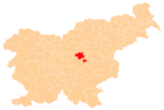
 Hrastnik pri Trojanah Location in Slovenia | |
| Coordinates: 46°11′2.94″N 14°54′28.02″E | |
| Country | |
| Traditional region | Upper Carniola |
| Statistical region | Central Sava |
| Municipality | Zagorje ob Savi |
| Area | |
| • Total | 0.38 km2 (0.15 sq mi) |
| Elevation | 545.5 m (1,789.7 ft) |
| Population (2002) | |
| • Total | 52 |
| [1] | |
Name
The name of the settlement was changed from Hrastnik to Hrastnik pri Trojanah in 1952.[4] In the past the German name was Hrastnigg.[2]
gollark: Macron's tokeniser must permit this.
gollark: The current most developed Minoteaur instance (take that, Macron) is in Nim.
gollark: Also `let`/`var`.
gollark: I find some of Nim's behaviour weird but it certainly has some cool parts. Such as templates, easy custom operators, the indentational syntax, and `result` in functions.
gollark: Nim *can* be slightly insane sometimes.
References
- Statistical Office of the Republic of Slovenia
- Leksikon občin kraljestev in dežel zastopanih v državnem zboru, vol. 6: Kranjsko. 1906. Vienna: C. Kr. Dvorna in Državna Tiskarna, p. 22.
- Zagorje ob Savi municipal site Archived 2012-03-06 at the Wayback Machine
- Spremembe naselij 1948–95. 1996. Database. Ljubljana: Geografski inštitut ZRC SAZU, DZS.
External links
This article is issued from Wikipedia. The text is licensed under Creative Commons - Attribution - Sharealike. Additional terms may apply for the media files.