Hollis Crossroads, Alabama
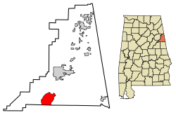
Hollis Crossroads is a census-designated place and unincorporated community in Cleburne County, Alabama, United States. Its population was 608 as of the 2010 census.[5] Hollis Crossroads is located along U.S. Route 431 between Anniston and Wedowee and Alabama State Route 9 between Lineville to Heflin; Routes 431 and 9 intersect here.[6] The Pleasant Grove Elementary School is located here.
Hollis Crossroads, Alabama | |
|---|---|
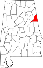
 Location of Hollis Crossroads in Cleburne County, Alabama. | |
 Hollis Crossroads Location of Hollis Crossroads in Cleburne County, Alabama. | |
| Coordinates: 33°31′25″N 85°38′14″W | |
| Country | United States |
| State | Alabama |
| County | Cleburne |
| Area | |
| • Total | 12.46 sq mi (32.26 km2) |
| • Land | 12.46 sq mi (32.26 km2) |
| • Water | 0.00 sq mi (0.00 km2) |
| Elevation | 889 ft (271 m) |
| Population | |
| • Total | 545 |
| • Estimate (2016)[3] | N/A |
| Time zone | UTC-6 (Central (CST)) |
| • Summer (DST) | UTC-5 (CDT) |
| Area code(s) | 256 & 938 |
| GNIS feature ID | 159791[4] |
Demographics
| Historical population | |||
|---|---|---|---|
| Census | Pop. | %± | |
| U.S. Decennial Census[7] | |||
gollark: I redid it now.
gollark: I can't find my results so I'll just do it again.
gollark: A JS operator.
gollark: I found the pink version of my website.
gollark: I can't actually find my 8values results. But I can find an old version of emu war.
References
- "2016 U.S. Gazetteer Files". United States Census Bureau. Retrieved Jul 17, 2017.
- "U.S. Census website". United States Census Bureau. Retrieved 2011-05-14.
- "Population and Housing Unit Estimates". Retrieved June 9, 2017.
- "Hollis Crossroads". Geographic Names Information System. United States Geological Survey.
- "Geographic Identifiers: 2010 Demographic Profile Data (G001): Hollis Crossroads CDP, Alabama". U.S. Census Bureau, American Factfinder. Archived from the original on February 12, 2020. Retrieved June 6, 2014.
- Google (12 June 2013). "Hollis Crossroads, Alabama" (Map). Google Maps. Google. Retrieved 12 June 2013.
- "Census of Population and Housing". Census.gov. Retrieved June 4, 2016.
This article is issued from Wikipedia. The text is licensed under Creative Commons - Attribution - Sharealike. Additional terms may apply for the media files.
