Hiji, Ōita
Hiji (日出町, Hiji-machi) is a town located in Hayami District, Ōita Prefecture, Japan.
Hiji 日出町 | |
|---|---|
Town | |
 Flag  Emblem | |
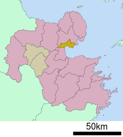 Location of Hiji in Ōita Prefecture | |
 Hiji Location in Japan | |
| Coordinates: 33°22′N 131°32′E | |
| Country | Japan |
| Region | Kyushu |
| Prefecture | Ōita Prefecture |
| District | Hayami |
| Area | |
| • Total | 73.32 km2 (28.31 sq mi) |
| Population (March 31, 2017) | |
| • Total | 28,524 |
| • Density | 390/km2 (1,000/sq mi) |
| Time zone | UTC+9 (JST) |
| Website | www |
As of March 2017, the town has an estimated population of 28,524 and the density of 390 persons per km2. The total area is 73.32 km2.[1]
Geography
Hiji is located within the eastern part of Ōita Prefecture and borders with the Beppu Bay.
Places of interests
The town has a trappist monastery and is also the home of Sanrio's Harmonyland theme park.
gollark: !typerace
gollark: PRs welcome!
gollark: How do you keep sending exactly 8 words?
gollark: But what if Macron is food?
gollark: Actually, we use GPT-3 to generate kit.osmarks.net content when the backend server is down.
References
- "Official website of Hiji town" (in Japanese). Japan: Hiji town. Retrieved 22 April 2017.
External links

- Town of Hiji (in Japanese)
Ōita (capital) | ||
| Core city |
| |
| Cities | ||
| Districts | ||
| Authority control |
|
|---|
This article is issued from Wikipedia. The text is licensed under Creative Commons - Attribution - Sharealike. Additional terms may apply for the media files.