Haven Creek (Ontario)
Haven Creek is a stream in the Unorganized Part of Kenora District in Northwestern Ontario, Canada.[1][4][5][6][7] It is in the Hudson Bay drainage basin, is a left tributary of the Rostoul River, and is within Woodland Caribou Provincial Park.[5]
| Haven Creek | |
|---|---|
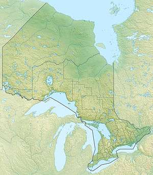 Location of the mouth of the creek in Ontario | |
| Location | |
| Country | Canada |
| Province | Ontario |
| Region | Northwestern Ontario |
| District | Kenora |
| Part | Unorganized Kenora District |
| Physical characteristics | |
| Source | unnamed lake |
| • coordinates | 50°53′43″N 94°49′29″W[1] |
| • elevation | 367 m (1,204 ft)[2] |
| Mouth | Rostoul Lake |
• coordinates | 50°56′24″N 94°46′34″W[3] |
• elevation | 337 m (1,106 ft)[2] |
| Basin features | |
| River system | Hudson Bay drainage basin |
Course
The creek begins at unnamed lake and flows north to the south end of Haven Lake. It heads northeast, passes through an unnamed lake, and reaches its mouth on the west side of Rostoul Lake on the Rostoul River. The Rostoul River flows via the Gammon River, the Bloodvein River, Lake Winnipeg, and the Nelson River to Hudson Bay.[1][4][5]
gollark: What does mola have that data for?
gollark: OH NO IT STARTED AGAIN ÅAAAAA
gollark: > Someone in charge of the Discord bots here should write or extend a bot to replace a regex match to replace 0/0 or x/0 by UNDEFINED automatically. Something like re.replace([0-9]*/ 0, UNDEFINED , string) (simplified because I am lazy) , so MrMola can no longer type 0 / 0 and it's automatically shown as UNDEFINED :- )<@520480232738652161> Bots and moderators cannot, for extremely obvious reasons, edit other people's messages.
gollark: As opposed to partial ordering, where some pairs of elements can't be ordered.
gollark: There's an ordering relation which works for all the elements, or something like that.
References
- "Toporama (on-line map and search)". Atlas of Canada. Natural Resources Canada. Retrieved 2018-08-26.
- "Google Earth". Retrieved 2018-08-26.
- "Toporama (on-line map and search)". Atlas of Canada. Natural Resources Canada. Retrieved 2018-08-26.
- "Haven Creek". Geographical Names Data Base. Natural Resources Canada. Retrieved 2018-08-26.
- "Ontario Geonames GIS (on-line map and search)". Ontario Ministry of Natural Resources and Forestry. 2014. Retrieved 2018-08-26.
- Map 16 (PDF) (Map). 1 : 1,600,000. Official road map of Ontario. Ministry of Transportation of Ontario. 2016-01-01. Retrieved 2018-08-26.
- Restructured municipalities - Ontario map #1 (Map). Restructuring Maps of Ontario. Ontario Ministry of Municipal Affairs and Housing. 2006. Retrieved 2018-08-26.
This article is issued from Wikipedia. The text is licensed under Creative Commons - Attribution - Sharealike. Additional terms may apply for the media files.