Harts Corner, New Jersey
Harts Corner is an unincorporated community located within Hopewell Township in Mercer County, New Jersey, United States.[2] The center of the settlement is located about the intersection of Washington Crossing-Pennington Road (County Route 546) and Scotch Road (CR 611 south of CR 546). Three of the four quadrants of the intersection contain farmland and Hopewell Township Municipal Offices, township public works, and recreational facilities occupy the remaining quadrant.[3]
Harts Corner, New Jersey | |
|---|---|
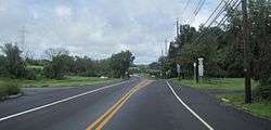
 Approaching Harts Corner from westbound CR 546 | |
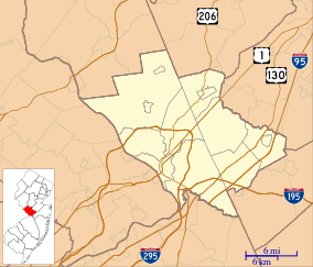
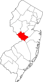
 Harts Corner, New Jersey Location of Harts Corner in Mercer County Inset: Location of county within the state of New Jersey  Harts Corner, New Jersey Harts Corner, New Jersey (New Jersey)  Harts Corner, New Jersey Harts Corner, New Jersey (the United States) | |
| Coordinates: 40°18′32″N 74°48′46″W | |
| Country | |
| State | |
| County | Mercer |
| Township | Hopewell |
| Elevation | 148 ft (45 m) |
| GNIS feature ID | 876981[1] |
References
- "Harts Corner". Geographic Names Information System. United States Geological Survey.
- Locality Search, State of New Jersey. Accessed January 8, 2015.
- Google (June 28, 2015). "Aerial view of Harts Corner" (Map). Google Maps. Google. Retrieved June 28, 2015.
This article is issued from Wikipedia. The text is licensed under Creative Commons - Attribution - Sharealike. Additional terms may apply for the media files.
