Harrison Township, Union County, Indiana
Harrison Township is one of six townships in Union County, Indiana, United States. As of the 2010 census, its population was 416 and it contained 182 housing units.[2]
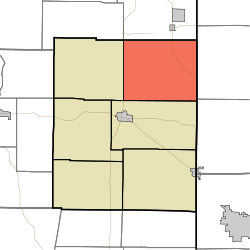
Harrison Township | |
|---|---|
 Location in Union County | |
| Coordinates: 39°41′16″N 84°51′58″W | |
| Country | United States |
| State | Indiana |
| County | Union |
| Government | |
| • Type | Indiana township |
| Area | |
| • Total | 30.13 sq mi (78.0 km2) |
| • Land | 30.11 sq mi (78.0 km2) |
| • Water | 0.02 sq mi (0.05 km2) 0.07% |
| Elevation | 1,109 ft (338 m) |
| Population (2010) | |
| • Total | 416 |
| • Density | 13.8/sq mi (5.3/km2) |
| Time zone | UTC-5 (Eastern (EST)) |
| • Summer (DST) | UTC-4 (EDT) |
| ZIP codes | 47353, 47374 |
| Area code(s) | 765 |
| GNIS feature ID | 453397 |
Geography
According to the 2010 census, the township has a total area of 30.13 square miles (78.0 km2), of which 30.11 square miles (78.0 km2) (or 99.93%) is land and 0.02 square miles (0.052 km2) (or 0.07%) is water.[2]
Unincorporated towns
- Five Points at 39.7119937°N 84.8519030°W
- Kitchel at 39.6831051°N 84.8613475°W
- Witts Station at 39.7122714°N 84.8616256°W
(This list is based on USGS data and may include former settlements.)
Cemeteries
The township contains these two cemeteries: Nutter and Railsback.
School districts
- Union County-College Corner Joint School District
Political districts
- Indiana's 6th congressional district
- State House District 55
- State Senate District 43
gollark: Apparently doing not-much-configuration mesh routing is a very hard problem, and it seems like the existing protocols are designed in ways which make it annoying too.
gollark: It would be neat if mesh networking was more practical.
gollark: There was also somewhat less carbohydratey stuff (bread/pasta) available for a bit, as far as I could tell.
gollark: (although marmite rice cakes seem to be missing now?)
gollark: People were complaining about supply chain disruption and how clearly everywhere needs to be self-sufficient during the start of the whole people-noticing-COVID-19 thing, but it seems like, on the whole, there was mostly food and stuff around and it got resolved fairly fast.
References
- United States Census Bureau 2007 TIGER/Line Shapefiles
- United States Board on Geographic Names (GNIS)
- IndianaMap
- "US Board on Geographic Names". United States Geological Survey. October 25, 2007. Retrieved 2017-05-09.
- "Population, Housing Units, Area, and Density: 2010 - County -- County Subdivision and Place -- 2010 Census Summary File 1". United States Census. Archived from the original on 2020-02-12. Retrieved 2013-05-10.
External links
Places adjacent to Harrison Township, Union County, Indiana | |
|---|---|
Municipalities and communities of Union County, Indiana, United States | ||
|---|---|---|
| Towns | Map of Indiana highlighting Union County | |
| Townships | ||
| Unincorporated communities | ||
This article is issued from Wikipedia. The text is licensed under Creative Commons - Attribution - Sharealike. Additional terms may apply for the media files.